Marker Logo
THE HISTORICAL
MARKER DATABASE
“Bite-Size Bits of Local, National, and Global History”
Salmon in Lemhi County, Idaho — The American West (Mountains)
 

The McNutt Building
 
 
The McNutt Building Marker image. Click for full size.
Photographed by Jimmy Emerson, July 17, 2009
1. The McNutt Building Marker
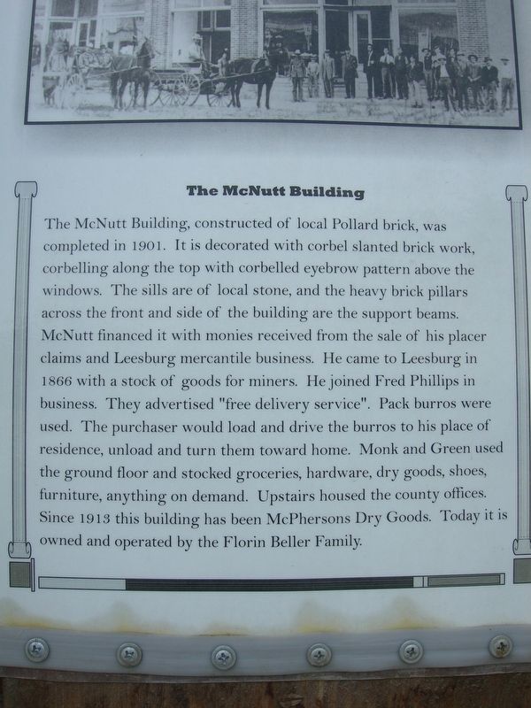
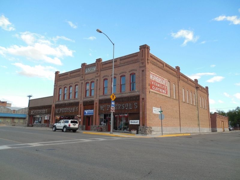
Inscription. The McNutt Building, constructed of local Pollard brick, was completed in 1901. It is decorated with corbel slanted brick work, corbelling along the top with corbelled eyebrow pattern above the windows. The sills are of local stone, and the heavy brick pillars across the front and side of the building are the support beams. McNutt financed it with monies received from the sale of his placer claims and Leesburg mercantile business. He came to Leesburg in 1866 with a stock of goods for miners. He joined Fred Phillips in business. They advertised "free delivery service". Pack burros were used. The purchaser would load and drive the burros to his place of residence, unload and turn them toward home. Monk and Green used the ground floor and stocked groceries, hardware, dry goods, shoes, furniture, anything on demand. Upstairs housed the county offices. Since 1913 this building has been McPhersons Dry Goods. Today it is owned and operated by the Florin Beller Family.
 
Topics. This historical marker is listed in these topic lists: ArchitectureIndustry & Commerce. A significant historical year for this entry is 1901.
 
Location. 45° 10.581′ N,
Paid Advertisement
Click or scan to see
this page online
113° 53.769′ W. Marker is in Salmon, Idaho, in Lemhi County. It is at the intersection of Main Street and S Terrace Street, on the left when traveling north on Main Street. Touch for map. Marker is at or near this postal address: 210 Main Street, Salmon ID 83467, United States of America. Touch for directions.

Regionally, this marker is in Central Idaho — Sawtooth Range. It is also in the American Mountain West and in the Lewis & Clark Corridor. Globally, it is in North America, the Rocky Mountains, the Western Hemisphere, the Western World, and the Anglosphere.

Other nearby markers. At least 8 other markers are within 10 miles of this marker, measured as the crow flies: The Dog of Discovery (approx. 1.7 miles away); Sacajawea (approx. 1.7 miles away); Sacajawea Historic Byway (approx. 1.7 miles away); Fort Bonneville (approx. 4.7 miles away); Historic Lemhi Co. (approx. 4.7 miles away); William Clark's Campsite, August 21 and 25, 1805 (approx. 9.4 miles away); Tower Rock: William Clark's "Clift" (approx. 9.4 miles away); The Bluff (approx. 9½ miles away). Touch for a list and map of all markers in Salmon.
 
The McNutt Building & Marker image. Click for full size.
Photographed by Jimmy Emerson, June 27, 2014
2. The McNutt Building & Marker
The marker is on the 2nd column from the left.
 
 
Credits. This page was last revised on July 22, 2026. It was originally submitted on July 22, 2026, by Jimmy Emerson of Dalton, Georgia. This page has been viewed 8 times since then. Photos:   1, 2. submitted on July 22, 2026, by Jimmy Emerson of Dalton, Georgia. • Andrew Ruppenstein was the editor who published this page.

m=306374

CeraNet Cloud Computing sponsors the Historical Marker Database.
This website earns income from purchases you make after using our links to Amazon.com. We appreciate your support.
Paid Advertisement
Jul. 30, 2026
