Western Division in Laredo in Webb County, Texas — The American South (West South Central)
Benavides-Herrera House
Photographed by Jeff Leichsenring, July 20, 2026
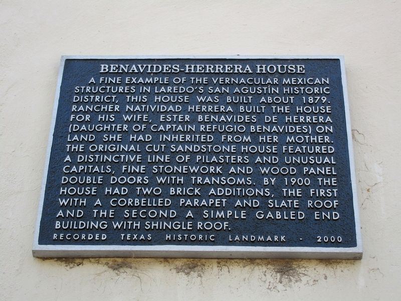
1. Benavides-Herrera House Marker
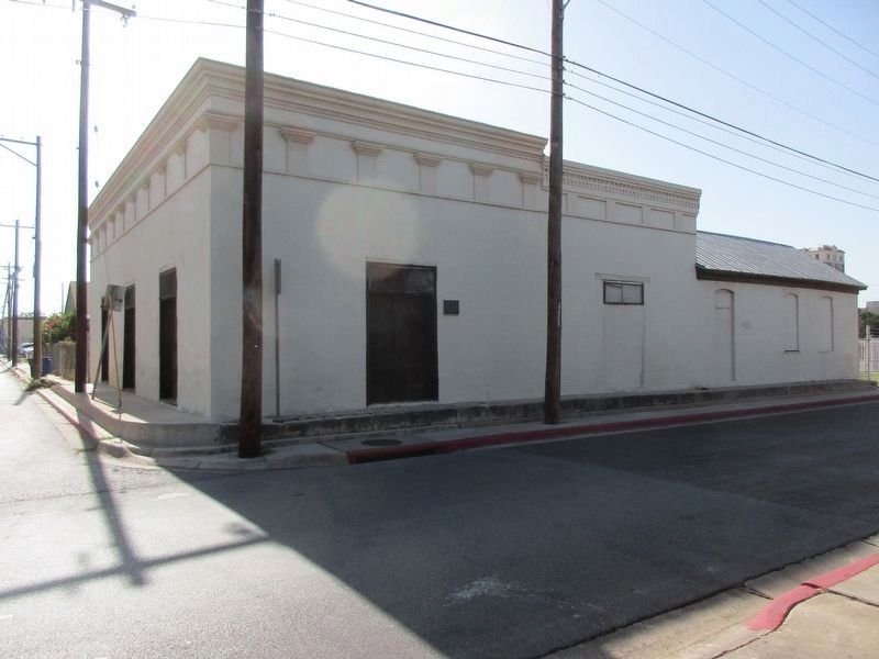
A fine example of the vernacular Mexican structures in Laredo's San Agustín historic district, this house was built about 1879. Rancher Natividad Herrera built the house for his wife, Ester Benavides de Herrera (daughter of Captain Refugio Benavides) on land she had inherited from her mother. The original cut sandstone house featured a distinctive line of pilasters and unusual capitals, fine stonework and wood panel double doors with transoms. By 1900 the house had two brick additions, the first with a corbelled parapet and slate roof and the second a simple gabled end building with shingle roof.
Erected 2000 by Texas Historical Commission. (Marker Number 12387.)
Topics. This historical marker is listed in this topic list: Notable Buildings. A significant historical year for this entry is 1879.
Location. 27° 30.174′ N, 99° 30.222′ W. Marker is in Laredo, Texas, in Webb County. It is in Western Division. It is at the intersection of Santa Ursula Ave and Grant Street, on the right when traveling south on Santa Ursula Ave. Touch for map. Marker is at or near this postal address: 802 Grant
this page online

Regionally, this marker is in South Texas. It is also in the American Borderlands. Globally, it is in North America, a Gulf of Mexico state, the Western Hemisphere, the Western World, and the Anglosphere. Historically, it finds itself in what was once New Spain, the Republic of Texas, and one of the Confederate States of America.
Other nearby markers. At least 8 other markers are within walking distance of this marker: The Ramón Family (about 400 feet away, measured in a direct line); Casa Ortiz, 1830 (about 600 feet away); St. Augustine Parochial School (about 600 feet away); Original Site of Villa De Laredo (about 700 feet away); Laredo Election Riot, 1886 (about 700 feet away); Benavides Brothers (about 800 feet away); Capitol, Republic of the Rio Grande (approx. 0.2 miles away); The Republic of the Rio Grande (approx. 0.2 miles away). Touch for a list and map of all markers in Laredo.
Photographed by Jeff Leichsenring, July 20, 2026
2. Benavides-Herrera House and marker
Credits. This page was last revised on July 23, 2026. It was originally submitted on July 22, 2026, by Jeff Leichsenring of Garland, Texas. This page has been viewed 16 times since then. Photos: 1, 2. submitted on July 22, 2026, by Jeff Leichsenring of Garland, Texas. • James Hulse was the editor who published this page.
