
Station Approach in Norfolk, England, United Kingdom — Northwestern Europe (the British Isles)
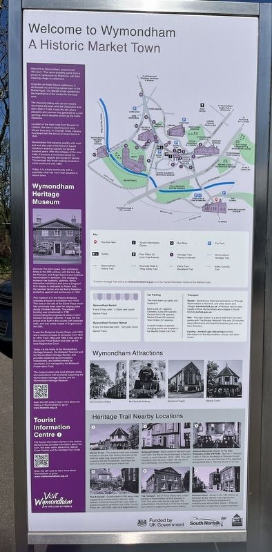
Welcome to Wymondham: A Historic Market Town
Photographed by Ray Gurganus, April 22, 2026
1. Welcome to Wymondham: A Historic Market Town Marker
Originally an Anglo-Saxon settlement, it developed into a thriving market town in the Middle Ages. The Market Cross symbolises the importance of the market for the local area.
The imposing Abbey with its twin towers dominated the town until the Dissolution and, soon after in 1549, it was the site where peasants and yeomen first gathered for a civil uprising, which became known as the Kett's Rebellion.
Located on the main road from Norwich to London, the town's coaching inns were always busy and, in Victorian times, industry flourished with the arrival of steam trains in 1845.
Wymondham first became wealthy with wool and was also part of the Norwich-based handloom weaving industry for several hundred years. After the collapse of the wool trade, it became a renowned centre for woodturning, spigots and bungs for barrels. This evolved into brush-making production which continued until 1985.
Today, it is a lively community with a population that has more than doubled in recent times.
Wymondham Heritage Museum
Discover the town's past, from prehistoric times to the 20th century, with the Iron Age, the Romans, and Anglo-Saxons and medieval Wymondham in between. This engaging museum has artefacts, galleries, family interactive exhibitions and even a dungeon! One display is dedicated to Robert Kett, the yeoman farmer who led Kett's Rebellion, protesting against land enclosures in 1549.
This museum is in the historic Bridewell, originally a house of correction from 1618. This was on the site of the Game Place which had previously been used for staging plays during Christian festivals. The present building was constructed in 1785 incorporating the progressive
this page online
It was the Divisional County Prison until 1825 and a women's house of correction from 1831 to 1878. From 1850 until 1963 it was used as the county Police Station and later as the local Magistrates Court.
Today it is the home of the Wymondham Heritage Museum, the Bridewell Tearoom and the Wymondham Heritage Society, and provides residential accommodation. Independent, and staffed entirely by volunteers, it is managed by the Bridewell Preservation Trust.
The museum shop sells local giftware, books, and publications with proceeds supporting the Wymondham Heritage Society and the Wymondham Heritage Museum.
Heritage Trail Nearby Locations
Market Cross - The original cross was probably erected in the late 13th century and was of the shaft-on-steps type. Documentary evidence suggests that the Elizabethan cross took the form of a small rectangular market hall.
Bridewell Street - Main London to Norwich road until 1959. The Manor House belonged to Richard Lincoln, a
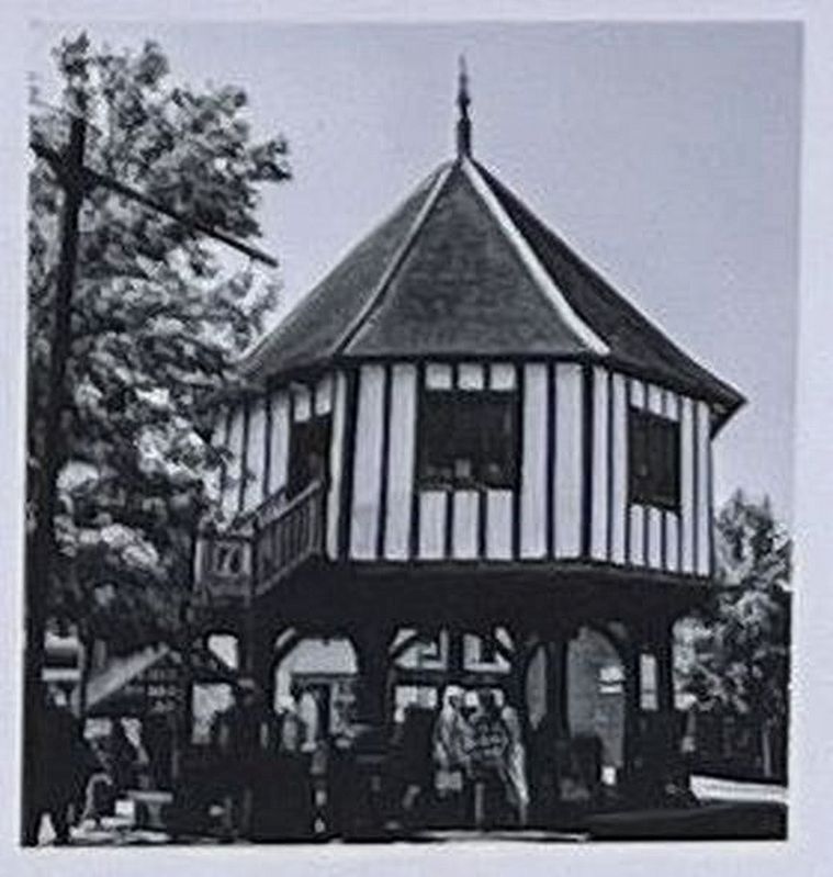
Picture from the marker
2. Market Cross
National Memorial Church of Far East Prisoners of War (FEPOW) - Built by Fr. Malcolm Cowin in 1952 to the design of Donovan Purcell, to prisoners of war and internees of the Japanese during World War II. The only church of its kind.
The Bridewell - Constructed in 1785 along lines suggested by notable prison reformer, John Howard. Divisional County Prison until 1825, a women's house of correction until 1878. County Police Stn. until 1963, later local Magistrates Ct.
The Fairland - Site of thrice-yearly fairs, a right granted to Wymondham by King Stephen in 1135. The town cattle pound was here. The United Reform Church built in 1715 has wooden Doric columns supporting the internal gallery.
Fairland Street - Known in the 19th century as Fairstead Street. Myhill's was originally the Woolpack P.H. The former blacksmith's workshop was where Edwin Gooch - Politician and Champion of agricultural workers was born.
Erected by South Norfolk Council.
Topics. This historical marker is listed in this topic list: Settlements & Settlers.
Location. 52° 33.932′ N, 1° 7.061′ E. Marker is in Station Approach, England, in Norfolk. It is on Station Approach. The marker is located in front of the Wymondham railway station. Touch for map. Marker is at or near this postal address: 3 Station Approach, Station Approach, England NR18 0JZ, United Kingdom. Touch for directions.

Regionally, this marker is in England’s East Anglia. Globally, it is on the Atlantic Ocean, in the North Atlantic Region, in Europe, in Atlantic Europe, on one of the British Isles, in the Western World, and in the Anglosphere. Historically, it finds itself in what was once the Roman Empire.
Other nearby markers. At least 8 other markers are within 14 kilometers of this marker, measured as the crow flies: Wymondham Abbey (approx. 0.9 kilometers away); St Mary's Church (approx. 8.6 kilometers away); The Bassingham Gateway (approx. 13.8 kilometers away); All Saints, Westlegate (approx. 13.8 kilometers away); 33 Timberhill (approx. 13.8 kilometers away); St Christopher's Church (approx. 14.1 kilometers away); Elm Hill (approx. 14.1 kilometers away); United Reformed Church (approx. 14.1 kilometers away).
Credits. This page was last revised on July 23, 2026. It was originally submitted on July 22, 2026, by Ray Gurganus of Washington, District of Columbia. This page has been viewed 5 times since then. Photos: 1, 2. submitted on July 22, 2026, by Ray Gurganus of Washington, District of Columbia. • Andrew Ruppenstein was the editor who published this page.
