West Footscray in Maribyrnong, Victoria, Australia — Oceania
Anders Mauritz Hansen
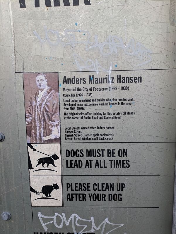
Photographed by Dean Barton-Ancliffe, June 20, 2026
1. Anders Mauritz Hansen Marker
Anders Mauritz Hansen
Mayor of the City of Footscray (1929-1930)
Councillor (1926-1935)
Local timber merchant and builder who also erected and developed many inexpensive workers homes in the area from 1913-1930's.
The original sales office building for this estate still stands at the corner of Robbs Road and Geelong Road.
Local Streets named after Anders Hansen -
Hansen Street
Nesnah Street (Hansen spelt backwards)
Sredna Street (Anders spelt backwards)
Erected by City of Maribyrnong.
Topics. This historical marker is listed in these topic lists: Architecture • Government & Politics. A significant historical year for this entry is 1913.
Location. 37° 48.294′ S, 144° 52.617′ E. Marker is in West Footscray, Victoria, in Maribyrnong. It is on Robbs Road 0.1 kilometers east of Exhibition Street, on the right when traveling east. Touch for map. Marker is at or near this postal address: 19 Robbs Road, West Footscray VIC 3012, Australia. Touch for directions.

Regionally, it is in Oceania, in Australasia, in the Pacific Ocean, in South Pacific, on the Pacific Rim, in the Western World,
this page online
Other nearby markers. At least 8 other markers are within 8 kilometers of this marker, measured as the crow flies: Station Pier - Cranes and Cargo (approx. 6.3 kilometers away); Destination (approx. 6.3 kilometers away); Station Pier - Milestones (approx. 6.3 kilometers away); Welcome to Port Melbourne (approx. 6.4 kilometers away); Centenary Bridge Pillar (approx. 6.5 kilometers away); Windsor Train Disaster of 1887 (approx. 6.6 kilometers away); World War I Rotunda Memorial Port Melbourne (approx. 6.6 kilometers away); The Sandridge Hotel (approx. 6.6 kilometers away).
Also see . . . Hansen Inter-war Housing. The precinct’s place in history.
Hansen Precinct is an example of West Footscray’s rapid growth as a new residential suburb during the 1920s to 1940s. It is also significant for its association with local builder, timber mill owner and former City of Footscray Mayor, Anders Hansen.
The precinct also includes Anders Park, the triangular reserve on the north side of Hansen Street. Anders Hansen created this park as part
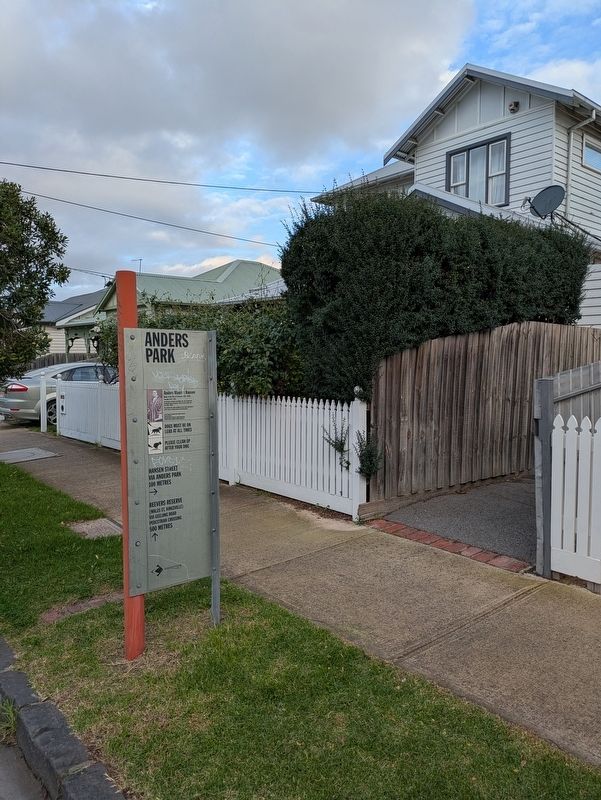
Photographed by Dean Barton-Ancliffe, June 20, 2026
2. Anders Mauritz Hansen Marker at the entrance to Anders Park
Credits. This page was last revised on July 23, 2026. It was originally submitted on July 23, 2026, by Dean Barton-Ancliffe of Rowville, Victoria. This page has been viewed 19 times since then. Photos: 1, 2. submitted on July 23, 2026, by Dean Barton-Ancliffe of Rowville, Victoria. • Andrew Ruppenstein was the editor who published this page.
