
Gladstone in Municipality of WestLake – Gladstone Municipality, Manitoba — Canada’s Prairie Region (North America)
Postage Stamp Province
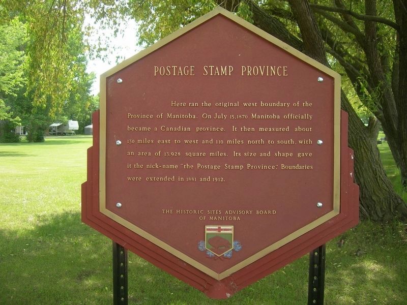
Photographed by Jimmy Emerson, June 25, 2013
1. Postage Stamp Province Marker
Erected by The Historic Sites Advisory Board of Manitoba.
Topics. This historical marker is listed in this topic list: Political Subdivisions. A significant historical date for this entry is July 15, 1870.
Location. 50° 13.744′ N, 98° 57.436′ W. Marker is in Gladstone, Manitoba, in Municipality of WestLake – Gladstone Municipality. It is at the intersection of 5 Street and Queen Street, on the left when traveling west on 5 Street. Touch for map. Marker is at or near this postal address: 88 5 Street, Gladstone MB R0J 0T0, Canada. Touch for directions.

Regionally, this marker is in the Prairies. Globally, it is in North America, the Western Hemisphere, the Western World, and the Anglosphere. Historically, it finds itself in what was once a British colony, the
this page online
Credits. This page was last revised on July 25, 2026. It was originally submitted on July 25, 2026, by Jimmy Emerson of Dalton, Georgia. This page has been viewed 10 times since then. Photo 1. submitted on July 25, 2026, by Jimmy Emerson of Dalton, Georgia. • Andrew Ruppenstein was the editor who published this page.
