Goderich in Huron County, Ontario — Central Canada (North America)
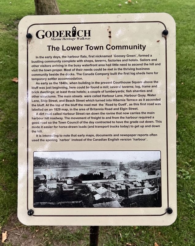
The Lower Town Community
| — | Goderich Marine Heritage Walkway | — |
Photographed by Tim Boyd, July 15, 2026
1. The Lower Town Community Marker
As early as the 1840s, when building in the present Courthouse Square above the bluff was just beginning, here could be found a mill; several taverns; log, frame and brick dwellings; at least three hotels; a couple of lumberyards; fish shanties and other structures. The main streets were called Harbour Lane, Harbour Quay, Water Lane, Ship Street, and Beach Street which turned into Hibernia Terrace as it ascended the bluff. At the top of the bluff the road met the Road tọ Guelf, as this first road was labelled on an 1829 map, in the area of Britannia Road and Elgin Street.
A dirt road called Harbour Street ran down the ravine that now carries the main harbour hill roadway.
this page online
It is interesting to note that early maps, documents and newspaper reports often used the spelling harbor instead of the Canadian English version ‘harbour’.
Topics. This historical marker is listed in these topic lists: Industry & Commerce • Settlements & Settlers. A significant historical year for this entry is 1829.
Location. 43° 44.647′ N, 81° 43.467′ W. Marker is in Goderich, Ontario, in Huron County. It is on Cove Road, on the right when traveling north. The marker is in a park between Cove Road and Beach Road, the second marker on the the right of the walkway when entering from Cove Road. Touch for map. Marker is at or near this postal address: 1 Cove Road, Goderich ON N7A 4J8, Canada. Touch for directions.

Regionally, this marker is in the Huron-Perth-Waterloo-Wellington Area and in Southwestern Ontario. It is also in Central Canada. Globally, it is in North America, on the
Photographed by Tim Boyd, July 15, 2026
2. The Lower Town Community Marker
Other nearby markers. At least 8 other markers are within walking distance of this marker: The Goderich Elevators (here, next to this marker); The Crab and Lee Families (here, next to this marker); The Waterworks (a few steps from this marker); Imperial Oil Storage Tanks (within shouting distance of this marker); The Last Canadian Coal Fired Lake Freighter (within shouting distance of this marker); Menesetung Mineral Springs (within shouting distance of this marker); The Ocean House Hotel (within shouting distance of this marker); Canada Company Piers (about 120 meters away, measured in a direct line). Touch for a list and map of all markers in Goderich.

Photographed by Tim Boyd, July 15, 2026
3. The Lower Town Community Marker
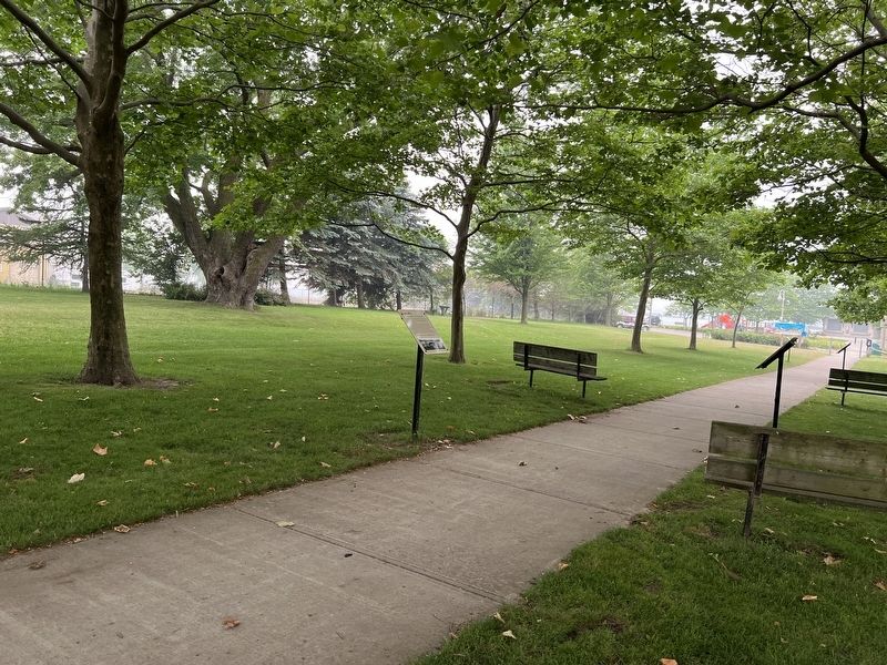
Looking from Cove Road, the marker is the second on the right side of the walkway
Credits. This page was last revised on July 25, 2026. It was originally submitted on July 25, 2026, by Tim Boyd of Hamilton, Ontario. This page has been viewed 10 times since then. Photos: 1, 2, 3. submitted on July 25, 2026, by Tim Boyd of Hamilton, Ontario. • Andrew Ruppenstein was the editor who published this page.
