Wimberley in Hays County, Texas — The American South (West South Central)
Danforth-Kerbow House

Photographed by Larry D. Moore, July 22, 2026
1. Danforth-Kerbow House Marker
Erected 2022 by Texas Historical Commission. (Marker Number 23632.)
Topics. This historical marker is listed in these topic lists: Architecture • Education. A significant historical year for this entry is 1942.
Location. 29° 59.805′ N, 98° 5.675′ W. Marker is in Wimberley, Texas, in Hays County. It is on Old Kyle Road 0.1 miles east of Ranch to Market Road 12, on the right when traveling east. Touch for map. Marker is at or near this postal address: 220 Old Kyle Rd, Wimberley TX 78676, United States of America. Touch for directions.

Regionally, this marker is in the Hill Country and in the Austin Metropolitan Area. It is also in the American South. Globally, it is in North America, a Gulf of Mexico state, the Western Hemisphere, the Western World, and the Anglosphere. Historically, it finds itself in what was once New Spain, the Republic of Texas, one of the Confederate States of America, and the Antebellum South.
Other nearby markers. At least 8 other markers are within 4 miles of this marker, measured as the crow flies: John R. Dobie House (about 300 feet away, measured in a direct line); James C. Lane House (approx. 0.2 miles away); The Century-Old Wimberley Cemetery (approx. ¼ mile
this page online
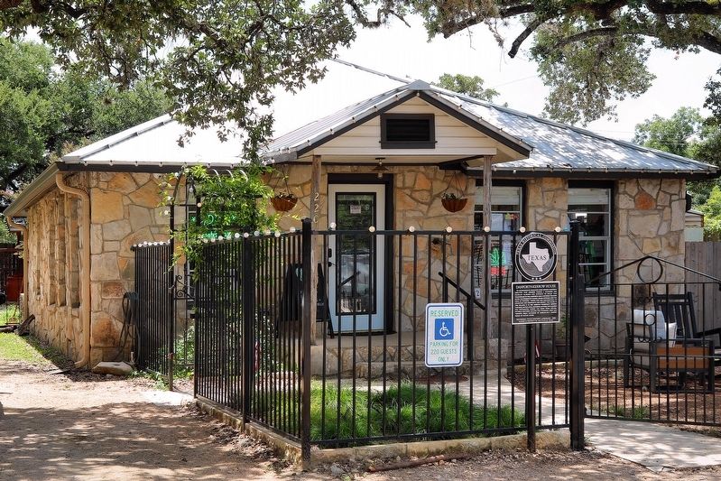
Photographed by Larry D. Moore, July 22, 2026
2. Danforth-Kerbow House Marker Area
Credits. This page was last revised on July 25, 2026. It was originally submitted on July 25, 2026, by Larry D. Moore of Del Valle, Texas. This page has been viewed 12 times since then. Photos: 1, 2. submitted on July 25, 2026, by Larry D. Moore of Del Valle, Texas.
