Russell in Municipality of Russell – Binscarth Municipality, Manitoba — Canada’s Prairie Region (North America)
History of the Town of Russell
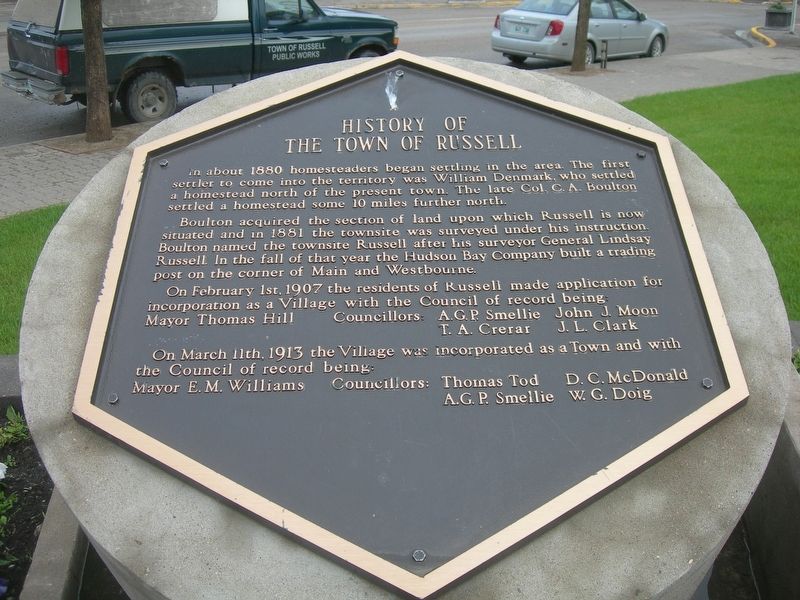
Photographed by Jimmy Emerson, June 26, 2013
1. History of the Town of Russell Marker
Boulton acquired the section of land upon which Russell is now situated and in 1881 the townsite was surveyed under his instruction. Boulton named the townsite Russell after his surveyor General Lindsay Russell In the fall of that year the Hudson Bay Company built a trading post on the corner of Main and Westbourne.
On February 1st, 1907 the residents of Russell made application for incorporation as a Village with the Council of record being:
Mayor Thomas Hill
Councillors:
A.G.P. Smellie
John J. Moon
T. A. Crerar
J. L. Clark
On March 11th, 1913 the Village was incorporated as a Town and with the Council of record being:
Mayor E. M. Williams
Councillors:
Thomas Tod
A.G.P. Smellie
D. C. McDonald
W. G. Doig
Erected by Town of Russell.
Topics. This historical marker is listed in this topic list: Settlements & Settlers. A significant historical year for this entry is 1907.
Location. 50° 46.799′ N,
this page online

Regionally, this marker is in the Prairies. Globally, it is in North America, the Western Hemisphere, the Western World, and the Anglosphere. Historically, it finds itself in what was once a British colony, the Viceroyalty of New France, and Rupert’s Land.
Other nearby markers. At least 6 other markers are within 19 kilometers of this marker, measured as the crow flies: St Matthew's Anglican Church (approx. 17.1 kilometers away); Binscarth Colony Farm (approx. 17.2 kilometers away); The Reliance Grain Company - La Reliance Grain Company (approx. 18.5 kilometers away); Elevator Five - The Paterson Elevator (approx. 18.5 kilometers away); Inglis Grain Elevators (approx. 18.6 kilometers away); a different marker also named Inglis Grain Elevators (approx. 18.6 kilometers away).
Credits. This page was last revised on July 27, 2026. It was originally submitted on July 26, 2026, by Jimmy Emerson of Dalton, Georgia. This page has been viewed 13 times since then. Photo 1. submitted on July 26, 2026, by Jimmy Emerson of Dalton, Georgia. • Andrew Ruppenstein was the editor who published this page.
