Fort Jefferson in Darke County, Ohio — The American Midwest (Great Lakes)
Dedicated in Memory to All American Soldiers Who Died at or Near Fort Jefferson, Northwest Territory
dulce et decorum est pro patria mori

Photographed by Craig Doda, July 17, 2026
1. Dedicated in Memory to All American Soldiers Who Died at or Near Fort Jefferson, Northwest Territory Marker
★★★ Revolutionary War Patriots ★★★
Lt. Col. George Gibson October 10, 1747 – December 11, 1791 Service Virginia Continental Line 2nd Regiment U.S. Levies
Capt. Joseph Montfort April 2, 1728 – April 27, 1792 Service 3rd North Carolina Regiment 1st U.S. Infantry Commandant of Fort Jefferson
Sgt. William Noble Unknown – December 15, 1791 Service Pennsylvania Continental Line 2nd Regiment U.S. Levies
★★★ Other Known and Honored Servicemen ★★★
Daniel Bohnam Teamster d. November 4, 1791
Joseph Shaylor, Jr. Son of Captain Shaylor, Commandant of Ft. Jefferson d. February 11, 1792
★★★ U.S. Levies (All Deceased 1791) ★★★
★ Private William Johnson • ★ Private William Simpson • ★ Private Joseph Lewis • ★ Sergeant Joel Chandler • ★ Private William Murphy • ★ Private Robert Johnson • ★ Private Peter Hartman • ★ Private John Brooks • ★ Private William Murphy • ★ Private Robert Johnson • ★ Private Peter Hartman • ★ Private John Brooks
Erected by Daughters
this page online
Topics and series. This memorial is listed in this topic list: War, US Revolutionary. In addition, it is included in the Daughters of the American Revolution (DAR), and the Ohio Historical Society / The Ohio History Connection series lists.
Location. 40° 1.546′ N, 84° 39.396′ W. Memorial is in Fort Jefferson, Ohio, in Darke County. It is at the intersection of Weavers-Fort Jefferson Road and Church Street, on the right when traveling east on Weavers-Fort Jefferson Road. Touch for map. Memorial is at or near this postal address: 3981 Weavers-Fort Jefferson Rd, Greenville OH 45331, United States of America. Touch for directions.

Regionally, this memorial is in Ohio’s Till Plains. It is also in the American Midwest and in the Corn Belt. Globally, it is in North America, the Western Hemisphere, the Western World, and the Anglosphere. Historically, it finds itself in what was once the Haudenosaunee (Iroquois) Confederacy, the territory of the Mississippian Culture, and the Northwest Territory.
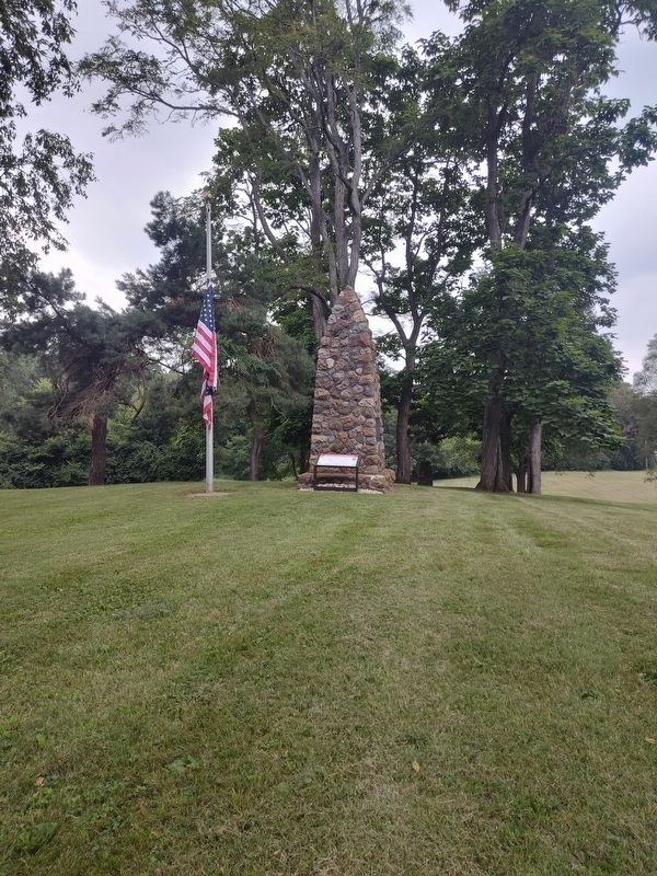
Photographed by Craig Doda, July 17, 2026
2. Dedicated in Memory to All American Soldiers Who Died at or Near Fort Jefferson, Northwest Territory
Other nearby markers. At least 8 other markers are within walking distance of this marker: Fort Jefferson (here, next to this marker); Firepit (a few steps from this marker); Well or Magazine Pit (a few steps from this marker); a different marker also named Ash Pit (within shouting distance of this marker); a different marker also named Excavation (within shouting distance of this marker); Underground Passage (within shouting distance of this marker); Fort Jefferson / St. Clair’s Defeat (within shouting distance of this marker); William Noble (about 500 feet away). Touch for a list and map of all markers in Fort Jefferson.
Other markers no longer nearby. Ash Pit (was a few steps from this marker but has been permanently removed); Trench (was a few steps from this marker but has been permanently removed); Excavation (was within shouting distance of this marker but has been permanently removed); a different marker also named Firepit (was within shouting distance of this marker but has been permanently removed); Fort Jefferson: A Link in a Chain (was within shouting distance of this marker but has been permanently removed); a different marker also named Underground Passage (was within shouting distance of this marker but has been permanently removed); a different marker also named Well or Magazine Pit (was within shouting distance of this marker but has been permanently removed); a different marker also named Fort Jefferson (was about 400 feet away, measured in a direct line but has been permanently removed).
Credits. This page was last revised on August 3, 2026. It was originally submitted on July 27, 2026, by Craig Doda of Napoleon, Ohio. This page has been viewed 19 times since then. Photos: 1, 2. submitted on July 27, 2026, by Craig Doda of Napoleon, Ohio. • Devry Becker Jones was the editor who published this page.
