Kelleys Island in Erie County, Ohio — The American Midwest (Great Lakes)
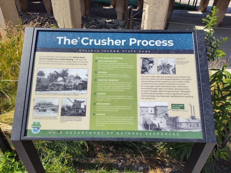
The Crusher Process
Kelleys Island State Park
Photographed by Craig Doda, July 4, 2026
1. The Crusher Process Marker
Steam shovel loads a train of four-wheel dump cars.
Lime Kilns. Some could be as much as 65 feet tall.
Example of a steam boiler powering the Stedman Hammermill crusher via leather belt drive.
The Six Steps to Crushing
1 Raw Stone Delivery Railroad cars, loaded with freshly quarried limestone, backed up through a hole in the upper part of this crusher building and tipped the stone down into the crusher.
2 Crushing The crusher wheels broke down the large limestone pieces into smaller, uniform pieces.
3 Conveyor Transport Once the stone was processed, belts carried the crushed stone into a series of storage troughs. Each of the troughs was equipped with multiple "chutes." Workers controlled the flow of stone through each of the chutes with gates.
4 Loading Railroad cars backed up underneath this "tunnel" where the crushed stone would drop into the cars through the chutes.
5 Steam Power The
this page online
6 Shipping Trains carried the loaded cars out onto the pocket dock, where the stone was either loaded into the kilns to produce lime or dumped into dock bins and loaded onto boats bound for ports across the Great Lakes.
(Left) Photo Credit: KIL&T Co. fans.
(Right) Kelleys Island North Bay dock.
The north crusher plant was accessed via an inclined ramp at the rear, where cars were emptied beneath a corrugated metal building and then pushed out onto a timber trestle. Crushed stone was loaded from beneath a concrete bin using a gate system operated by lever mechanisms connected through cables and pulleys, allowing workers to control the gates safely from ground level. These gates could be opened partially or fully to regulate the rate of stone discharge, ensuring proper loading without overfilling the railroad cars.
Erected by Ohio Department Of Natural Resources, Ohio State Parks & Watercraft.
Topics. This historical marker is listed in this topic list: Industry & Commerce.
Location. 41° 37.066′ N,

Photographed by Craig Doda, July 4, 2026
2. The Crusher Process Marker

Regionally, this marker is on the Lake Erie Shore and in the Western Reserve. It is also in the American Midwest and in the Corn Belt. Globally, it is in North America, on the Great Lakes, in the Western Hemisphere, in the Western World, and in the Anglosphere. Historically, it finds itself in what was once the Haudenosaunee (Iroquois) Confederacy, the territory of the Mississippian Culture, and the Northwest Territory.
Other nearby markers. At least 8 other markers are within walking distance of this marker: The Crusher Trail (a few steps from this marker); Columbus Limestone / Kelleys Island Lime & Transport Co. (a few steps from this marker); The Small, but Mighty (within shouting distance of this marker); Island History (about 600 feet away); Welcome to Glacial Grooves Geological Preserve (about 600 feet away); a different marker also named The Crusher Trail (about 600 feet away); Quarrying (about 600 feet away); Excavation (about 700 feet away). Touch for a list and map of all markers in Kelleys Island.
Another marker is no longer nearby. Glacial Grooves State Memorial (was about 500 feet away, measured in a direct line but has been permanently removed).
Credits. This page was last revised on August 1, 2026. It was originally submitted on July 27, 2026, by Craig Doda of Napoleon, Ohio. This page has been viewed 11 times since then. Photos: 1, 2. submitted on July 27, 2026, by Craig Doda of Napoleon, Ohio. • Andrew Ruppenstein was the editor who published this page.
