Old Boston in Bowie County, Texas — The American South (West South Central)
Old Boston
Photographed by Jeff Leichsenring, July 28, 2026
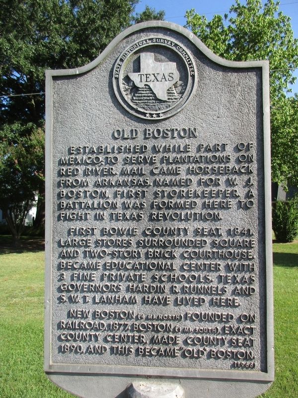
1. Old Boston Marker
Established while part of Mexico; to serve plantations on Red River. Mail came horseback from Arkansas. Named for W.J. Boston, first storekeeper. A battalion was formed here to fight in Texas Revolution.
First Bowie County Seat, 1841. Large stores surrounded square and two-story brick courthouse. Became educational center with 3 fine private schools. Texas governors Hardin R. Runnels and S.W.T. Lanham have lived here.
New Boston (4 mi. North) founded on railroad, 1877. Boston (1 mi. South), exact county center, made county seat 1890, and this became "Old" Boston.
Erected 1966 by State Historical Survey Committee. (Marker Number 9498.)
Topics. This historical marker is listed in this topic list: Settlements & Settlers. A significant historical year for this entry is 1841.
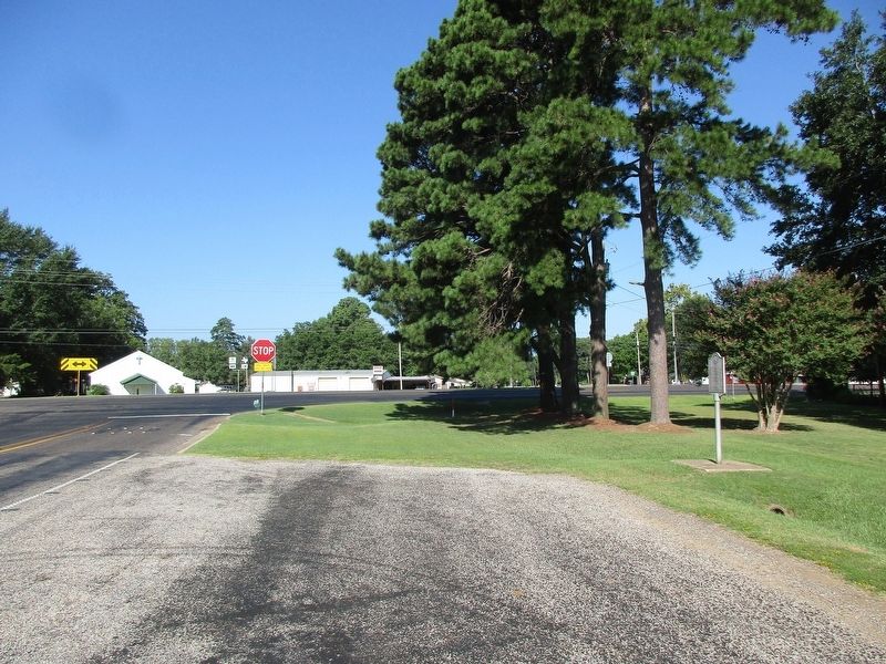
Location. 33° 24.24′ N, 94° 24.958′ W. Marker is in Old Boston, Texas, in Bowie County. It is at the intersection of Farm to Market Road 2149 and State Highway 8, on the right when traveling west on Road 2149. Touch for map. Marker is at or near this postal address: 33 Co Rd 2149, New Boston TX 75570, United States of America. Touch for directions.

Regionally,
this page online
Other nearby markers. At least 8 other markers are within 7 miles of this marker, measured as the crow flies: Arkadelphia Rosenwald School (approx. 3.1 miles away); New Boston (approx. 3.8 miles away); Jones-Tyson House (approx. 4.1 miles away); James Bowie / Gold Star County (approx. 4.8 miles away); Bowie County (approx. 4.8 miles away); Red Bayou Methodist Church (approx. 5.9 miles away); Maud United Methodist Church (approx. 6½ miles away); Site of Epperson's Ferry (approx. 6.8 miles away).
Photographed by Jeff Leichsenring, July 28, 2026
2. Old Boston Marker
Credits. This page was last revised on July 29, 2026. It was originally submitted on July 28, 2026, by Jeff Leichsenring of Garland, Texas. This page has been viewed 18 times since then. Photos: 1, 2. submitted on July 28, 2026, by Jeff Leichsenring of Garland, Texas. • James Hulse was the editor who published this page.
