Mount Holly in Gaston County, North Carolina — The American South (South Atlantic)
Historic Homesite and Landscape

Photographed by Mark Parker, July 28, 2026
1. Historic Homesite and Landscape Marker
Hunter first built a simple cabin and barn before constructing the house around 1875. The house was expanded and remodeled several times. In the 1940s and 1950s, bathrooms were added, and the kitchen was connected to the main house. Steps under the kitchen sink led to a cellar that held canned goods and treasured items.
The farmland around the home was used for growing crops and raising livestock. A livery stable housed horses, which Ransom cared for in exchange for payment. He grew a field of "Ida Raines" corn to feed the horses and used the well with white-painted boards to water them. By the mid-1900s, the landscape included fruit treeplum, lime, pear, and peach. "The peach tree was next to the driveway. Grandmother [Mena] would stand on the back porch, pull peaches from the tree, and make frosted peach pie. She would peel them, lay them on cheesecloth to sun dry, and then make a pie." - Wanda Holloway
(captions)
This is an archival photo taken around 1910 this early photograph shows Ransom Halunter next to his home. The house was set on large stones and designed in the same floorplan as the main house at Hoyle Homestead.
Water from a well on the Hunter plantation which piped water to the animal trough located away from the house.
These are archival photos of Ransom Hunter's home. Though the soil is rocky Mena's love of flowers created a colorful and welcoming front yard. A walloway to the gated front porch passes a hill of daylillies and rose bushes below the trees.
Erected 2025
this page online
Topics. This historical marker is listed in these topic lists: African Americans • Horticulture & Forestry • Notable Buildings • Settlements & Settlers. A significant historical year for this entry is 1875.
Location. 35° 17.647′ N, 81° 1.276′ W. Marker is in Mount Holly, North Carolina, in Gaston County. It can be reached from the intersection of West Glendale Avenue and South Hawthorne Street, on the right when traveling east. Located in Ransom Hunter Park. Touch for map. Marker is at or near this postal address: 325 West Glendale Avenue, Mount Holly NC 28120, United States of America. Touch for directions.

Regionally, this marker is in the Piedmont and in Greater Charlotte. It is also in the American South and specifically in the Upper South. Globally, it is in North America, the Western Hemisphere, the Western World, and the Anglosphere. Historically, it finds itself in what was once the territory of the Mississippian Culture, one of the original Thirteen Colonies, one of the Confederate States of America, and the Antebellum South.
Other nearby markers. At least 8 other markers are

Photographed by Mark Parker, July 28, 2026
2. Historic Homesite Foundation Outline and Marker
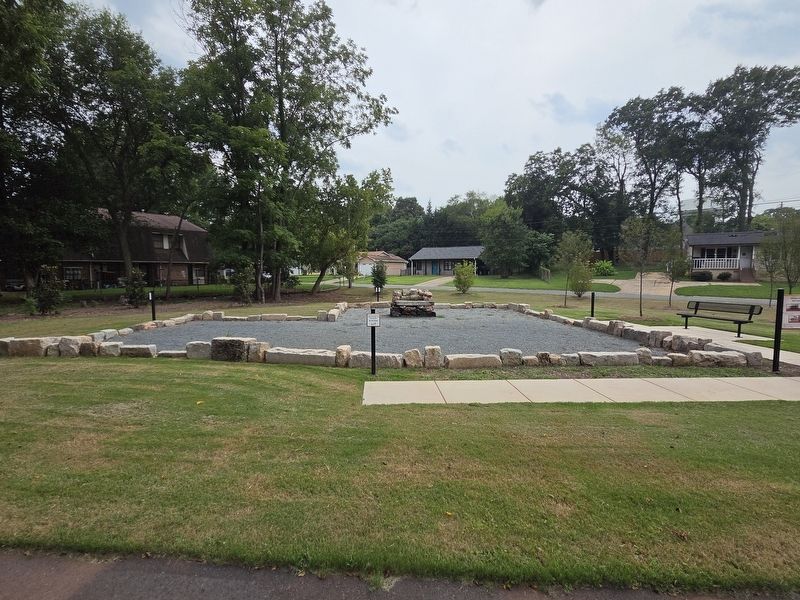
Photographed by Mark Parker, July 28, 2026
3. Full view Ransom Hunter Homesite
Credits. This page was last revised on August 4, 2026. It was originally submitted on July 28, 2026, by Mark Parker of Hickory, North Carolina. This page has been viewed 14 times since then. Photos: 1, 2, 3. submitted on July 28, 2026, by Mark Parker of Hickory, North Carolina. • Bernard Fisher was the editor who published this page.
