Milam in Sabine County, Texas — The American South (West South Central)
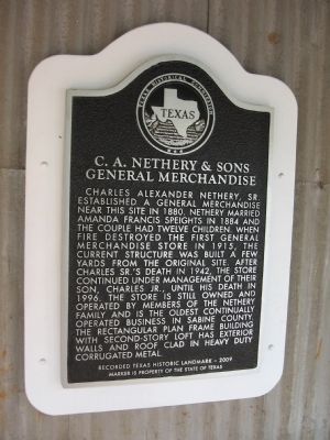
C.A. Nethery & Sons General Merchandise
Photographed by Steve Gustafson, May 8, 2010
1. C.A. Nethery & Sons General Merchandise Marker
Erected 2009 by Texas Historical Commission. (Marker Number 15813.)
Topics. This historical marker is listed in these topic lists: Industry & Commerce • Notable Buildings • Settlements & Settlers. A significant historical year for this entry is 1880.
Location. 31° 25.926′ N, 93° 50.964′ W. Marker is in Milam, Texas, in Sabine County. It is on State
this page online

Regionally, this marker is in the American South, specifically in the Deep South, and in the Piney Woods. Globally, it is in North America, a Gulf of Mexico state, the Western Hemisphere, the Western World, and the Anglosphere. Historically, it finds itself in what was once New Spain, the Republic of Texas, one of the Confederate States of America, and the Antebellum South.
Other nearby markers. At least 8 other markers are within walking distance of this marker: Milam (about 700 feet away, measured in a direct line); Kings Highway (about 700 feet away); a different marker also named Milam (about 700 feet away); The Old San Antonio Road (about 700 feet away); John C. Hale (approx. 0.2 miles away); Milam Masonic Institute (approx. 0.2 miles away); Bethany Baptist Church (approx. ¼ mile away); Milam Cemetery (approx. 0.3 miles away). Touch for a list and map of all markers in Milam.
Photographed by Steve Gustafson, May 8, 2010
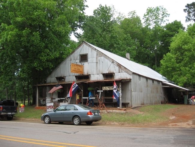
2. C.A. Nethery & Sons General Merchandise Store
The marker is on the wall between the doors.
Credits. This page was last revised on June 16, 2016. It was originally submitted on May 14, 2010, by Steve Gustafson of Lufkin, Texas. This page has been viewed 1,288 times since then and 42 times this year. Photos: 1, 2. submitted on May 14, 2010, by Steve Gustafson of Lufkin, Texas. • Bill Pfingsten was the editor who published this page.
