
Bishop's Stortford in Hertfordshire, England, United Kingdom — Northwestern Europe (the British Isles)
Castle Park
The Remains of Waytemore Castle
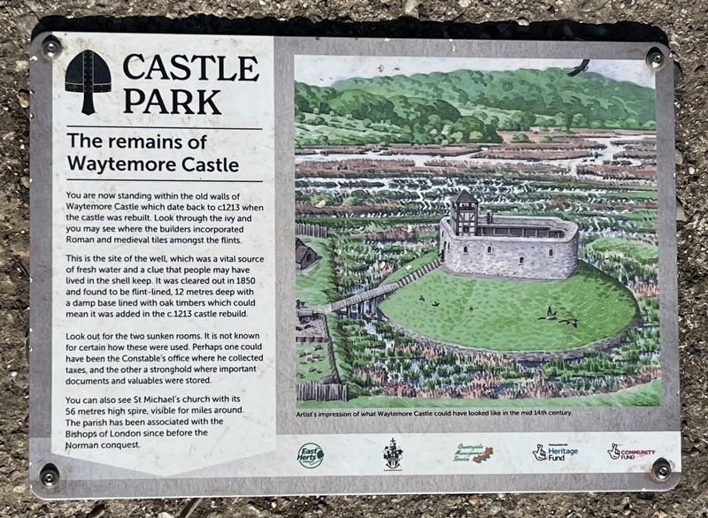
Photographed by Ray Gurganus, May 1, 2026
1. Castle Park Marker
This is the site of the well, which was a vital source of fresh water and a clue that people may have lived in the shell keep. It was cleared out in 1850 and found to be flint-lined, 12 metres deep with a damp base lined with oak timbers which could mean it was added in the c.1213 castle rebuild.
Look out for the two sunken rooms. It is not known for certain how these were used. Perhaps one could have been the Constable's office where he collected taxes, and the other a stronghold where important documents and valuables were stored.
You can also see St Michael's church with its 56 metres high spire, visible for miles around. The parish has been associated with the Bishops of London since before the Norman conquest.
Erected by East Herts Council.
Topics. This historical marker is listed in this topic list: Forts and Castles. A significant historical year for this entry is 1213.
Location. 51° 52.316′ N,
this page online

Regionally, this marker is in the Greater South East. Globally, it is on the Atlantic Ocean, in the North Atlantic Region, in Europe, in Atlantic Europe, on one of the British Isles, in the Western World, and in the Anglosphere. Historically, it finds itself in what was once the Roman Empire.
Other nearby markers. At least one other marker is within 19 kilometers of this marker, measured as the crow flies: Broxbourne Station (approx. 18.5 kilometers away).
Also see . . . Waytemore Castle (Wikipedia). Overview:
Waytemore Castle is a ruined castle in the town of Bishop's Stortford in Hertfordshire, England. The remains are a Grade I listed structure.(Submitted on July 29, 2026.)
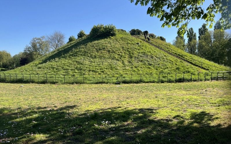
This began as a motte and bailey castle in the time of William the Conqueror. A rectangular great tower was added on the motte in the 12th century.It was improved in the 13th century during the reign of King John and a licence to crenellate was granted in the mid-14th century. It was slighted after the Civil War. In the 17th century it was used as a prison.Photographed by Ray Gurganus, May 1, 20262. The site of Waytemore Castle
Only earthworks, the large motte and foundations of a square tower can now be seen.
Credits. This page was last revised on July 29, 2026. It was originally submitted on July 29, 2026, by Ray Gurganus of Washington, District of Columbia. This page has been viewed 3 times since then. Photos: 1, 2. submitted on July 29, 2026, by Ray Gurganus of Washington, District of Columbia. • Andrew Ruppenstein was the editor who published this page.
Editor’s want-list for this marker. photo of the marker within its surroundings • Can you help?
