
Monroe Township in West Liberty in Logan County, Ohio — The American Midwest (Great Lakes)
Limestone: Seabed to Castle Wall
Photographed by Craig Doda, July 11, 2026
1. Limestone: Seabed to Castle Wall Marker
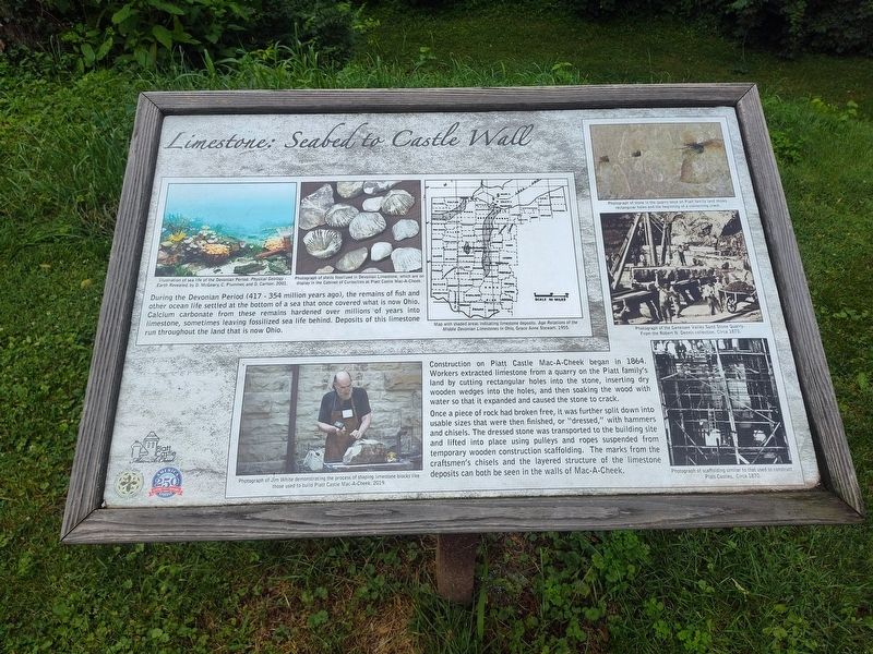
During the Devonian Period (417 - 354 million years ago), the remains of fish and other ocean life settled at the bottom of a sea that once covered what is now Ohio. Calcium carbonate from these remains hardened over millions of years into limestone, sometimes leaving fossilized sea life behind. Deposits of this limestone run throughout the land that is now Ohio.
Construction on Piatt Castle Mac-A-Cheek began in 1864. Workers extracted limestone from a quarry on the Piatt family's land by cutting rectangular holes into the stone, inserting dry wooden wedges into the holes, and then soaking the wood with water so that it expanded and caused the stone to crack.
Once a piece of rock had broken free, it was further split down into usable sizes that were then finished, or "dressed," with hammers and chisels. The dressed stone was transported to the building site and lifted into place using pulleys and ropes suspended from temporary wooden construction scaffolding. The marks from the craftsmen's chisels and the layered structure of the limestone deposits can both be seen in the walls of Mac-A-Cheek.
Erected by Piatt
this page online
Topics and series. This historical marker is listed in these topic lists: Architecture • Forts and Castles • Natural Resources. In addition, it is included in the America 250: Ohio Commission series list. A significant historical year for this entry is 1864.
Location. 40° 15.07′ N, 83° 43.6′ W. Marker is in West Liberty, Ohio, in Logan County. It is in Monroe Township. It is at the intersection of County Route 47 and County Route 245, on the right when traveling north on County Route 47. Touch for map. Marker is at or near this postal address: 10051 Co Rd 47, West Liberty OH 43357, United States of America. Touch for directions.

Regionally, this marker is in Ohio’s Till Plains. It is also in the American Midwest and in the Corn Belt. Globally, it is in North America, the Western Hemisphere, the Western World, and the Anglosphere. Historically, it finds itself in what was once the Viceroyalty of New France, the Haudenosaunee (Iroquois) Confederacy, the territory of the Mississippian Culture, and the Northwest
Photographed by Craig Doda, July 11, 2026
2. Limestone: Seabed to Castle Wall Marker
Other nearby markers. At least 8 other markers are within walking distance of this marker: Let's Play (a few steps from this marker); Who's in the Dog House? (a few steps from this marker); They Lived Long on the Land (a few steps from this marker); A Castle as a Farmhouse (within shouting distance of this marker); The Broad and Fertile Acres (within shouting distance of this marker); Over a Century of Tours (within shouting distance of this marker); Industry on the Macacheek (within shouting distance of this marker); Finding the Balance Between History & Legacy (within shouting distance of this marker). Touch for a list and map of all markers in West Liberty.
Credits. This page was last revised on August 11, 2026. It was originally submitted on July 30, 2026, by Craig Doda of Napoleon, Ohio. This page has been viewed 11 times since then. Photos: 1, 2. submitted on July 30, 2026, by Craig Doda of Napoleon, Ohio. • Devry Becker Jones was the editor who published this page.
