Hybart in Monroe County, Alabama — The American South (East South Central)
Mt Olive Ev. Lutheran Church & School
Photographed by Jimmy Emerson, July 29, 2026
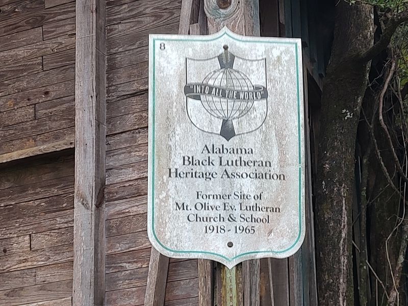
1. Mt Olive Ev. Lutheran Church & School Marker
Former Site of Mt. Olive Ev. Lutheran Church & School
1918-1965
Erected by Alabama Black Lutheran Heritage Association.
Topics. This historical marker is listed in these topic lists: African Americans • Education • Religion & Religious Structures. A significant historical year for this entry is 1918.
Location. 31° 47.607′ N, 87° 23.667′ W. Marker is in Hybart, Alabama, in Monroe County. It is on Alabama 41 (Alabama Route 41), on the left when traveling south. Touch for map. Marker is at or near this postal address: 23561 AL-41, Franklin AL 36444, United States of America. Touch for directions.

Regionally, this marker is in the American South and specifically in the Deep South. Globally, it is in North America, a Gulf of Mexico state, the Western Hemisphere, the Western World, and the Anglosphere. Historically, it finds itself in what was once New Spain, the territory of the Mississippian Culture, one of the Confederate States of America, and the Antebellum South.
Other nearby markers. At least 8 other markers are within 16 miles of this marker, measured as the crow flies: Bell's Landing / Tinela & Hybart
this page online

Photographed by Jimmy Emerson, July 29, 2026
2. Mt Olive Ev. Lutheran Church & School and Marker

Photographed by Jimmy Emerson, July 29, 2026
3. Mt Olive Ev. Lutheran Church & School and Marker
Credits. This page was last revised on August 1, 2026. It was originally submitted on July 30, 2026, by Jimmy Emerson of Dalton, Georgia. This page has been viewed 16 times since then. Photos: 1, 2, 3. submitted on July 30, 2026, by Jimmy Emerson of Dalton, Georgia. • Andrew Ruppenstein was the editor who published this page.
