Near Milam in Sabine County, Texas — The American South (West South Central)
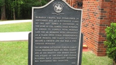
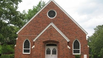
McMahan's Chapel
— United Methodist Church Registered Historic Site No. 3 —
The Reverend Littleton Fowler, early Texas missionary, made his home nearby and at his request was buried under the pulpit of the first dirt-floor building. Each subsequent building has maintained this tradition.
Erected 1991 by United Methodist historic landmark. (Marker Number 3.)
Topics and series. This historical marker is listed in these topic lists: Churches & Religion • Notable Buildings. In addition, it is included in the United Methodist Church Historic Sites series list. A significant historical month for this entry is September 1833.
Location. 31° 27.318′ N, 93° 57.906′ W. Marker is near Milam, Texas, in Sabine County. Marker is on Route 35 Spur, 2 miles south of Texas Highway 21, on the right when traveling south. Touch for map. Marker is in this post office area: Milam TX 75959, United States of America. Touch for directions.
Other nearby markers. At least 8 other markers are within 4 miles of this marker, measured as the crow flies. A different marker also named McMahan's Chapel (within shouting distance of this marker); El Camino Real de los Tejas 1680-1845 (approx. 1.8 miles away); A Snapshot In Time?/¿Una instantánea en el tiempo? (approx. 1.8 miles away); Two Miles Southeast to McMahan's Chapel (approx. 1.9 miles away); County Line Baptist Church and Cemetery (approx. 2 miles away); Kings Highway Camino Real — Old San Antonio Road (approx. 3.2 miles away); El Lobanillo (approx. 3.2 miles away); Thompson Family (approx. 3.9 miles away).
Credits. This page was last revised on August 20, 2023. It was originally submitted on May 15, 2010, by Steve Gustafson of Lufkin, Texas. This page has been viewed 663 times since then and 13 times this year. Photos: 1, 2. submitted on May 15, 2010, by Steve Gustafson of Lufkin, Texas. • Syd Whittle was the editor who published this page.

