Chicksands in Central Bedfordshire, England, United Kingdom — Northwestern Europe (the British Isles)
Biggleswade Station
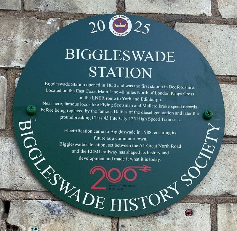
Photographed by Ray Gurganus, May 2, 2026
1. Biggleswade Station Marker
Near here, famous locos like Flying Scotsman and Mallard broke speed records before being replaced by the famous Deltics of the diesel generation and later the groundbreaking Class 43 InterCity 125 High Speed Train sets.
Electrification came to Biggleswade in 1988, ensuring its future as a commuter town.
Biggleswade's location, set between the A1 Great North Road and the ECML railway has shaped its history and development and made it what it is today.
Erected 2025 by Biggleswade Town Council.
Topics. This historical marker is listed in this topic list: Railroads & Streetcars. A significant historical year for this entry is 1850.
Location. 52° 5.1′ N, 0° 15.692′ W. Marker is in Chicksands, England, in Central Bedfordshire. It is on Station Road. Touch for map. Marker is at or near this postal address: 11 Station Road, Chicksands, England SG18 8AL, United Kingdom. Touch for directions.

Regionally, it is on the Atlantic
this page online
Other nearby markers. At least 8 other markers are within 16 kilometers of this marker, measured as the crow flies: The Sandy Show (approx. 5 kilometers away); In celebration of the life and reign of our beloved Queen Elizabeth II (approx. 5 kilometers away); Captain Sir William Peal (approx. 5 kilometers away); The Two Shannons (approx. 5 kilometers away); Rose & Crown (approx. 15.4 kilometers away); The Angel Vaults (approx. 15.4 kilometers away); Jeeves Yard 2002 (approx. 15.5 kilometers away); Hitchin British Schools (approx. 15.5 kilometers away).
Also see . . . Biggleswade railway station (Wikipedia). (Submitted on July 31, 2026.)

Photographed by Rodney Burton (via Wikimedia Commons under CC 2.0 license), May 19, 2006
2. Biggleswade Station
Credits. This page was last revised on July 31, 2026. It was originally submitted on July 31, 2026, by Ray Gurganus of Washington, District of Columbia. This page has been viewed 9 times since then. Photos: 1. submitted on July 31, 2026, by Ray Gurganus of Washington, District of Columbia. 2. submitted on July 31, 2026. • Andrew Ruppenstein was the editor who published this page.
