Burfordville in Cape Girardeau County, Missouri — The American Midwest (Upper Plains)
History of Covered Bridges in America
Photographed by Cosmos Mariner, August 20, 2021
1. History of Covered Bridges in America Marker
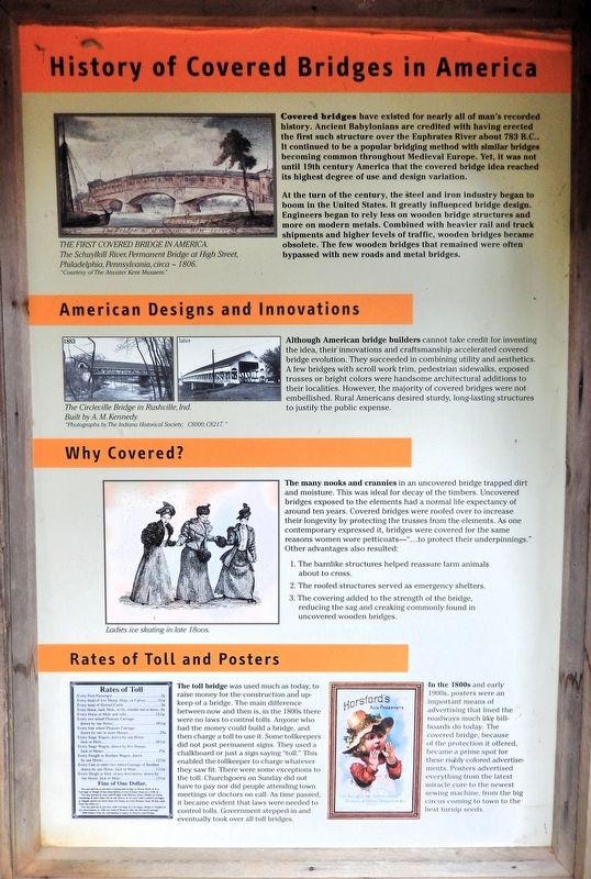
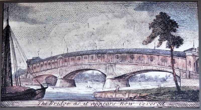
Covered bridges have existed for nearly all of man's recorded history. Ancient Babylonians are credited with having erected the first such structure over the Euphrates River about 783 B.C.. It continued to be a popular bridging method with similar bridges becoming common throughout Medieval Europe. Yet, it was not until 19th century America that the covered bridge idea reached its highest degree of use and design variation.
At the turn of the century, the steel and iron industry began to boom in the United States. It greatly influenced bridge design. Engineers began to rely less on wooden bridge structures and more on modern metals. Combined with heavier rail and truck shipments and higher levels of traffic, wooden bridges became obsolete. The few wooden bridges that remained were often bypassed with new roads and metal bridges.
American Designs and Innovations
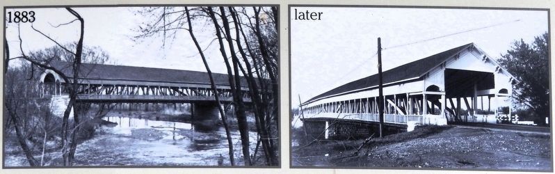
Although American bridge builders cannot take credit for inventing the idea, their innovations and craftsmanship accelerated covered bridge evolution. They succeeded in combining utility and aesthetics. A few bridges with scroll work trim, pedestrian sidewalks, exposed trusses or bright colors were handsome architectural additions to their localities. However, the majority of covered bridges were not embellished. Rural Americans desired sturdy, long-lasting structures to justify the public expense.
Why Covered?
The many nooks and crannies in an uncovered bridge trapped dirt and moisture. This was ideal for decay of the timbers. Uncovered bridges exposed to the elements had a normal life expectancy of around ten years. Covered bridges were roofed over to increase their longevity by protecting the trusses from the elements. As one contemporary expressed it, bridges were covered for the same reasons women wore petticoats — “...to protect their underpinnings.”
this page online
Other advantages also resulted:
1. The barnlike structures helped reassure farm animals about to cross.
2. The roofed structures served as emergency shelters.
3. The covering added to the strength of the bridge, reducing the sag and creaking commonly found in uncovered wooden bridges.
Rates of Toll and Posters
The toll bridge was used much as today, to raise money for the construction and up-keep of a bridge. The main difference between now and then is, in the 1800s there were no laws to control tolls. Anyone who had the money could build a bridge, and then charge a toll to use it. Some tollkeepers did not post permanent signs. They used a chalkboard or just a sign saying “toll.” This enabled the tollkeeper to charge whatever they saw fit. There were some exceptions to the toll. Churchgoers on Sunday did not have to pay nor did people attending town meetings or doctors on call. As time passed, it became evident that laws were needed to control tolls. Government stepped in and eventually took over all toll bridges.
In the 1800s and early 1900s, posters were an important means of advertising that lined the roadways much like billboards do
Courtesy The Atwater Kent Museum
2. Marker detail: The First Covered Bridge in America
The Schuylkill River, Permanent Bridge at High Street, Philadelphia, Pennsylvania, circa 1806.
[image caption] Ladies ice skating in the late 1800s.
Erected by Missouri Department of Natural Resources.
Topics and series. This historical marker is listed in these topic lists: Architecture • Bridges & Viaducts. In addition, it is included in the Covered Bridges series list.
Location. 37° 22.052′ N, 89° 48.165′ W. Marker is in Burfordville, Missouri, in Cape Girardeau County. It is on Bollinger Mill Road just south of State Highway HH, on the left when traveling south. The marker is on the interpretive kiosk at Bollinger Mill State Historic Site. Touch for map. Marker is at or near this postal address: 113 Bollinger Mill Road, Burfordville MO 63739, United States of America. Touch for directions.

Regionally, this marker is in Southeast Missouri. It is also in the American Ozarks, in the Lewis &
Courtesy Indiana Historical Society; C8000, C8217
3. Marker detail: The Circleville Bridge in Rushville, Ind.
Other nearby markers. At least 8 other markers are within 8 miles of this marker, measured as the crow flies: Basic Truss Designs for Covered Bridges (here, next to this marker); Genealogy of Howe Truss Design (here, next to this marker); History of Burfordville Covered Bridge (here, next to this marker); Restoration of the Burfordville Covered Bridge (here, next to this marker); Covered Bridges in Missouri (here, next to this marker); Bollinger Mill / Burfordville Covered Bridge (a few steps from this marker); "Historical Marker" (approx. 6.3 miles away); Most…are poor and exceedingly dissipated. (approx. 7½ miles away). Touch for a list and map of all markers in Burfordville.
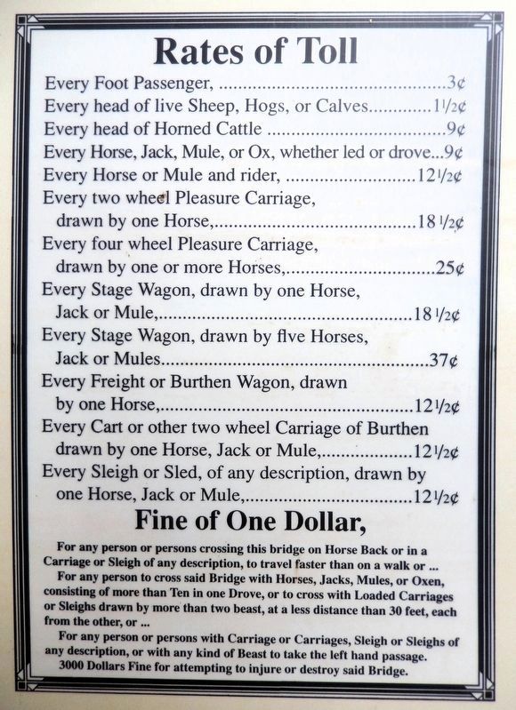
4. Marker detail: Rates of Toll
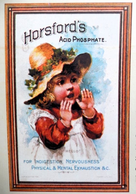
5. Marker detail: Advertising Poster
Photographed by Cosmos Mariner, August 20, 2021
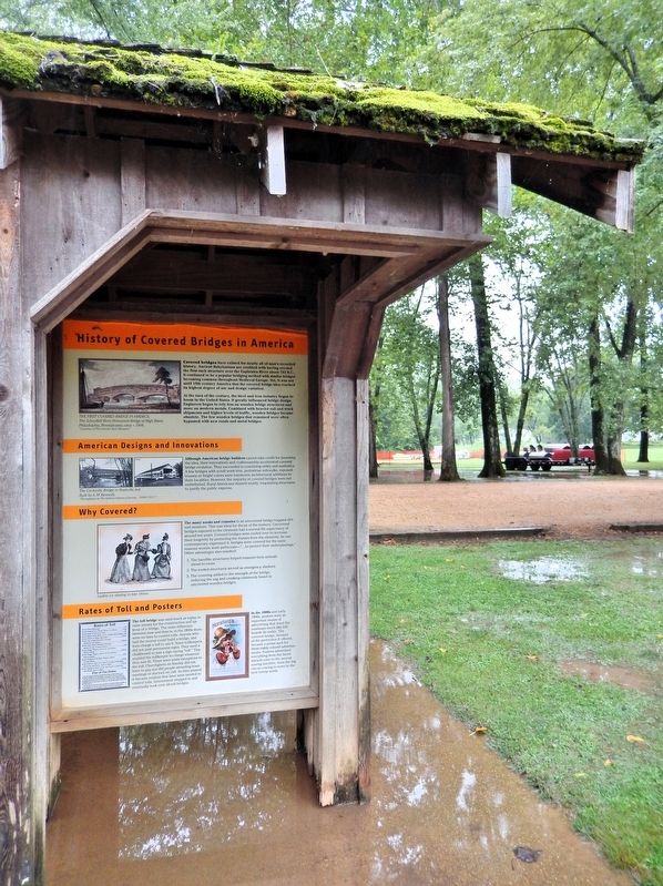
6. History of Covered Bridges in America Marker
This marker is on the east side of the interpretive kiosk at Bollinger Mill State Historic Site.
Credits. This page was last revised on August 4, 2026. It was originally submitted on August 1, 2026, by Cosmos Mariner of Cape Canaveral, Florida. This page has been viewed 19 times since then. Photos: 1, 2, 3, 4, 5, 6. submitted on August 2, 2026, by Cosmos Mariner of Cape Canaveral, Florida.
