Tyrone Township in Altoona in Blair County, Pennsylvania — The American Northeast (Mid-Atlantic)
The Lead Mines
Photographed by Richard Kicovic, August 1, 2026
1. 400 Feet North of This Marker Marker
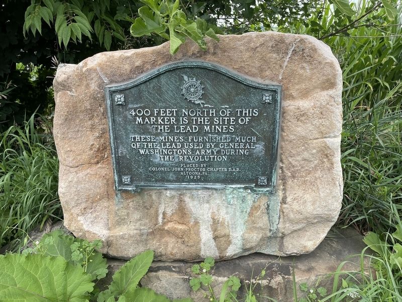
400 Feet north of this marker is the site of the lead mines
These mines furnished much of the lead used by General Washingtons army during the revolution.
Erected 1925 by Daughters of the American Revolution Colonel John Proctor Chapter.
Topics and series. This historical marker is listed in these topic lists: Industry & Commerce • War, US Revolutionary. In addition, it is included in the Daughters of the American Revolution (DAR) series list.
Location. 40° 34.191′ N, 78° 16.278′ W. Marker is in Altoona, Pennsylvania, in Blair County. It is in Tyrone Township. It is on Kettle Road, on the left when traveling north. Touch for map. Marker is at or near this postal address: 4540 Kettle Road, Altoona PA 16601, United States of America. Touch for directions.

Regionally, this marker is in the American Northeast, in the Mid-Atlantic, in Appalachia, and specifically in Northern Appalachia. Globally, it is in North America, the Western Hemisphere, the Western World, and the Anglosphere. Historically, it finds itself in what was once the Haudenosaunee (Iroquois)
this page online
Other nearby markers. At least 8 other markers are within 4 miles of this marker, measured as the crow flies: Conestoga Wagon & Pennsylvania Barn (approx. 0.9 miles away); "The Lead Mine Fort" (approx. 0.9 miles away); The 1976 Bicentennial Reconstruction (approx. 0.9 miles away); The Three Sisters (approx. 0.9 miles away); Fort Roberdeau (approx. 3.1 miles away); War Memorial (approx. 3.4 miles away); Miss R Track Dedication (approx. 3.6 miles away); a different marker also named War Memorial (approx. 3.6 miles away). Touch for a list and map of all markers in Altoona.
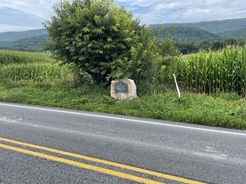
More about this marker. Low down on the side of the 2 lane road.
Also see . . . Geologists search for former lead mines (CS Observer-Reporter, April 9, 2017). (Submitted on August 4, 2026.)
Photographed by Richard Kicovic, August 1, 2026
2. 400 Feet North of This Marker Marker
Photographed by Richard Kicovic, August 1, 2026
3. 400 Feet North of This Marker Marker
Credits. This page was last revised on August 5, 2026. It was originally submitted on August 2, 2026, by Richard Kicovic of Pittsburgh, Pennsylvania. This page has been viewed 21 times since then. Photos: 1, 2, 3. submitted on August 2, 2026, by Richard Kicovic of Pittsburgh, Pennsylvania. • Andrew Ruppenstein was the editor who published this page.
