
Santa Barbara in Santa Barbara County, California — The American West (Pacific Coastal)
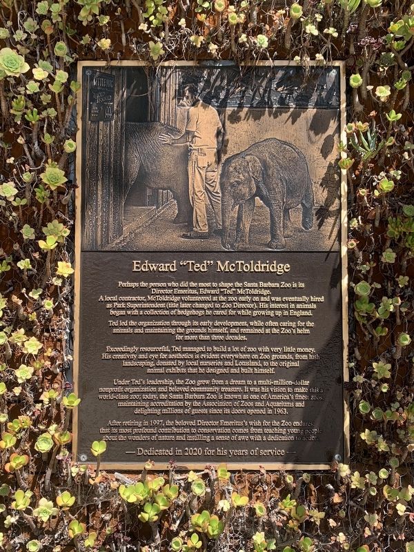
Edward "Ted" McToldridge
Photographed by Liam Williams, August 1, 2026
1. Edward "Ted" McToldridge Marker
A local contractor, McToldridge volunteered at the zoo early on and was eventually hired as Park Superintendent (title later changed to Zoo Director). His interest in animals began with a collection of hedgehogs he cared for while growing up in England.
Ted led the organization through its early development, while often caring for the animals and maintaining the grounds himself, and remained at the Zoo's helm for more than three decades.
Exceedingly resourceful, Ted managed to build a lot of zoo with very little money. His creativity and eye for aesthetics is evident everywhere on Zoo grounds, from lush landscaping, donated by local nurseries and Lotusland, to the original animal exhibits that he designed and built himself.
Under Ted's leadership, the Zoo grew from a dream to a multi-million-dollar nonprofit organization and beloved community treasure. It was his vision to make this. world-class zoo; today, the Santa Barbara Zoo is known as one of America's finest zoos maintaining accreditation by
this page online
After retiring in 1997, the beloved Director Emeritus's wish for the Zoo endures that its most profound contribution to conservation comes from teaching young people about the wonders of nature and instilling a sense of awe with a dedication to action.
-Dedicated in 2020 for his years of service-
Erected 2020.
Topics. This historical marker is listed in these topic lists: Animals • Charity & Public Work. A significant historical year for this entry is 1963.
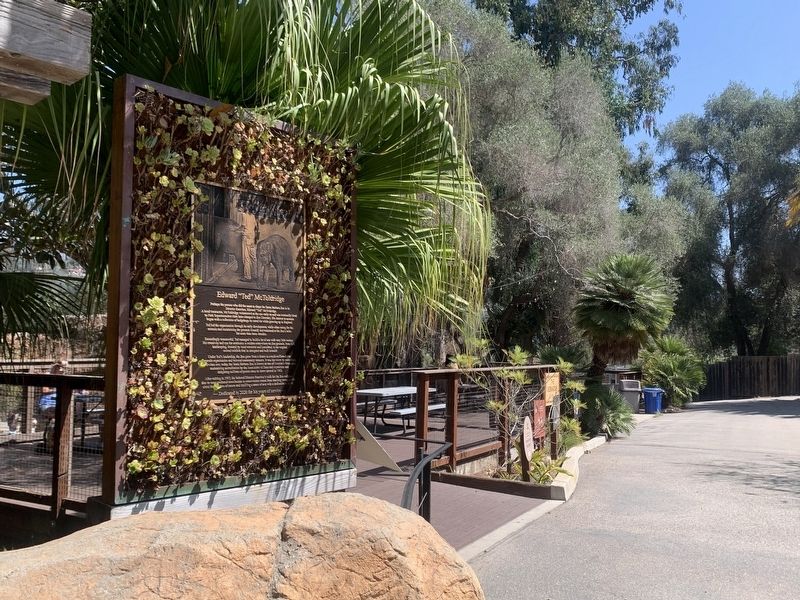
Location. 34° 25.2′ N, 119° 39.9′ W. Marker is in Santa Barbara, California, in Santa Barbara County. It can be reached from Ninos Drive. This marker is located on the grounds of the Santa Barbara Zoo. Touch for map. Marker is at or near this postal address: 500 Ninos Drive, Santa Barbara CA 93103, United States of America. Touch for directions.

Regionally, this marker is on California’s Central Coast, specifically on the Coast Ranges, and specifically in the Transverse Ranges. It is also on the American Pacific Coast. Globally, it is in North America, on
Photographed by Liam Williams, August 1, 2026
2. Edward "Ted" McToldridge Marker
Other nearby markers. At least 8 other markers are within 2 miles of this marker, measured as the crow flies: Civil War Memorial (approx. 0.6 miles away); The Southern Pacific RR Roundhouse (approx. 0.7 miles away); "St. Barbara" (approx. 1.4 miles away); Stearns Wharf (approx. 1.4 miles away); Historic Capstan (approx. 1.4 miles away); Richard Henry Dana, Jr. (approx. 1.4 miles away); Stearns Wharf Fire (approx. 1.4 miles away); Fly To-Day (approx. 1½ miles away). Touch for a list and map of all markers in Santa Barbara.
Credits. This page was last revised on August 2, 2026. It was originally submitted on August 2, 2026, by Liam Williams of Irvine, California. This page has been viewed 14 times since then. Photos: 1, 2. submitted on August 2, 2026, by Liam Williams of Irvine, California. • Andrew Ruppenstein was the editor who published this page.
