New Woodstock in Madison County, New York — The American Northeast (Mid-Atlantic)
New Woodstock Regional Historical Society
Photographed by Kevin W., August 1, 2024
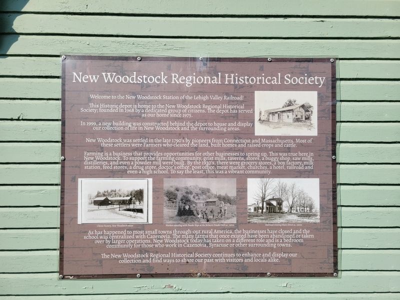
1. New Woodstock Regional Historical Society Marker
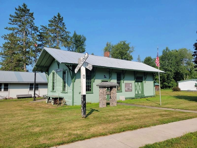
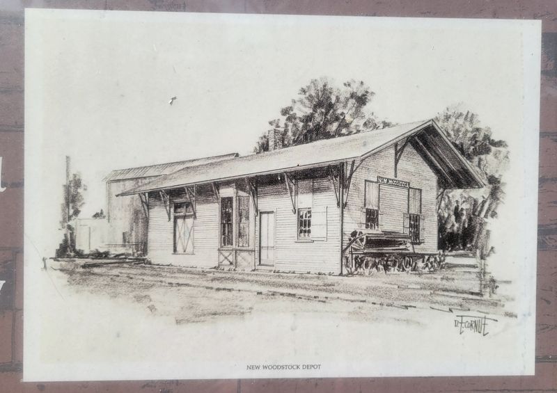
This Historic depot is home to the New Woodstock Regional Historical Society; founded in 1968 by a dedicated group of citizens. The depot has served as our home since 1975.
In 1999, a new building was constructed behind the depot to house and display our collection of life in New Woodstock and the surrounding areas.
New Woodstock was settled in the late 1790's by pioneers from Connecticut and Massachusetts. Most of these settlers were Farmers who cleared the land, built homes and raised crops and cattle.
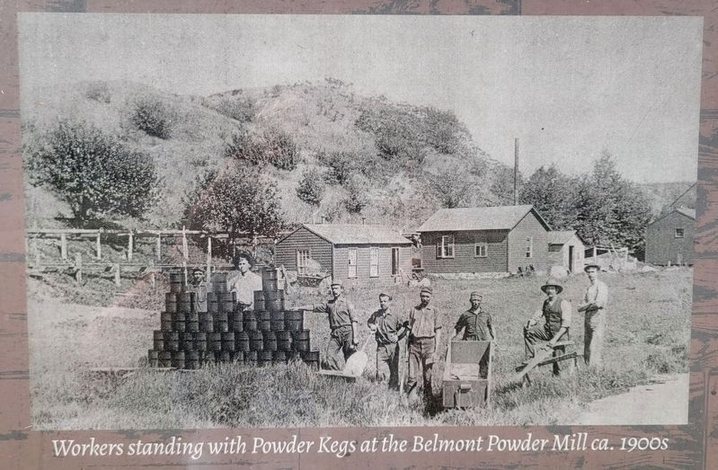
Farming is a business that provides opportunities for other businesses to spring up. This was true here in New Woodstock. To support the farming community, grist mills, taverns, stores, a buggy shop, saw mills, distilleries, and even a powder mill were built. By the 1930's, there were grocery stores, a box factory, milk station, feed stores, a drug store, doctor's office, post office, meat market, churches, a hotel, railroad and even a high school. To say the least, this was a vibrant community.
As has happened to most small towns through-out
this page online
The New Woodstock Regional Historical Society continues to enhance and display our collection and find ways to share our past with visitors and locals alike.
Erected by New Woodstock Regional Historical Society.
Topics. This historical marker is listed in these topic lists: Charity & Public Work • Railroads & Streetcars • Settlements & Settlers. A significant historical year for this entry is 1968.
Location. 42° 50.958′ N, 75° 51.493′ W. Marker is in New Woodstock, New York, in Madison County. It is on Railroad Street just north of Main Street (New York State Route 13), on the left when traveling north. Touch for map. Marker is at or near this postal address: 2641 Railroad St, New Woodstock NY 13122, United States of America. Touch for directions.

Regionally, this marker is in Upstate New York,
Photographed by Kevin W., August 1, 2024
2. New Woodstock Regional Historical Society Marker and Historic depot
Other nearby markers. At least 8 other markers are within 3 miles of this marker, measured as the crow flies: Baptist Church (about 400 feet away, measured in a direct line); New Woodstock War Memorial (about 500 feet away); Church Building (approx. 0.2 miles away); Smith Tavern (approx. 0.2 miles away); New Woodstock Heritage Park (approx. 0.2 miles away); a different marker also named New Woodstock Heritage Park (approx. 0.2 miles away); Belmont School (approx. 2 miles away); Site of Belmont Powder Mill (approx. 2.2 miles away). Touch for a list and map of all markers in New Woodstock.
Another marker is no longer nearby. Lehigh Valley Railroad (was a few steps from this marker but has been confirmed missing).
Photographed by Kevin W., August 1, 2024
3. New Woodstock Regional Historical Society Marker Photo
This photo is from the upper right of the marker.

Photographed by Kevin W., August 1, 2024
4. New Woodstock Regional Historical Society Marker Photo
Cheese Factory, New Woodstock 1900s
Photographed by Kevin W., August 1, 2024
5. New Woodstock Regional Historical Society Marker Photo
Workers standing with powder kegs at the Belmont Powder Mill ca. 1900s.
Photographed by Kevin W., August 1, 2024
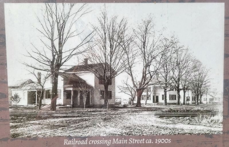
6. New Woodstock Regional Historical Society Marker Photo
Railroad Crossing, Main Street ca 1900s.
Photographed by Kevin W., August 1, 2024
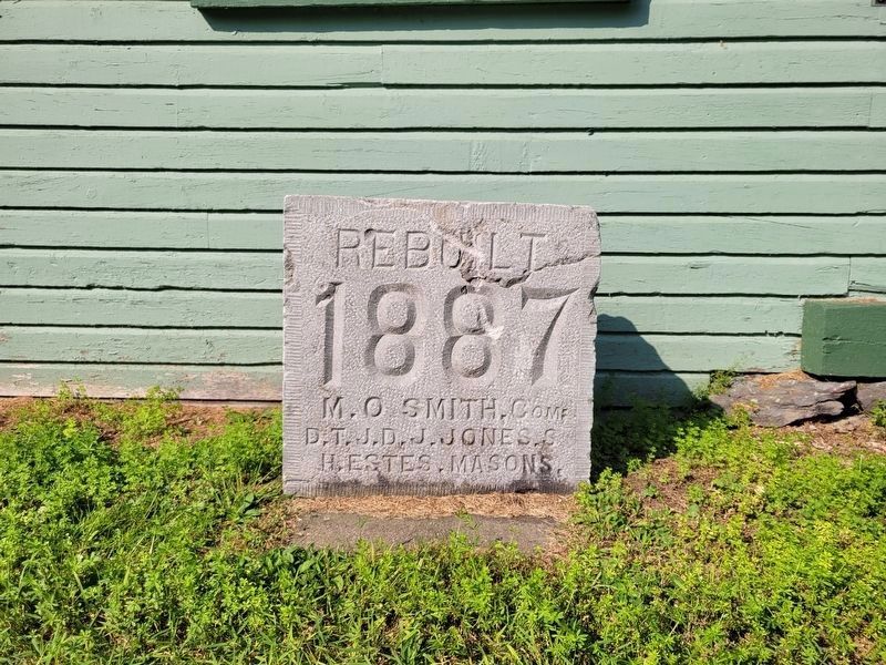
7. Corner(?) Stone near the marker.
Rebuilt 1887
M. O. Smith, Com
D.T.J.D. J. Jones, S.
H. Estes, Masons
M. O. Smith, Com
D.T.J.D. J. Jones, S.
H. Estes, Masons
Credits. This page was last revised on August 4, 2026. It was originally submitted on August 2, 2026, by Kevin W. of Stafford, Virginia. This page has been viewed 12 times since then. Photos: 1, 2, 3, 4, 5, 6, 7. submitted on August 2, 2026, by Kevin W. of Stafford, Virginia.
