Peterborough, England, United Kingdom — Northwestern Europe (the British Isles)
Foundry Walk
Photographed by Ray Gurganus, May 3, 2026
1. Foundry Walk Marker
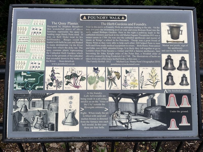
The Quay Planter.
Designed by Stephen Broadbent this wonderful piece of street furniture represents the quay or landing stage Henry Penn used. It was on Bell Dyke near to his bellfoundry. Barges could be loaded with bells he cast and floated to many destinations via the River Nene into which the dyke ran. The quay contains plants representing the Cathedral Herb Gardens which were in the grounds of the cathedral that extended down to the banks of the River.
The Herb Gardens and Foundry.
Near to this point is Foundry Walk an underpass leading to the site. On the way you pass the swimming pool or Lido and cross Bishops Road into the aptly named Bishops Gardens. Here to the right a pathway leads to the cathedral cloisters and back to the old Market Square. Theophilus Hill was a minor canon in 1709. He was also the cathedral apothecary and master of music at 'Kings' a school in the Precincts. Theophilus was a great friend of Henry Penn as they were able to help each other. Hill helped Penn to tune bells and Penn made medical equipment in return. Both Henry Penn junior and John, son of Hill, attended Kings. It is likely
this page online
At the foundry.
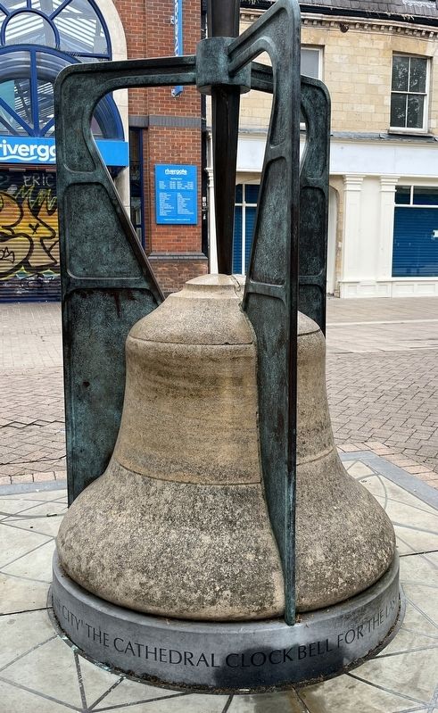
Left, bell moulds are being made in a pit using a strickle as on the "Voice of the City' outside the Rivergate entrance.
Right - When ready the pit is filled with sand and molten bronze is directed from the furnace into each bell mould. In this case there are four bells.
Topics. This historical marker is listed in this topic list: Industry & Commerce.
Location. 52° 34.177′ N, 0° 14.507′ W. Marker is in Peterborough, England. It is on Bridge Street. Touch for map. Marker is at or near this postal address: 49 Bridge Street, Peterborough, England PE1 1DY, United Kingdom. Touch for directions.

Regionally, this marker is in East Anglia. Globally, it is on the Atlantic Ocean, in the North Atlantic Region,
Photographed by Ray Gurganus, May 3, 2026
2. Foundry Walk Bell Sculpture
Other nearby markers. At least 8 other markers are within walking distance of this marker: Narrow Bridge Street (about 90 meters away, measured in a direct line); Crossing the River (about 90 meters away); Abbey and Cathedral (approx. 0.3 kilometers away); Simon Gunton (approx. 0.3 kilometers away); St Thomas Becket (approx. 0.3 kilometers away); Welcome to Peterborough Cathedral (approx. 0.3 kilometers away); The Guildhall (approx. 0.3 kilometers away); Markets and Monarchs (approx. 0.4 kilometers away). Touch for a list and map of all markers in Peterborough.
Credits. This page was last revised on August 4, 2026. It was originally submitted on August 3, 2026, by Ray Gurganus of Washington, District of Columbia. This page has been viewed 10 times since then. Photos: 1, 2. submitted on August 3, 2026, by Ray Gurganus of Washington, District of Columbia. • Andrew Ruppenstein was the editor who published this page.
