Burfordville in Cape Girardeau County, Missouri — The American Midwest (Upper Plains)
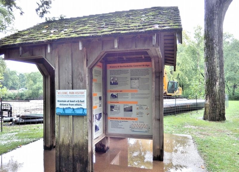
History of Burfordville Covered Bridge
Photographed by Cosmos Mariner, August 20, 2021
1. History of Burfordville Covered Bridge Marker
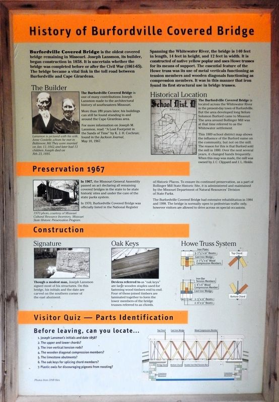
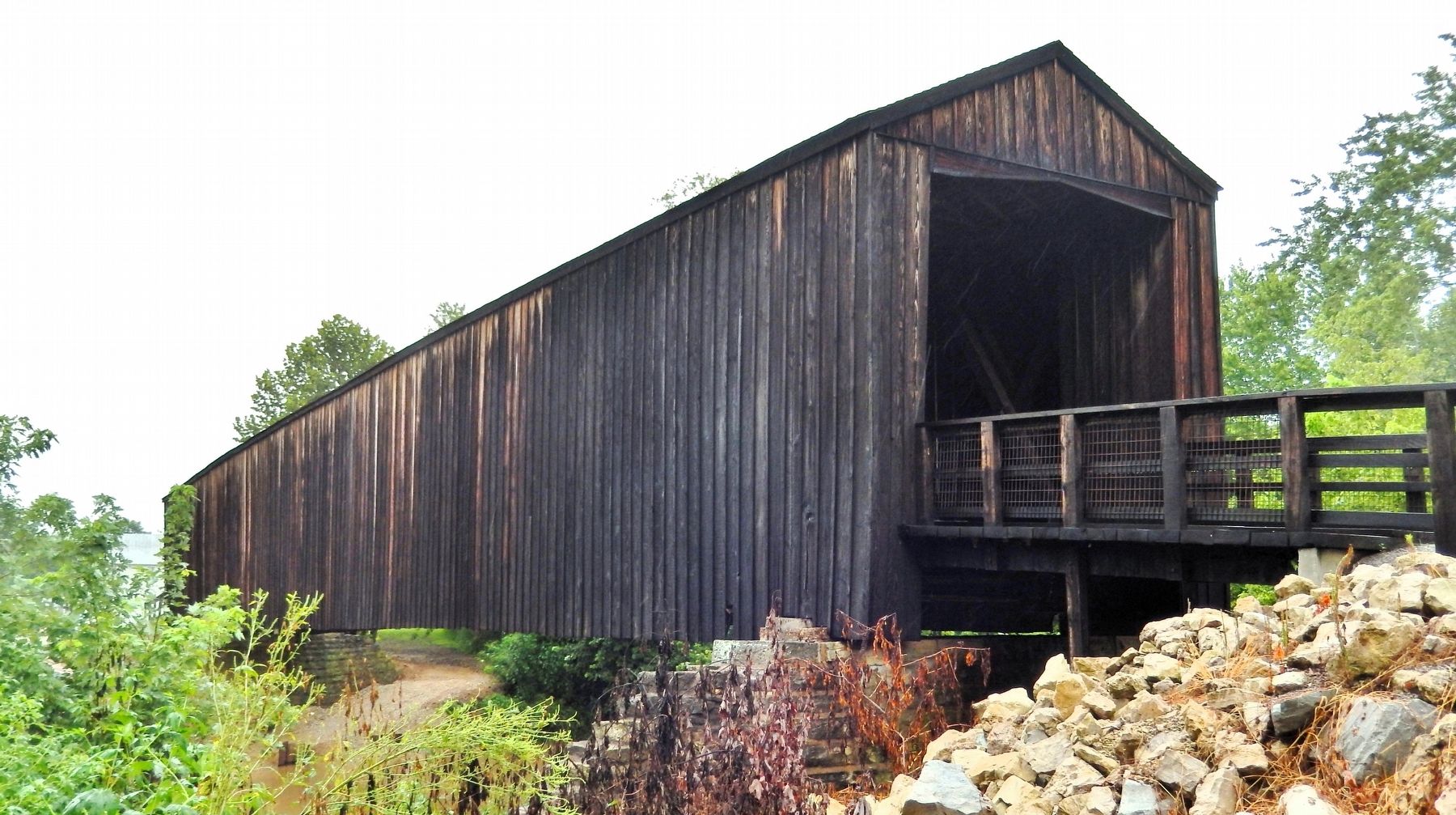
Burfordville Covered Bridge is the oldest covered bridge remaining in Missouri. Joseph Lansmon, its builder, began construction in 1858. It is uncertain whether the bridge was completed before or after the Civil War (1861-65). The bridge became a vital link in the toll road between Burfordville and Cape Girardeau.
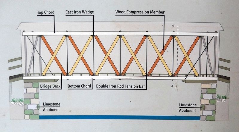
Spanning the Whitewater River, the bridge is 140 feet in length, 14 feet in height, and 12 feet in width. It is constructed of native yellow poplar and uses Howe trusses for its means of support. The essential feature of the Howe truss was its use of metal verticals functioning as tension members and wooden diagonals functioning as compression members. It was in this manner that iron found its first structural use in bridge trusses.
The Builder
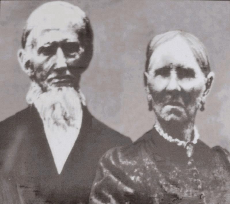
The Burfordville Covered Bridge is one of many contributions Joseph Lansmon made to the architectural history of southeastern Missouri. More than 100 years later, his buildings can still be found standing in and around the Cape Girardeau area. For more information on Joseph M. Lansmon, read: “A Lost Footprint in the Sands of Time” by K. J. H. Cochran; found in the Jackson Journal,
this page online
Historical Location
The Burfordville Covered Bridge is located across the Whitewater River in the present-day town of Burfordville. But the area developed long before Solomon Burford came to Missouri. The area around Bollinger Mill was at that time referred to as the Whitewater settlement.
This 1889 school district map shows the influence of the Burford name on the community, but not on the mill. The reason for this is that Burford sold the mill in 1880. Over the next several years, it changed hands frequently. When this map was made, the mill was owned by J. C. Clippard and J. L Hinkle.
Preservation 1967
In 1967, the Missouri General Assembly passed an act declaring all remaining covered bridges in the state to be state historic sites and under the care of the state parks system. In 1970, Burfordville Covered Bridge was officially listed in the National Register of Historic Places. To ensure its continued preservation, as a part of Bollinger Mill State Historic Site, it is administered and maintained by the Missouri Department of Natural Resources' Division of State Parks.
The Burfordville Covered Bridge had extensive rehabilitation
Courtesy Missouri Department of Natural Resources
2. Marker detail: The Builder
Lansmon is pictured with his wife, Anne Cordelle, whom he met in Baltimore, Md. They were married on Jan. 13, 1842, and later had 13 children. Joseph died on Feb. 23, 1895.
Construction
Signature
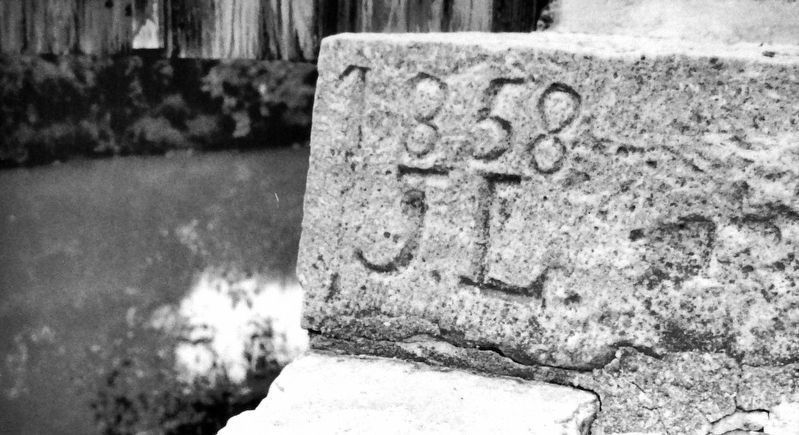
Though a modest man, Joseph Lansmon signed most of his structures. On this bridge, his initials and the date are carved on the southern corner of the east abutment.
Oak Keys
Devices referred to as “oak keys” are large wooden staples used for fastening wood timbers end to end. Four of these joined timbers are laminated together to form the lower members of the bridge trusses referred to as chords.
Visitor Quiz — Parts Identification
Before leaving, can you locate…
1. Joseph Lansmon's initials and date 1858?
2. The upper and lower chords?
3. The iron vertical tension rods?
4. The wooden diagonal compression members?
5. The limestone abutments?
6. The oak keys for splicing chord members?
7. Plastic owls for discouraging pigeons from roosting?
[image captions]
• Historical Location - 1889 School District Map
• 1970 Bridge Photo
• Oak Keys
• Howe Truss System
Erected by Missouri Department of Natural Resources.
Topics and series. This historical marker is listed in these
Courtesy Missouri Department of Natural Resources
3. Marker detail: Signature
Though a modest man, Joseph Lansmon signed most of his structures. On this bridge, his initials and the date are carved on the southern corner of the east abutment.
Location. 37° 22.052′ N, 89° 48.168′ W. Marker is in Burfordville, Missouri, in Cape Girardeau County. It is on Bollinger Mill Road just south of State Highway HH, on the left when traveling south. The marker is on the interpretive kiosk at Bollinger Mill State Historic Site. Touch for map. Marker is at or near this postal address: 113 Bollinger Mill Road, Burfordville MO 63739, United States of America. Touch for directions.

Regionally, this marker is in Southeast Missouri. It is also in the American Ozarks, in the Lewis & Clark Corridor, in the Corn Belt, and in the Great River Road Region. Globally, it is in North America, the Western Hemisphere, the Western World, and the Anglosphere. Historically, it finds itself in what was once the territory of the Mississippian Culture, the Louisiana Purchase, and the Antebellum South.
Other nearby markers. At least 8 other markers are within 8 miles of this marker,
4. Marker detail: Burfordville Covered Bridge Diagram
Regarding History of Burfordville Covered Bridge. National Register of Historic Places № 70000325.
From the National Register Nomination prepared by Charla A. Piggott, 3/5/1970:
The Burfordville Covered Bridge is primarily significant as one of only four surviving covered bridges in Missouri. It has further significance as one of three covered bridges in Missouri employing the Howe Truss in its construction. The rectangular structure above the bridge floor was originally yellow poplar. During restoration original structural memberswere left intact. Replacement lumber of pressure treated Douglas fir was used for siding, battens, joists and approaches. The original roofing material of the ridge roof has been replaced with corrugated galvanized metal. At either end of the bridge are spacious portals. The floor of the bridge projects beyond the housing structure to form a short, uncovered bridge spanning a depression between the abutment and the road. Wooden guard railings are on either side of the approach. Inside the bridge there are no enclosures and diagonal cross timbers, and vertical iron bars characteristic of Howe truss construction are visible. The structural technique of dovetailing and mortising renders the bridge self-supporting. The trusses are held in position by cross bracing overhead.Photographed by Cosmos Mariner, August 20, 20215. History of Burfordville Covered Bridge MarkerThis marker is on the west side of the interpretive kiosk at Bollinger Mill State Historic Site.
Also see . . . Burfordville Covered Bridge (Missouri State Parks).
Excerpt: After the Civil War, the bridge became a vital link, especially to farmers driving wagonloads of grain destined for the mill. The bridge exhibits Howe-truss construction, named for William Howe, who patented the design in 1840. The essential feature of the design was its use(Submitted on August 3, 2026, by Cosmos Mariner of Cape Canaveral, Florida.)of vertical iron rods to draw the diagonal wooden members tight against the top and bottom of the truss.Photographed by Cosmos Mariner, August 20, 20216. Burfordville Covered BridgeThe road going through the bridge was part of the toll-road system between Burfordville, Jackson and Cape Girardeau. At that time, toll roads and bridges were commonly operated as private businesses. Tolls were charged until 1906 when local farmers, tired of waiting for the courts to abolish the tolls, broke down the gates and used the roads without paying.
The most extensive repairs to the bridge were completed in the summer of 1998 when the trusses were repaired. Lower truss timbers, support timbers and vertical iron rods, which provide the necessary tension needed for the trusses to function, were replaced. Although some damaged siding was replaced, every attempt was made to avoid altering the appearance of the bridge.
Credits. This page was last revised on August 4, 2026. It was originally submitted on August 3, 2026, by Cosmos Mariner of Cape Canaveral, Florida. This page has been viewed 9 times since then. Photos: 1, 2, 3, 4, 5, 6. submitted on August 3, 2026, by Cosmos Mariner of Cape Canaveral, Florida.
