
Moulineaux in Seine-Maritime, Normandy, France — Western Europe
Entre ruine romantique et site archéologique
⎯⎯⎯
Between Romantic Ruin and Archaeological Site
1750-1900
| — | Robert le Diable / Robert the Devil | — |
Photographed by James Hulse
1. Entre ruine romantique et site archéologique / Between Romantic Ruin and Archaeological Site Marker

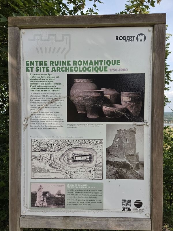
À la fin du Moyen Âge, le château de Moulineaux est abandonné. Au XVIIIᵉ siècle, ses ruines romantiques commencent à éveiller l’intérêt. C’est à cette époque que le château de Moulineaux devient le château de Robert le Diable.
Les premières fouilles archéologiques sont effectuées vers 1758. Elles permettent de retracer le plan de la forteresse du Moyen Âge. Un siècle plus tard, en 1855, des travaux menés à l’emplacement des douves par le nouveau propriétaire des ruines, M. Martin, négociant à Rouen, révèlent un cimetière gaulois.
Les tombes étaient logées dans la craie. Une dizaine de vases furent mis au jour par l’abbé Cochet, membre de la Commission départementale des antiquités et pionnier de l’archéologie comme discipline scientifique en France. Plusieurs de ces objets entrent alors dans les collections du musée des Antiquités de Rouen, actuel Musée Beauvoisine.
Un lieu de combats pendant la guerre de 1870
En 1870, le château entre à nouveau dans l’Histoire. Lors de la guerre de 1870 qui oppose les soldats français aux Prussiens, les deux troupes se combattent dans les ruines du château.
Un monument commémoratif fut édifié en 1901. Il représente un soldat appelé « mobile », dressé devant une évocation du château.
Vases découverts dans les fossés de Moulineaux lors des fouilles de 1855 © Musée-Métropole Rouen Normandie – Clichés Yohann Deslandes
Plan aquarellé du château (reproduction) © Archives départementales de la Seine-Maritime, 6 Fi 5
At the end of the Middle Ages, the Château de Moulineaux was abandoned. In the 18th century, its romantic ruins began to attract interest. It was during this period that the Château de Moulineaux became known as Robert the Devil’s Castle.
The first archaeological excavations were conducted around 1758. They made it possible to reconstruct the plan of the medieval fortress. A century later, in 1855, work carried out at the site of the moats by the ruins’ new owner, Mr. Martin, a merchant in Rouen, revealed a Gallic cemetery.
The graves had been cut into the chalk. About ten vessels were uncovered by Abbé Cochet, a member of the Departmental Commission of Antiquities and a pioneer of archaeology as a scientific discipline in France. Several of these objects then entered the collections of the Museum of Antiquities in Rouen, now the Musée Beauvoisine.
A Place of Fighting During the War of 1870
In 1870, the castle once again entered history. During the Franco-Prussian War, French and Prussian soldiers fought among the castle ruins.
A commemorative monument was erected in 1901. It depicts a soldier known as a mobile, standing before a representation of the castle.
Vessels discovered in the ditches at Moulineaux during the 1855 excavations © Musée-Métropole Rouen Normandie — Photographs by Yohann Deslandes
Watercolor plan of the castle (reproduction) © Seine-Maritime Departmental Archives, 6 Fi 5
Erected by Métropole
this page online
Topics. This historical marker is listed in this topic list: Forts and Castles. A significant historical year for this entry is 1758.
Location. 49° 20.401′ N, 0° 57.604′ E. Marker is in Moulineaux, Normandie (Normandy), in Seine-Maritime. It is at the intersection of State Road D64 and Rue Pierre Gosselin (Route D67A) on State Road D64. Touch for map. Marker is in this post office area: Moulineaux, Normandie 76530, France. Touch for directions.

Regionally, it is in the North Atlantic Region, Europe, the European Union, Atlantic Europe, the Schengen Area, Western Europe, a coastal Mediterranean country, and the Western World. Historically, it finds itself in what was once a French colony and also the Roman Empire.
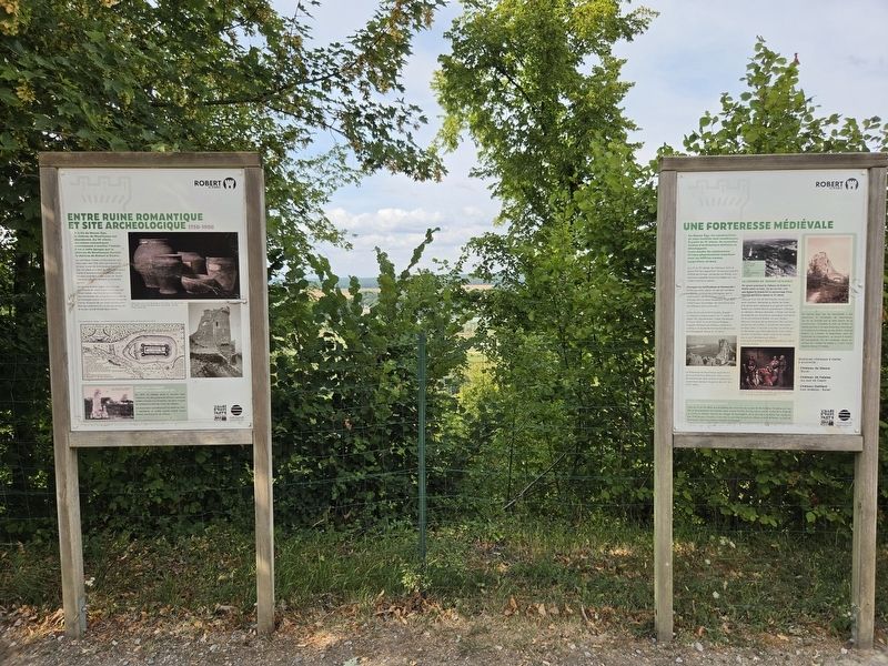
Other nearby markers. At least 8 other markers are within 16 kilometers of this marker, measured as the crow flies: Une forteresse médiévale / A Medieval Fortress (here, next to this marker); La renaissance du château / The Restoration of the Castle (within shouting distance of this marker); Les ruines du château de Robert le Diable / The ruins of Robert the Devil’s Castle (within shouting distance
Photographed by James Hulse, July 31, 2026
2. Entre ruine romantique et site archéologique / Between Romantic Ruin and Archaeological Site Marker
Photographed by James Hulse, July 31, 2026
3. Entre ruine romantique et site archéologique / Between Romantic Ruin and Archaeological Site Marker
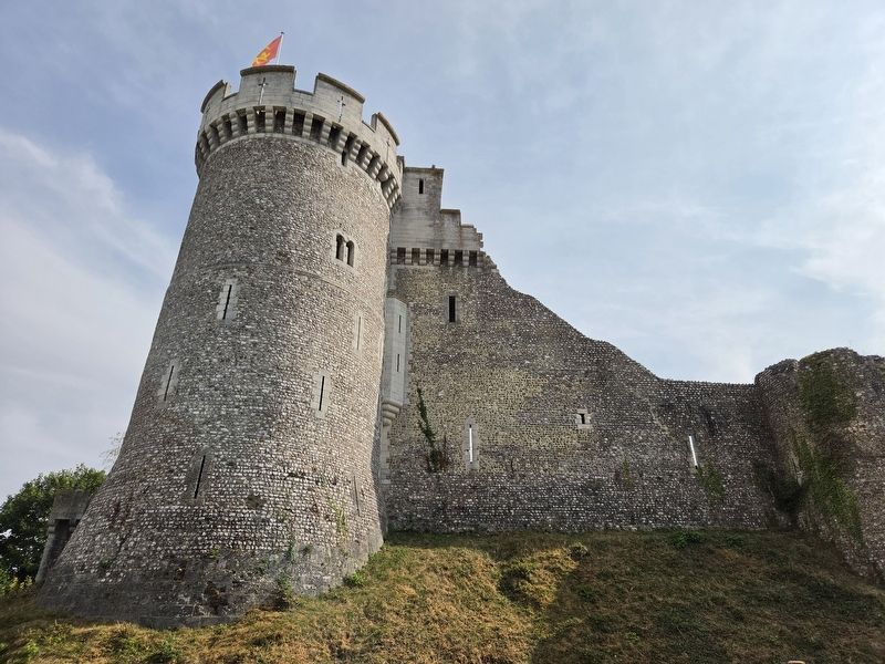
The view of the castle
Photographed by James Hulse, July 31, 2026
4. Entre ruine romantique et site archéologique / Between Romantic Ruin and Archaeological Site Marker
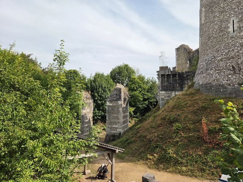
The view of the former draw bridge to the castle.
Credits. This page was last revised on August 5, 2026. It was originally submitted on August 3, 2026, by James Hulse of Medina, Texas. This page has been viewed 5 times since then. Photos: 1, 2, 3, 4. submitted on August 5, 2026, by James Hulse of Medina, Texas.
