Burfordville in Cape Girardeau County, Missouri — The American Midwest (Upper Plains)
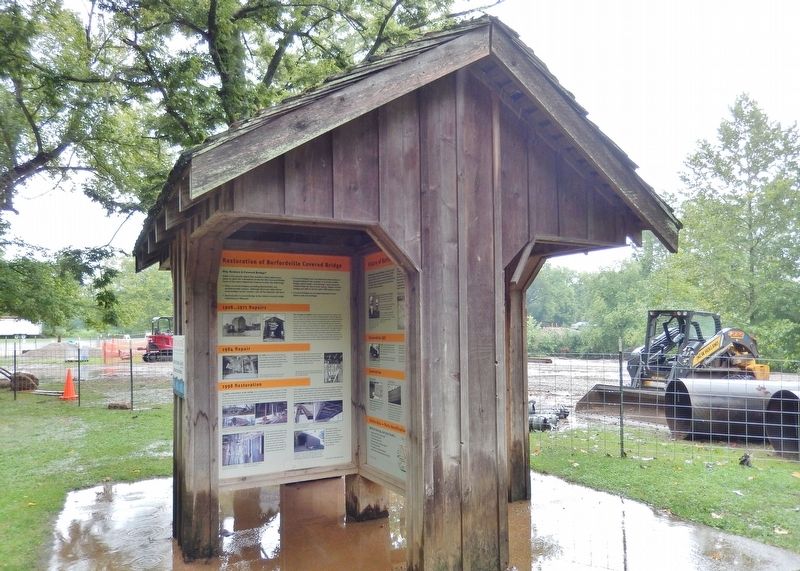
Restoration of the Burfordville Covered Bridge
Photographed by Cosmos Mariner, August 20, 2021
1. Restoration of the Burfordville Covered Bridge Marker
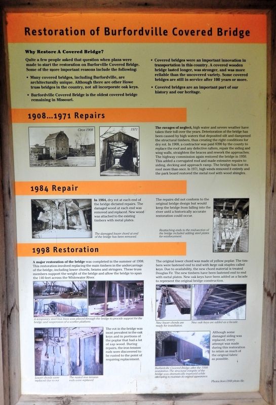
Why Restore A Covered Bridge?
Quite a few people asked that question when plans were made to start the restoration on Burfordville Covered Bridge. Some of the more important reasons include the following:
• Many covered bridges, including Burfordville, are architecturally unique. Although there are other Howe truss bridges in the country, not all incorporate oak keys.
• Burfordville Covered Bridge is the oldest covered bridge remaining in Missouri.
• Covered bridges were an important innovation in transportation in this country. A covered wooden bridge lasted longer, was stronger, and was more reliable than the uncovered variety. Some covered bridges are still in service after 100 years or more.
• Covered bridges are an important part of our history and our heritage.
1908...1971 Repairs
The ravages of neglect, high water and severe weather have taken their toll over the years. Deterioration of the bridge has been caused by high waters that deposited silt and dampened the structural timbers, thus creating the right conditions for dry rot. In 1908, a contractor was paid $390 by the county to replace the roof and any defective rafters, repair the siding and wing walls, straighten the braces and rework the approaches. The highway commission again restored the bridge in 1950. This added a corrugated roof and made extensive repairs to siding, decking and approach ramp. The bridge has lost its roof more than once. In 1971, high winds removed it entirely and the park board restored the metal roof with wood shingles.
1984 Repair
In 1984, dry rot at each end of the bridge dictated repairs. The damaged wood at each end was removed and replaced. New wood was attached to the existing timbers with metal plates.
The repairs did not conform to the original bridge design but would keep the bridge from falling into the river until
this page online
1998 Restoration
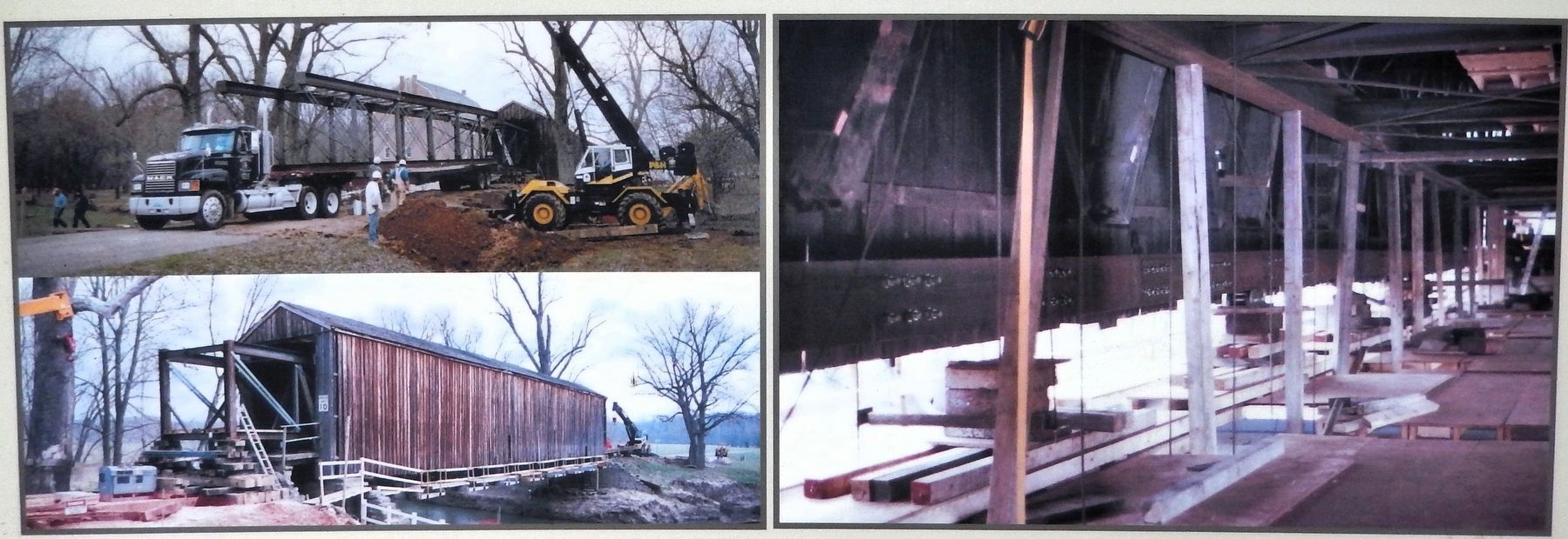
A major restoration of the bridge was completed in the summer of 1998. This restoration involved replacing the main timbers in the undercarriage of the bridge, including lower chords, beams and stringers. These truss members support the weight of the bridge and allow the bridge to span the 140 feet across the Whitewater River.
The original lower chord was made of yellow poplar. The timbers were fastened end to end with large oak staples called keys. Due to availability, the new chord material is treated Douglas Fir. The new timbers have been fastened end to end with metal plates. New oak keys have been added as a facade
The rot in the bridge was most prevalent in the oak keys and in portions of the poplar that had a lot of sap wood. During repairs, the iron tension rods were discovered to be rusted to the point of requiring replacement.
Although some damaged siding was replaced, every attempt was made during this restoration to retain as much of the original fabric as possible.
[image captions]
• Circa 1908
• 1971
• 1984 repair: The damaged lower chord at end of the bridge
Courtesy Missouri Department of Natural Resources
2. Marker detail: 1998 Restoration
• 1998 restoration: Lower chords were replaced due to rot. The rusted iron tension rods were replaced. New lower chords are ready for installation. New oak keys are added as a façade.
Erected by Missouri Department of Natural Resources.
Topics and series. This historical marker is listed in these topic lists: Architecture • Bridges & Viaducts. In addition, it is included in the Covered Bridges series list.
Location. 37° 22.051′ N, 89° 48.168′ W. Marker is in Burfordville, Missouri, in Cape Girardeau County. It is on Bollinger Mill Road just south of State Highway HH, on the left when traveling south. The marker is on the interpretive kiosk at Bollinger Mill State Historic Site. Touch for map. Marker is at or near this postal address: 113 Bollinger Mill Road, Burfordville MO 63739, United States of America. Touch for directions.

Regionally, this marker is in Southeast Missouri. It is also in the American Ozarks, in the Lewis & Clark Corridor, in the Corn Belt,

Courtesy Missouri Department of Natural Resources
3. Marker detail: Burfordville Covered Bridge after 1998 Restoration
Other nearby markers. At least 8 other markers are within 8 miles of this marker, measured as the crow flies: History of Burfordville Covered Bridge (here, next to this marker); Covered Bridges in Missouri (here, next to this marker); Basic Truss Designs for Covered Bridges (here, next to this marker); History of Covered Bridges in America (here, next to this marker); Genealogy of Howe Truss Design (here, next to this marker); Bollinger Mill / Burfordville Covered Bridge (a few steps from this marker); "Historical Marker" (approx. 6.3 miles away); Most…are poor and exceedingly dissipated. (approx. 7½ miles away). Touch for a list and map of all markers in Burfordville.
Regarding Restoration of the Burfordville Covered Bridge. National Register of Historic Places № 70000325.
From the National Register Nomination prepared by Charla A. Piggott, 3/5/1970:Photographed by Cosmos Mariner, August 20, 20214. Restoration of the Burfordville Covered Bridge MarkerThis marker is on the west side of the interpretive kiosk at Bollinger Mill State Historic Site.
The Burfordville Covered Bridge is primarily significant as one of only four surviving covered bridges in Missouri. It has further significance as one of three covered bridges in Missouri employing the Howe Truss in its construction.
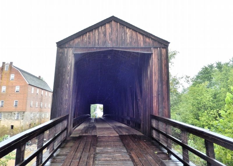
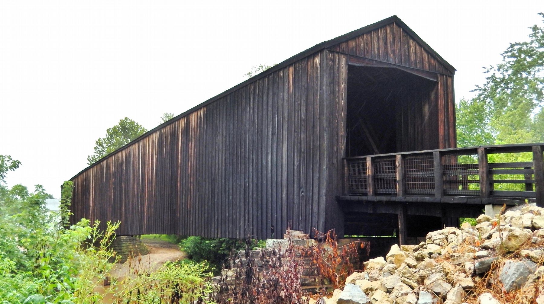
Also see . . . Bollinger Mill State Historic Site: Bridge History (Wikipedia).Excerpt: Around 1900, the bridge had fallen into disrepair, with some missing siding and a partially collapsed roof. In 1967, the same year the mill was donated to the state, the Missouri State Park system began maintaining the four remaining covered bridges in the state. The bridge was added to the National Register of Historic Places in 1970, one year before it was restored by the park service, at which time the metal roof was replaced with wooden shingles. In 1986, the Whitewater River reached record levels, 17 inches over the deck of the bridge, which damaged the bridge and resulted in its closure to both vehicular and pedestrian traffic. The bridge remained closed until 1998 when repairs to lower trusses, support timbers, and vertical iron rods made it possible to reopen the bridge to pedestrian traffic.(Submitted on August 3, 2026, by Cosmos Mariner of Cape Canaveral, Florida.)Photographed by Cosmos Mariner, August 20, 20215. Burfordville Covered BridgeLooking west across the Whitewater River. The Bollinger Mill is on the left.Photographed by Cosmos Mariner, August 20, 20216. Burfordville Covered Bridge
Credits. This page was last revised on August 4, 2026. It was originally submitted on August 3, 2026, by Cosmos Mariner of Cape Canaveral, Florida. This page has been viewed 12 times since then. Photos: 1, 2, 3, 4, 5, 6. submitted on August 3, 2026, by Cosmos Mariner of Cape Canaveral, Florida.