Burfordville in Cape Girardeau County, Missouri — The American Midwest (Upper Plains)
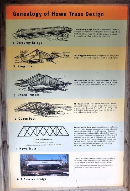
Genealogy of Howe Truss Design
Photographed by Cosmos Mariner, August 20, 2021
1. Genealogy of Howe Truss Design Marker
1. Corduroy Bridge
The corduroy bridge was the earliest of the American bridges and consisted of logs laid across supporting timbers. These were effective for narrow streams, but would have had a short life expectancy.
2. King Post
The king post truss added strength to the bridge, but length was still limited by the length of the timbers.
3. Boxed Trusses
Before covered bridges became common, trusses were sometimes boxed in to protect them from the weather. This helped extend the life of the bridge.
4. Queen Post
The development of the queen post truss allowed the construction of a longer bridge that could span a wider river. However, the length of the bridge was still limited as the queen post could not be expanded and still retain its strength.
5. Howe Truss
In America the Howe truss, combining wood and metal, was the most popular truss system among railroads during the latter half of the 19th century because the vertical iron rods could be adjusted to remove the sagging of old age and because a 100 foot model could be easily erected in 24 hours, with roof and sides added while in use. Although this design was an improvement on the all-wood bridge, a number of infamous railroad disasters were caused by structural failures in Howe trusses.
6. A Covered Bridge
Any of the early designs easily lent themselves to having a roof and sides added for protection and strength. The result was a covered bridge.
Erected by Missouri Department of Natural Resources.
Topics. This historical marker is listed in these topic lists: Architecture • Bridges & Viaducts.
Location. 37° 22.05′ N, 89° 48.165′ W. Marker is in Burfordville, Missouri, in Cape Girardeau County. It is on Bollinger Mill Road just south of State Highway HH, on the left when traveling south. The marker
this page online

Regionally, this marker is in Southeast Missouri. It is also in the American Ozarks, in the Lewis & Clark Corridor, in the Corn Belt, and in the Great River Road Region. Globally, it is in North America, the Western Hemisphere, the Western World, and the Anglosphere. Historically, it finds itself in what was once the territory of the Mississippian Culture, the Louisiana Purchase, and the Antebellum South.
Other nearby markers. At least 8 other markers are within 8 miles of this marker, measured as the crow flies: Basic Truss Designs for Covered Bridges (here, next to this marker); Covered Bridges in Missouri (here, next to this marker); History of Covered Bridges in America (here, next to this marker); Restoration of the Burfordville Covered Bridge (here, next to this marker); History of Burfordville Covered Bridge (here, next to this marker); Bollinger Mill / Burfordville Covered Bridge (a few steps from
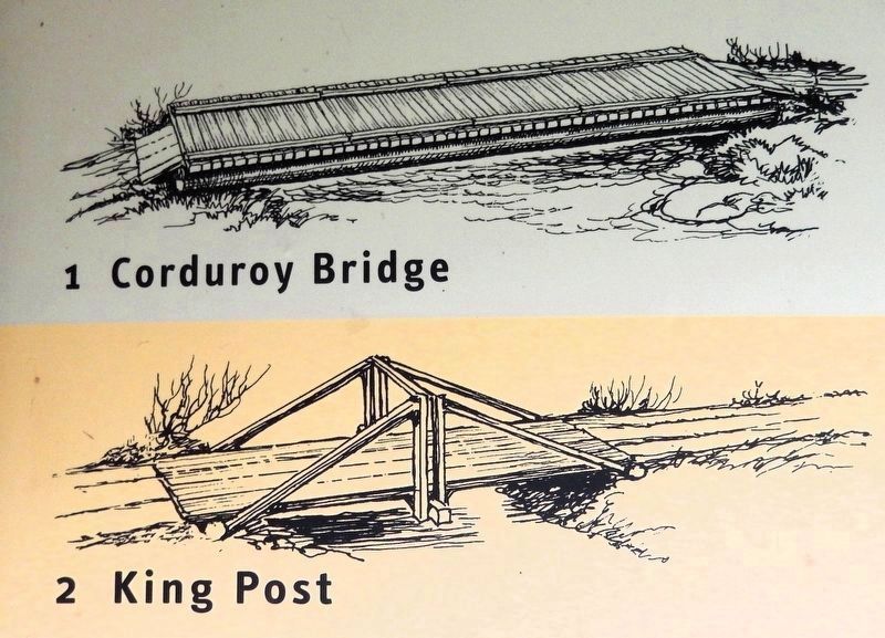
2. Marker detail: Corduroy Bridge & King Post
Also see . . . Howe truss (Wikipedia).
Excerpt: A Howe truss is a truss bridge consisting of chords, verticals, and diagonals whose vertical members are in tension and whose diagonal members are in compression. The Howe truss was invented by William Howe in 1840 and was widely used as a bridge in the mid to late 1800s.(Submitted on August 4, 2026, by Cosmos Mariner of Cape Canaveral, Florida.)The Howe truss bridge consists of an upper and lower chord, each chord consisting of two parallel beams and each chord parallel to one another. The web consists of verticals, braces, and counterbraces. Vertical posts connect the upper and lower chords to one another and create panels. A diagonal brace in each panel strengthens the bridge, and a diagonal counterbrace in each panel enhances this strength. Howe truss bridges may be all wood, a combination of wood and iron, or all iron.
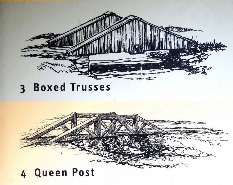
3. Marker detail: Boxed Trusses & Queen Post
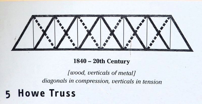
4. Marker detail: Howe Truss
1840 - 20th Century
[wood, verticals of metal]
diagonals in compression, verticals in tension
[wood, verticals of metal]
diagonals in compression, verticals in tension

Courtesy Missouri Department of Natural Resources
5. Marker detail: Union Covered Bridge
Located eight miles southwest of Paris, Mo. in Monroe County.

Photographed by Cosmos Mariner, August 20, 2021
6. Genealogy of Howe Truss Design Marker
Looking north; The historic Bollinger Mill is visible in the right background. This marker is on the east side of the interpretive kiosk at Bollinger Mill State Historic Site.
Credits. This page was last revised on August 4, 2026. It was originally submitted on August 4, 2026, by Cosmos Mariner of Cape Canaveral, Florida. This page has been viewed 17 times since then. Photos: 1, 2, 3, 4, 5, 6. submitted on August 4, 2026, by Cosmos Mariner of Cape Canaveral, Florida.
