Marine Villa in St. Louis, Missouri — The American Midwest (Upper Plains)
1941 Cherokee
Family Ties
| — | Cherokee-Lemp Historic District | — |
Photographed by Garrett Koch, July 31, 2026
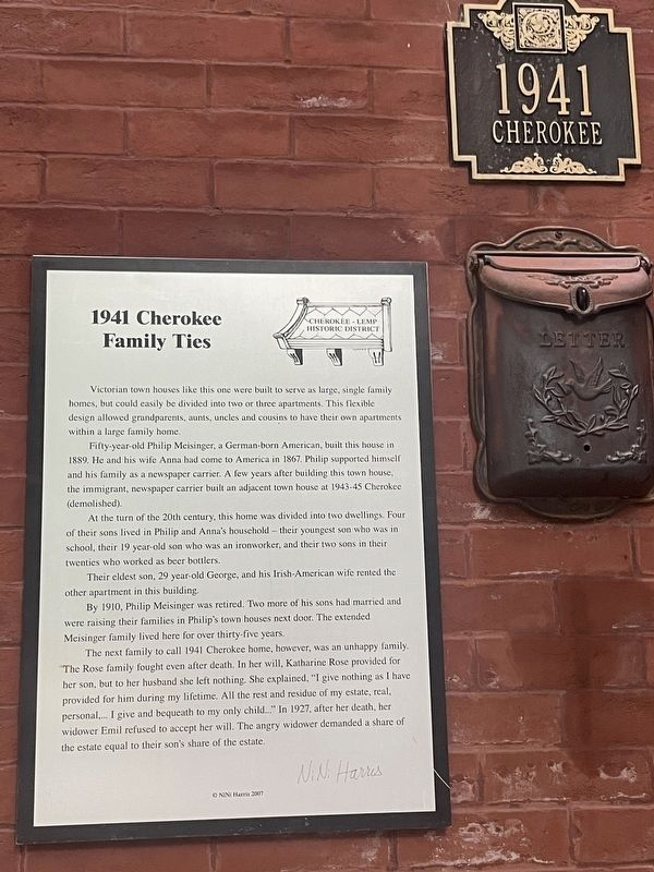
1. 1941 Cherokee - Family Ties Marker
Victorian town houses like this one were built to serve as large, single family homes, but could easily be divided into two or three apartments. This flexible design allowed grandparents, aunts, uncles and cousins to have their own apartments within a large family home.
Fifty-year-old Philip Meisinger, a German-born American, built this house in 1889. He and his wife Anna had come to America in 1867. Philip supported himself and his family as a newspaper carrier. A few years after building this town house, the immigrant, newspaper carrier built an adjacent town house at 1943-45 Cherokee (demolished).
At the turn of the 20th century, this home was divided into two dwellings. Four of their sons lived in Philip and Anna's household - their youngest son who was in school, their 19 year-old son who was an ironworker, and their two sons in their twenties who worked as beer bottlers.
Their eldest son, 29 year-old George, and his Irish-American wife rented the other apartment in this building.
By 1910, Philip Meisinger was retired. Two more of his sons had married and were raising their families in Philip's town houses
this page online
The next family to call 1941 Cherokee home, however, was an unhappy family. The Rose family fought even after death. In her will, Katharine Rose provided for her son, but to her husband she left nothing. She explained, "I give nothing as I have provided for him during my lifetime. All the rest and residue of my estate, real, personal,… I give and bequeath to my only child…" In 1927, after her death, her widower Emil refused to accept her will. The angry widower demanded a share of the estate equal to their son's share of the estate.
Erected 2007 by NiNi Harris.
Topics. This historical marker is listed in these topic lists: Architecture • Industry & Commerce. A significant historical year for this entry is 1941.
Location. 38° 35.563′ N, 90° 13.212′ W. Marker is in St. Louis, Missouri. It is in Marine Villa. It is on Cherokee Street west of Salena Street, on the right when traveling west. Touch for map. Marker is at or near this postal address: 1941 Cherokee Street, Saint Louis MO 63118, United States of America. Touch for directions.

Regionally, this marker is in the American Midwest, in the Lewis & Clark Corridor, in the Corn Belt, and in the Great River Road Region. Globally, it is in North America, the Western Hemisphere, the Western World, and the Anglosphere. Historically, it finds itself in what was once the territory of the Mississippian Culture, the Louisiana Purchase, and the Antebellum South.
Other nearby markers. At least 8 other markers are within walking distance of this marker: Settlers' Homes (a few steps from this marker); The Elusive Cemetery (within shouting distance of this marker); 1959 Cherokee (within shouting distance of this marker); The Blacksmith Shop (within shouting distance of this marker); 2008 Cherokee (about 300 feet away, measured in a direct line); The Simon Complex (about 300 feet away); 1905 - 09 Cherokee (about 300 feet away); At Home On Cherokee (about 400 feet away). Touch for a list and map of all markers in St. Louis.
Credits. This page was last revised on August 25, 2026. It was originally submitted on August 4, 2026, by Garrett Koch of Saint Louis, Missouri. This page has been viewed 16 times since then. Photo 1. submitted on August 4, 2026, by Garrett Koch of Saint Louis, Missouri. • Devry Becker Jones was the editor who published this page.
Editor’s want-list for this marker. A wide shot of the marker in context & a photo of the building (may be the same photo). dbj 8.25.26 • Can you help?
