Dumbo in Brooklyn in Kings County, New York — The American Northeast (Mid-Atlantic)
Evacuation Site – Fulton Landing
Revolutionary War Heritage Trail
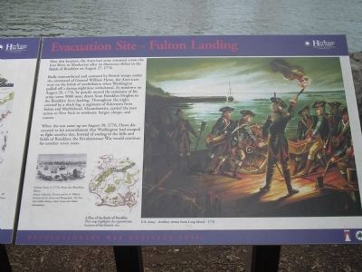
Badly outnumbered and cornered by British troops under the command of General William Howe, the Americans were on the brink of annihilation when Washington pulled off a daring nighttime withdrawal. At sundown on August 29, 1776, he quietly moved the remnants of his army, some 9000 men, down from Brooklyn Heights to the Brooklyn ferry landing. Throughout the night, covered by a thick fog, a regiment of fishermen from Salem and Marblehead, Massachusetts, carried the men across to New York in rowboats, barges, sloops, and canoes.
When the sun came up on August 30, 1776, Howe discovered to his astonishment that Washington had escaped to fight another day. Instead of ending in the hills and fields of Brooklyn, the Revolutionary War would continue for another seven years.
Erected by New York State.
Topics. This historical marker is listed in this topic list: War, US Revolutionary. A significant historical year for this entry is 1776.
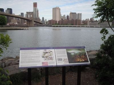
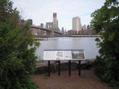
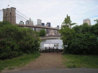
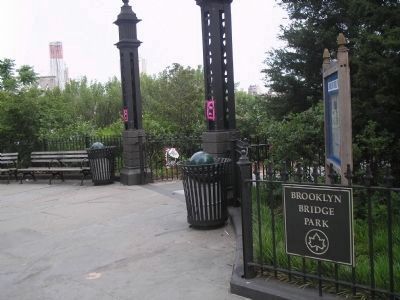
Location. 40° 42.25′ N, 73° 59.448′ W. Marker is in Brooklyn, New York, in Kings County. It is in Dumbo. Marker can be reached from the intersection of Main Street and Plymouth Street, on the left when traveling north. Marker is located in Brooklyn Bridge Park, between the Brooklyn and Manhattan Bridges. Touch for map. Marker is in this post office area: Brooklyn NY 11201, United States of America. Touch for directions.
Other nearby markers. At least 8 other markers are within walking distance of this marker. The Battle of Brooklyn (here, next to this marker); History in the Park (about 300 feet away, measured in a direct line); Jane's Carousel (about 400 feet away); Nicholas Galanin (about 500 feet away); a different marker also named History in the Park (about 600 feet away); a different marker also named Nicholas Galanin (about 700 feet away); Billion Oyster Project Community Reef Site: Brooklyn Bridge Park (about 800 feet away); Emily Warren Roebling Plaza (approx. 0.2 miles away). Touch for a list and map of all markers in Brooklyn.
More about this marker. The right of the marker contains a picture of Gen. Washington overseeing the loading of boats with artillery and horses. It has a caption of “U.S. Army – Artillery retreat from LongIsland – 1776.”
The bottom left of the marker features a picture of “Fulton Ferry in 1750, from the Brooklyn Shore. Emmet Collection, Miriam and Ira D. Wallach Division of Art Prints and Photographs, the New York Public Library, Astor, Lenox and Tilden Foundations.” Next to this is a map of Brooklyn with the caption “A
Plan of the Battle of Brooklyn. This map highlights the approximate location of this historic site.”
Also see . . .
1. The Battle of Long Island, August 27, 1776 at Long Island, New York. The American Revolutionary War website. (Submitted on May 16, 2010, by Bill Coughlin of Woodland Park, New Jersey.)
2. Battle of Long Island, August 27, 1776. (Submitted on May 16, 2010, by Bill Coughlin of Woodland Park, New Jersey.)
3. The Battle of Long Island 1776. A British perspective of the battle from BritishBattles.com. (Submitted on May 16, 2010, by Bill Coughlin of Woodland Park, New Jersey.)
Credits. This page was last revised on January 31, 2023. It was originally submitted on May 16, 2010, by Bill Coughlin of Woodland Park, New Jersey. This page has been viewed 1,718 times since then and 56 times this year. Photos: 1, 2, 3, 4, 5. submitted on May 16, 2010, by Bill Coughlin of Woodland Park, New Jersey.
