Stamford in Lincolnshire, England, United Kingdom — Northwestern Europe (the British Isles)
St Michael's Churchyard and its surroundings
Photographed by Ray Gurganus, May 5, 2026
1. St Michael's Churchyard and its surroundings Marker
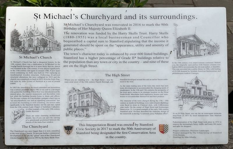
The renovation was funded by the Harry Skells Trust. Harry Skells (1880-1955) was a local businessman and Councillor who bequeathed a capital sum to Stamford stipulating that the income it generated should be spent on the "appearance, utility and amenity of public places."
The town's character today is enhanced by over 600 listed buildings. Stamford has a higher percentage of Grade II* buildings relative to the population than any town or city in the country - and nine of these are on the High Street.
St Michael's Church
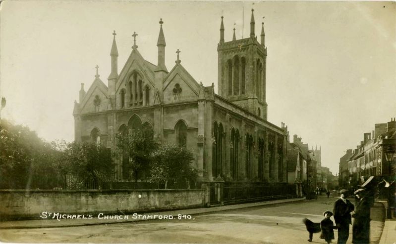
St Michael's Church has had a chequered history. In the 10th century there was a dedication to St Michael in the Anglo-Danish borough but it is more likely that the church was founded in the 12th century. It was altered significantly in the 15th century and again in around 1700. A new stone tower containing six bells was built in 1761 replacing an insubstantial wooden structure. Following ill-advised structural alterations the nave collapsed in 1832 and the church was completely re-built
this page online
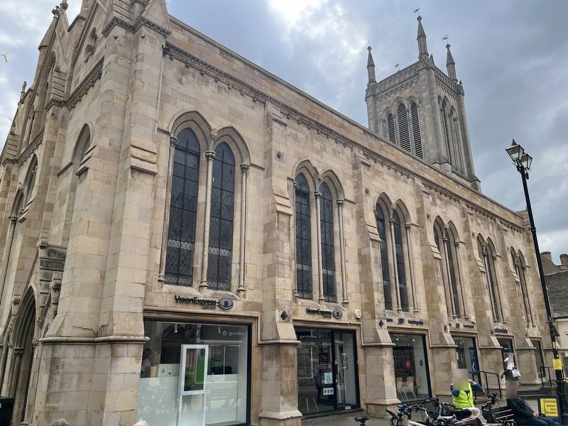
In 1963 the church was declared redundant and demolition was a serious possibility but in 1982 it was sold to a developer who gutted the building. A first floor was introduced and the stained glass, the interior monuments and decoration were lost when the building became home to shops and offices. The Pevsner volume on Lincolnshire castigates what it saw as "an unsympathetic use and an appalling conversion" but at least the building is still standing. Its tower adds significantly to the Stamford skyline and the east end, copied from the 13th century Lady Chapel of Salisbury Cathedral, is a fine example of the early 19th century Gothic Revival.
There are some charming architectural details. See if you can spot the carving of a greyhound positioned between the lancets of the main East window.
The Churchyard
The Churchyard was once bigger than it is now, extending to the west of the Church. To prevent further commercial development on the site the "green" area of the Churchyard was purchased for the town in 1993 by the Harry Skells Trust.
The High Street
Where
Photographed by Ray Gurganus, May 5, 2026
2. St Michael's Church Building
As the main trading area of the town this street has seen many developments to accommodate the changing needs of shopkeepers. In the 12th and 13th centuries the prosperity of the town grew owing to its strategic location on the Great North Road. Merchants built impressive houses and ware-houses to accommodate themselves and their produce.
The character of the town changed during the 17th 18th century as medieval buildings were redeveloped. Buildings were faced in stone in Classical style, with Collyweston slate roofs. On the corner of High Street and Ironmonger Street at no. 21, is a good example of the early 18th century Stamford style. Pevsner described the elaborate design of the stonework as having "a curiously jazzy Palladian effect".
In the 19th century civic improvements continued. Behind you, the originally open portico with Tuscan columns was built in 1808 to accommodate the old meat market, or shambles. This was converted into a public library
Photographed by Dolby Bros. Stationers, Stamford, circa 1920
3. St Michael's Church Stamford
At no.30 High Street, you can see an extravagant terracotta shop-front of 1871 by local manufacturer John Marriott Blashfield.
Pedestrianisation of the High Street took place in 1972 to remove the increasingly heavy traffic and make life easier and safer for shoppers.
This Interpretation Board was erected by Stamford Civic Society in 2017 to mark the 50th Anniversary of Stamford being designated the first Conservation Area in the country.
Erected 2017 by Stamford Civic Society.
Topics and series. This historical marker is listed in these topic lists: Architecture • Education • Religion & Religious Structures. In addition, it is included in the Carnegie Libraries series list. A significant historical year for this entry is 2016.
Location. 52° 39.156′ N, 0° 28.65′ W. Marker is in Stamford, England, in Lincolnshire. It is on High Street, on the left when traveling west. Touch for map. Marker is at or near this postal address: 53 High Street, Stamford, England PE9 2DE, United Kingdom. Touch for directions.

Regionally,
Photographed by John Valentine and Sons Co., Ltd., circa 1910
4. High Street, Stamford (looking west)
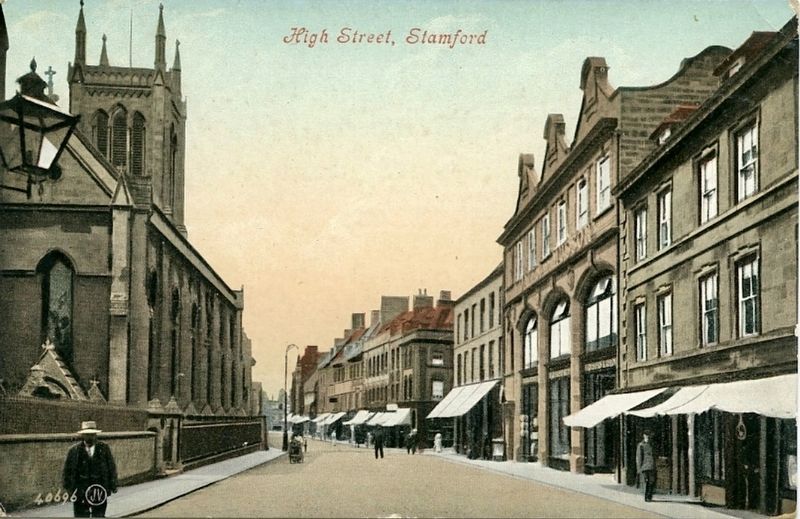
This view was taken from only a few steps distant from the marker location. St Michael’s Church is visible on the left.
Other nearby markers. At least 5 other markers are within 19 kilometers of this marker, measured as the crow flies: Stamford's Stone Heritage (within shouting distance of this marker); Stamford Theatre (about 90 meters away, measured in a direct line); The Sundial at All Saints' Church (about 240 meters away); The Hospital of Thomas Truesdale (approx. 0.4 kilometers away); Oundle Bridge (approx. 18.4 kilometers away).
Credits. This page was last revised on August 5, 2026. It was originally submitted on August 5, 2026, by Ray Gurganus of Washington, District of Columbia. This page has been viewed 5 times since then. Photos: 1, 2. submitted on August 5, 2026, by Ray Gurganus of Washington, District of Columbia. 3. submitted on August 5, 2026. 4. submitted on August 5, 2026, by Andrew Ruppenstein of Lamorinda, California. • Andrew Ruppenstein was the editor who published this page.
Editor’s want-list for this marker. photo of the marker within its surroundings • Can you help?
