
Doncaster in South Yorkshire, England, United Kingdom — Northwestern Europe (the British Isles)
Mansion House
Photographed by Ray Gurganus, May 8, 2026
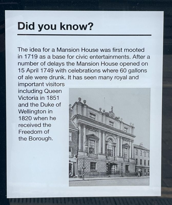
1. Mansion House Marker
The idea for a Mansion House was first mooted in 1719 as a base for civic entertainments. After a number of delays the Mansion House opened on 15 April 1749 with celebrations where 60 gallons of ale were drunk. It has seen many royal and important visitors including Queen Victoria in 1851 and the Duke of Wellington in 1820 when he received the Freedom of the Borough.
Topics. This historical marker is listed in this topic list: Notable Buildings. A significant historical date for this entry is April 15, 1749.
Location. 53° 31.394′ N, 1° 8.05′ W. Marker is in Doncaster, England, in South Yorkshire. It is at the intersection of Priory Place and High Street on Priory Place. The marker is in the lower right corner of an informational kiosk just a few steps to the west of Mansion House. Touch for map. Marker is at or near this postal address: 1 Priory Place, Doncaster, England DN1 1TR, United Kingdom. Touch for directions.

Regionally, this marker is in England’s Yorkshire & The Humber. Globally, it is on the Atlantic Ocean, in the North Atlantic Region, in Europe, in Atlantic Europe, on one of the British
this page online
Other nearby markers. At least 8 other markers are within 8 kilometers of this marker, measured as the crow flies: Silver Street (about 120 meters away, measured in a direct line); Sir Nigel Gresley 1876-1941 (approx. 0.4 kilometers away); Sir Nigel Gresley (approx. 0.4 kilometers away); Hyde Park Cemetery, Doncaster (approx. 0.9 kilometers away); The View North (approx. 7.4 kilometers away); The View to the South-west (approx. 7.4 kilometers away); The View into the Inner Bailey (approx. 7.4 kilometers away); The View to the South-east (approx. 7.5 kilometers away). Touch for a list and map of all markers in Doncaster.
Also see . . . Mansion House, Doncaster (Wikipedia). (Submitted on August 6, 2026.)
Photographed by Ray Gurganus, May 8, 2026
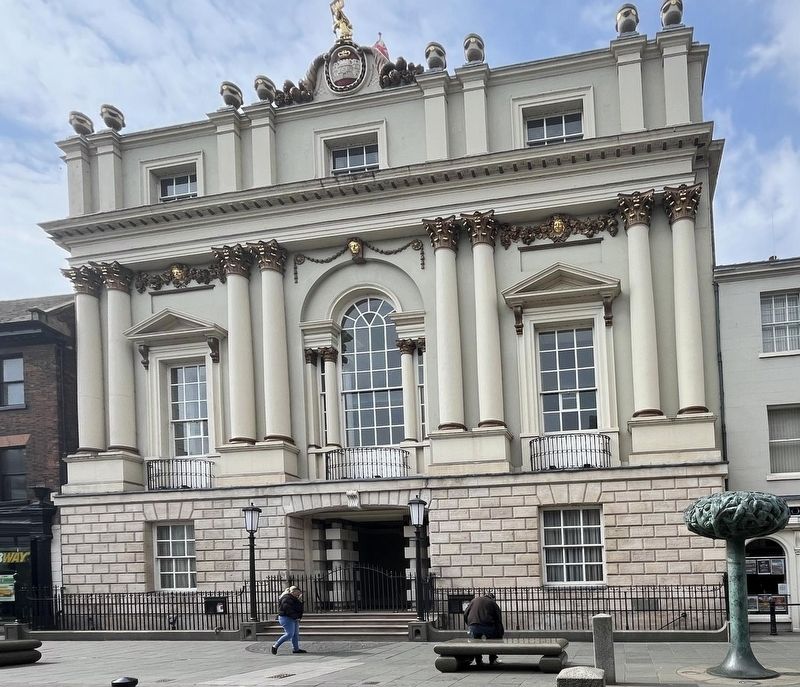
2. Mansion House
Credits. This page was last revised on August 6, 2026. It was originally submitted on August 5, 2026, by Ray Gurganus of Washington, District of Columbia. This page has been viewed 8 times since then. Photos: 1, 2. submitted on August 5, 2026, by Ray Gurganus of Washington, District of Columbia. • Andrew Ruppenstein was the editor who published this page.
