Milford Township in Oakland County, Michigan — The American Midwest (Great Lakes)
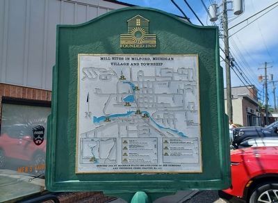
Mill Sites in Milford, Michigan Village and Township
Photographed by Joel Seewald, May 16, 2026
1. Mill Sites in Milford, Michigan Village and Township Marker
Fuller Grist Mill, 1834
Woolen Mill, ca. 1835
Peters Road, south of the Huron River
Pettibone Grist Mill, 1846
Hebbard and Davis Woolen Mill, 1850
Tower & Tenny Woodworking Mill, 1854
Henry Ford I Mill, 1938
North Main Street, at the foot of Upper Mill Pond
Ruggles Saw Mill, 1832
Armstrong Grist Mill, 1839
East Huron Street, at Former River Street
Phelps Saw Mill and Distillery, ca. 1836
West Liberty Street, at the foot of Mill Pond
Isaiah Hudson Saw Mill, 1832
Hudson-White Rake Factory, after 1832
West Dawson Road at Huron River, south of the road and west of the river in Kensington Park
Eaton Cabinet & Chair Factory, ca. 1835
Summit Street, on east side of Pettibone Creek
Wells Brothers Foundry, 1865
Main Street, on the south side of Huron River at Main Street bridge
Erected 1994 by Michigan State Organization of the Questers and Pettibone Creek Chapter No. 777.
Topics. This historical marker is listed in this topic list: Industry & Commerce. A significant historical year for this entry is 1834.
Location. 42° 35.447′ N, 83° 35.981′ W. Marker is in Milford, Michigan, in Oakland County.
this page online

Regionally, this marker is in Southeast Michigan and in Greater Detroit. It is also in the American Midwest. Globally, it is in North America, the Western Hemisphere, the Western World, and the Anglosphere. Historically, it finds itself in what was once the Northwest Territory.
Other nearby markers. At least 8 other markers are within walking distance of this marker: Motley Lights (within shouting distance of this marker); Milford Rural Agricultural School (within shouting distance of this marker); Wood-Hubbell House (about 300 feet away, measured in a direct line); Milford Presbyterian Congregation (about 600 feet away); Milford's Water Works Building (approx. 0.2 miles away); A Ford Village Industry (approx. 0.2 miles away); Pettibone Creek Hydroelectric Station (approx. 0.2 miles away); Milford at Work (approx. 0.2 miles away). Touch for a list and map of all markers in Milford.
Related markers. Click here
Photographed by Joel Seewald, May 16, 2026
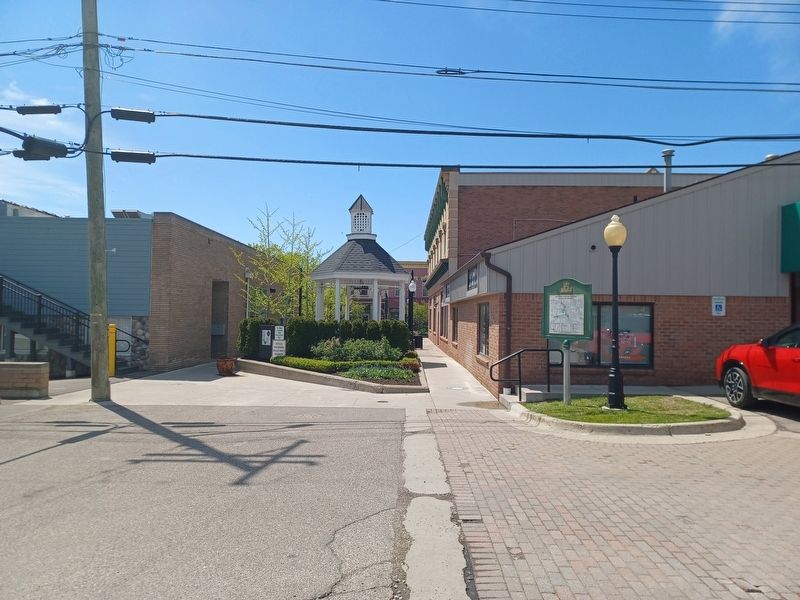
2. Mill Sites in Milford, Michigan Village and Township Marker
Credits. This page was last revised on August 5, 2026. It was originally submitted on August 5, 2026, by Joel Seewald of Madison Heights, Michigan. This page has been viewed 16 times since then. Photos: 1, 2. submitted on August 5, 2026, by Joel Seewald of Madison Heights, Michigan.
