
Moulineaux in Seine-Maritime, Normandy, France — Western Europe
La réhabilitation du château
⎯⎯⎯
The Rehabilitation of the Castle
| — | Robert le Diable / Robert the Devil | — |
Photographed by James Hulse
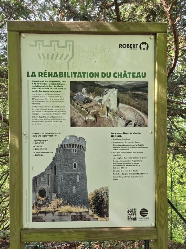
1. La réhabilitation du château / The Rehabilitation of the Castle Marker

Abandonné à la végétation, livré à de nombreuses dégradations, le château de Robert le Diable subissait depuis sa fermeture au public les assauts du temps.
Le château dont la fréquentation se comptait, durant la seconde moitié du 20ᵉ siècle, par milliers de visiteurs, faisait partie intégrante des circuits touristiques normands.
C’est pourquoi, attachée depuis toujours à la restauration et à la préservation de son patrimoine, la Métropole Rouen Normandie s’est portée acquéreur du château en 2007.
L’attrait du public qui est toujours aussi vivace, repose à la fois sur l’histoire du site et le panorama qu’il offre sur la vallée de la Seine.
Le rachat du château s’inscrit dans une triple vocation :
1 ▪︎ pédagogique et culturelle
2 ▪︎ sociale et économique
3 ▪︎ environnementale et technique
Les grandes étapes du chantier 2009-2013 :
▪︎ Défrichage du château
▪︎ Aménagement des chemins d’accès
▪︎ Démontage et évacuation de la chapelle nordique, du drakkar et du hourd en mauvais état de conservation
▪︎
this page online
▪︎ Mise en place d’un atelier de taille de pierre
▪︎ Restauration des piliers du pont-levis, de la façade ouest et de la tour de Bourgtheroulde, de la façade est et de la tour d’Elbeuf
▪︎ Réfection de la tour de La Bouille
▪︎ Restitution des planchers de la tour de Rouen
▪︎ Sécurisation, entretien et maintenance du site
Métropole Rouen Normandie — Photos © Alan Aubry et © Balloïde-Photo.
Abandoned to vegetation and subjected to extensive deterioration, Robert the Devil’s Castle had suffered the ravages of time since it was closed to the public.
During the second half of the 20th century, the castle attracted thousands of visitors and formed an integral part of Normandy’s tourist routes.
For this reason, Métropole Rouen Normandie, which has always been committed to restoring and preserving its heritage, acquired the castle in 2007.
Public interest remains as strong as ever, owing both to the history of the site and to the panoramic view it offers over the Seine Valley.
The acquisition of the castle serves three purposes:
1
Photographed by James Hulse, July 31, 2026
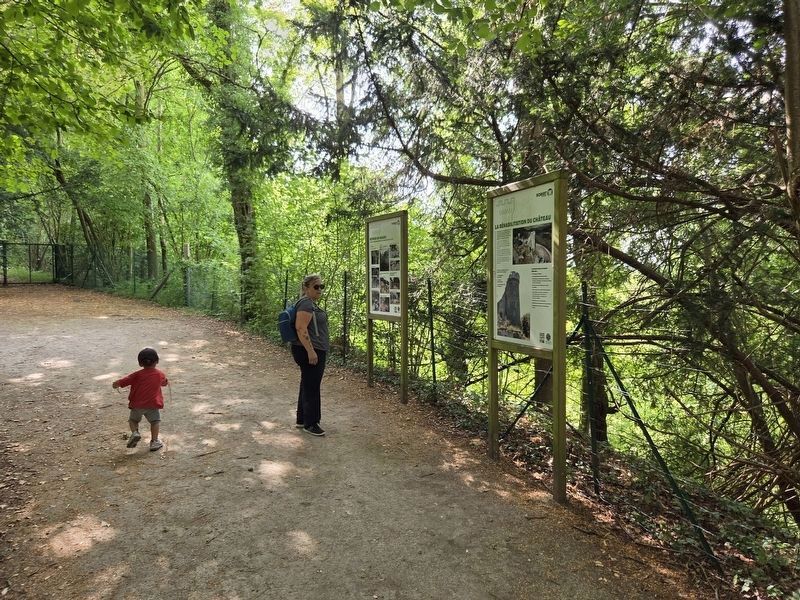
2. La réhabilitation du château / The Rehabilitation of the Castle Marker
First marker from the right side and the supplemental marker is on the left side.
2 ▪︎ social and economic
3 ▪︎ environmental and technical
The main stages of the 2009-2013 project:
▪︎ Clearing vegetation from the castle
▪︎ Improving the access paths
▪︎ Dismantling and removing the Nordic chapel, the Viking ship and the timber hoarding, which were in poor condition
▪︎ Installing a new staircase to provide access to the castle
▪︎ Establishing a stone-cutting workshop
▪︎ Restoring the drawbridge pillars, the west façade and the Bourgtheroulde Tower, the east façade and the Elbeuf Tower
▪︎ Repairing the La Bouille Tower
▪︎ Reconstructing the floors of the Rouen Tower
▪︎ Securing, maintaining and caring for the site
Métropole Rouen Normandie — Photographs © Alan Aubry and © Balloïde-Photo.
Erected by Métropole Rouen Normandie.
Topics. This historical marker is listed in this topic list: Forts and Castles. A significant historical year for this entry is 2007.
Location. 49° 20.394′ N, 0° 57.549′ E. Marker is in Moulineaux,
Photographed by James Hulse, July 31, 2026
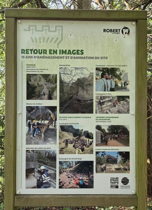
3. La réhabilitation du château / The Rehabilitation of the Castle Marker
Supplemental marker to the left side of the marker.

Regionally, it is in the North Atlantic Region, Europe, the European Union, Atlantic Europe, the Schengen Area, Western Europe, a coastal Mediterranean country, and the Western World. Historically, it finds itself in what was once a French colony and also the Roman Empire.
Other nearby markers. At least 8 other markers are within walking distance of this marker: L’architecture du château / The Architecture of the Castle (a few steps from this marker); Un château du 20ᵉ siècle ? / A 20th-Century Castle? (a few steps from this marker); La renaissance du château / The Restoration of the Castle (within shouting distance of this marker); Entre ruine romantique et site archéologique / Between Romantic Ruin and Archaeological Site (within shouting distance of this marker); Une forteresse médiévale / A Medieval Fortress (within shouting distance of this marker); Les ruines du château de Robert le Diable / The ruins of Robert the Devil’s Castle
Photographed by James Hulse, July 31, 2026
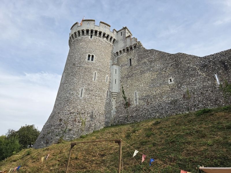
4. La réhabilitation du château / The Rehabilitation of the Castle Marker
The main castle tower.
Photographed by James Hulse, July 31, 2026
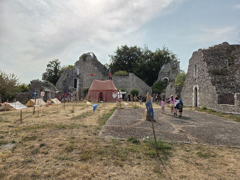
5. La réhabilitation du château / The Rehabilitation of the Castle Marker
The view of the upper courtyard.
Credits. This page was last revised on August 7, 2026. It was originally submitted on August 6, 2026, by James Hulse of Medina, Texas. This page has been viewed 17 times since then. Photos: 1, 2, 3, 4, 5. submitted on August 7, 2026, by James Hulse of Medina, Texas.
