
Moulineaux in Seine-Maritime, Normandy, France — Western Europe
L’architecture du château
Mode d’emploi
⎯⎯⎯
The Architecture of the Castle
Instructions for Use
| — | Robert le Diable / Robert the Devil | — |
Photographed by James Hulse, July 31, 2026
1. L’architecture du château / The Architecture of the Castle Marker

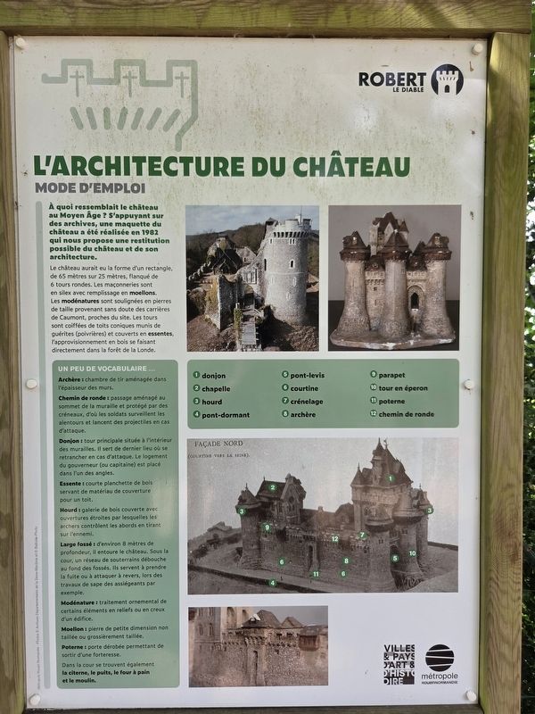
À quoi ressemblait le château au Moyen Âge ? S’appuyant sur des archives, une maquette du château a été réalisée en 1982 qui nous propose une restitution possible du château et de son architecture.
Le château aurait eu la forme d’un rectangle, de 65 mètres sur 25 mètres, flanqué de 6 tours rondes. Les maçonneries sont en silex avec remplissage en moellons. Les modénatures sont soulignées en pierres de taille provenant sans doute des carrières de Caumont, proches du site. Les tours sont coiffées de toits coniques munis de guérites (poivrières) et couverts en essentes, l’approvisionnement en bois se faisant directement dans la forêt de la Londe.
Un peu de vocabulaire
Archère : chambre de tir aménagée dans l’épaisseur des murs.
Chemin de ronde : passage aménagé au sommet de la muraille et protégé par des créneaux, d’où les soldats surveillent les alentours et lancent des projectiles en cas d’attaque.
Donjon : tour principale située à l’intérieur des murailles. Il sert de dernier lieu où se retrancher en cas d’attaque. Le logement du gouverneur (ou capitaine) est placé dans l’un des angles.
Essente
this page online
Hourd : galerie de bois couverte avec ouvertures étroites par lesquelles les archers contrôlent les abords en tirant sur l’ennemi.
Large fossé : d’environ 8 mètres de profondeur, il entoure le château. Sous la cour, un réseau de souterrains débouche au fond des fossés. Ils servent à prendre la fuite ou à attaquer à revers, lors des travaux de sape des assiégeants par exemple.
Modénature : traitement ornemental de certains éléments en reliefs ou en creux d’un édifice.
Moellon : pierre de petite dimension non taillée ou grossièrement taillée.
Poterne : porte dérobée permettant de sortir d’une forteresse.
Dans la cour se trouvent également la citerne, le puits, le four à pain et le moulin.
① donjon ② chapelle ③ hourd ④ pont-dormant ⑤ pont-levis ⑥ courtine ⑦ crénelage ⑧ archère ⑨ parapet ⑩ tour en éperon ⑪ poterne ⑫ chemin de ronde
Métropole Rouen Normandie — Photos © Archives départementales de la Seine-Maritime et © Balloïde-Photo
Photographed by James Hulse, July 31, 2026
2. L’architecture du château / The Architecture of the Castle Marker
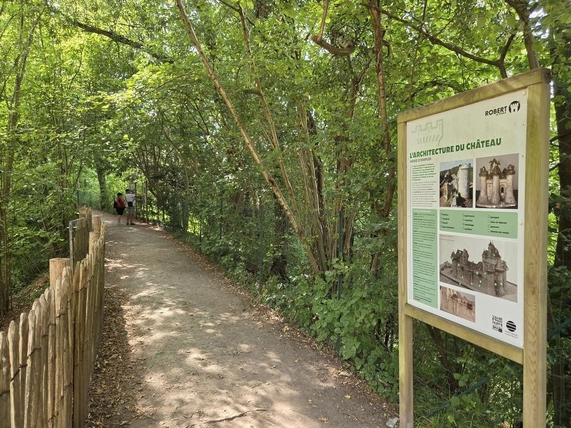
The marker next to the end of the trail.
The castle may have had the shape of a rectangle measuring 65 metres by 25 metres, flanked by six round towers. The masonry is made of flint with a rubble-stone filling. The architectural details are emphasized with dressed stone, probably obtained from the quarries of Caumont near the site. The towers are topped with conical roofs fitted with small turrets known as pepper-pot turrets and covered with wooden shingles. The wood was obtained directly from the Forest of La Londe.
A Little Vocabulary
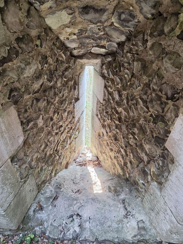
Arrow slit: a firing chamber built into the thickness of the walls.
Wall walk: a passage built along the top of the wall and protected by battlements, from which soldiers watched the surrounding area and launched projectiles during an attack.
Keep: the main tower located within the walls. It served as the final place of refuge during an attack. The governor’s—or captain’s—quarters were located in one of its corners.
Wooden shingle: a
Photographed by James Hulse, July 31, 2026
3. L’architecture du château / The Architecture of the Castle Marker
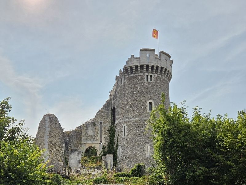
The front entrance (unrestored) to the castle.
Hoarding: a covered wooden gallery with narrow openings through which archers defended the surrounding area by firing upon the enemy.
Wide moat: approximately 8 metres deep, it surrounds the castle. Beneath the courtyard, a network of underground passages opens into the bottom of the moats. They were used to escape or to attack from the rear, during the besiegers’ tunnelling operations, for example.
Architectural moulding: the ornamental treatment of certain raised or recessed elements of a building.
Rubble stone: a small stone that is uncut or only roughly shaped.
Postern: a concealed doorway that allows someone to leave a fortress.
The courtyard also contains the cistern, the well, the bread oven and the mill.
① keep ② chapel ③ hoarding ④ fixed bridge ⑤ drawbridge ⑥ curtain wall ⑦ battlements ⑧ arrow slit ⑨ parapet ⑩ spur tower ⑪ postern ⑫ wall walk
Métropole Rouen Normandie — Photographs © Seine-Maritime Departmental Archives and © Balloïde-Photo
Erected by Métropole Rouen
Photographed by James Hulse
4. L’architecture du château / The Architecture of the Castle Marker
Inside view of a Arrow slit.
Topics. This historical marker is listed in these topic lists: Architecture • Forts and Castles. A significant historical year for this entry is 1982.
Location. 49° 20.397′ N, 0° 57.563′ E. Marker is in Moulineaux, Normandie (Normandy), in Seine-Maritime. It is at the intersection of State Road D64 and Rue Pierre Gosselin (State Road D67A) on State Road D64. Touch for map. Marker is in this post office area: Moulineaux, Normandie 76530, France. Touch for directions.

Regionally, it is in the North Atlantic Region, Europe, the European Union, Atlantic Europe, the Schengen Area, Western Europe, a coastal Mediterranean country, and the Western World. Historically, it finds itself in what was once a French colony and also the Roman Empire.
Other nearby markers. At least 8 other markers are within walking distance of this marker: Un château du 20ᵉ siècle ? / A 20th-Century Castle? (here, next to this marker); La renaissance du château / The Restoration of the Castle (a few steps from this marker); La réhabilitation du château / The Rehabilitation of the Castle (a few steps from this marker); Entre ruine romantique et site archéologique / Between Romantic Ruin and Archaeological Site
Photographed by James Hulse
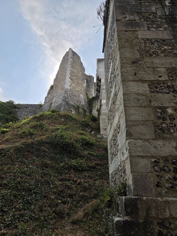
5. L’architecture du château / The Architecture of the Castle Marker
The view up the castle wall from along the moat.
Credits. This page was last revised on August 7, 2026. It was originally submitted on August 6, 2026, by James Hulse of Medina, Texas. This page has been viewed 12 times since then. Photos: 1, 2, 3, 4, 5. submitted on August 7, 2026, by James Hulse of Medina, Texas.
