Near Simpson in Johnson County, Illinois — The American Midwest (Great Lakes)
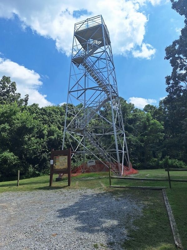
Trigg Tower
Photographed by Jason Voigt, July 30, 2026
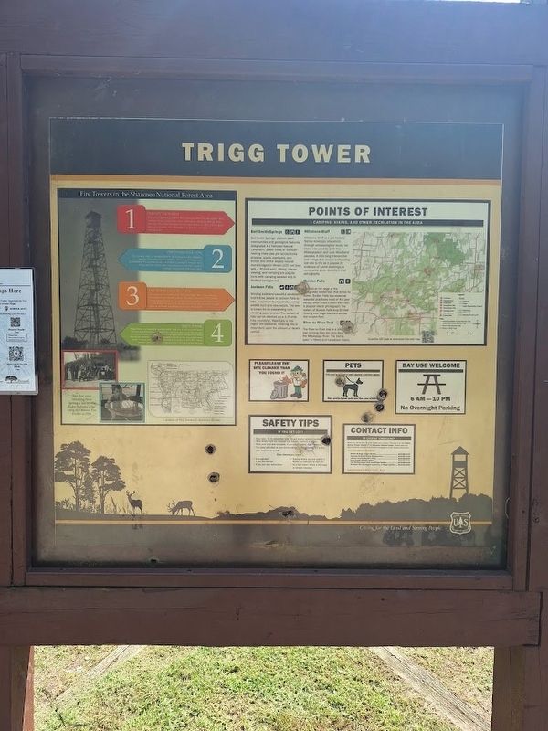
1. Trigg Tower Marker
Fire Towers in the Shawnee National Forest Area
1) Fires on the Forest
Because of lightning strikes, field clearing practices and sparks from passing trains, forest fires were common in southern Illinois. Soon after the Shawnee National Forest was formed in 1933, a fixed point detection system was established to observe and respond to the emergencies.
2) Fire Tower Function
Fire towers were an integral part of the fixed-point fire detection system. They maximized visibility, total area coverage, and accessibility. The maximum area of visibility averaged between 6-12 miles, and the towers were positioned so that their areas of coverage intersected with each other.
3) Fire Tower Construction
The creation of the Shawnee National Forest led for the need for increased fire protection efforts. Between 1934 and 1939, Civilian Conservation Corps (CCC) crews constructed sixteen fire towers. Tower design varied as structures either had wood or steel frames, open or enclosed platforms, and stairs or ladders.
4) Trigg Tower
Trigg Tower was originally constructed in 1934 as a 40-foot wooden tower but was replaced four years
this page online
Photo captions:
Fire crew returning from fighting a fire in 1936.
Sighting a fire using an Osborne Fire Finder in 1938.
Points of Interest
Camping, hiking, and other recreation in the area
Bell Smith Springs. Bell Smith Springs' distinct plant communities and geological features designated it a National Natural Landmark. Seven miles of interconnecting trails take you across rocky streams, scenic overlooks, and across one of the largest natural stone bridges in Illinois (125 feet long with a 30-foot arch). Hiking, nature viewing, and camping are popular here, with camping allowed only in Redbud Campground.
Jackson Falls. Winding trails and beautiful sandstone bluffs draw people to Jackson Falls to hike, mushroom hunt, primitive camp, wildlife hunt and view nature. The area is known
Photographed by Jason Voigt, July 30, 2026
2. Trigg Tower Marker
Millstone Bluff. Millstone bluff is a pre-historic Native American site which, through archaeological study, we know was used by both the Mississippian and Late Woodland peoples. A mile-long interpretive trail brings this unique archaeological site to life as it passes by evidence of home dwellings, a community area, stonefort, and petroglyphs.
Burden Falls. Located at the edge of designated wilderness that bares its name. Burden Falls is a seasonal waterfall and flows most of the year except when there's been little rain. A popular site to photograph, the waters of Burden Falls drop 80-feet flowing over huge boulders across the canyon floor.
River to River Trail. The River to River trail is a 160 (unreadable) trail running from the Ohio River to the Mississippi River. The trial is open to hikers and horseback riders.
Erected by U.S. Forest Service.
Topics. This historical marker is listed in this topic list: Horticulture & Forestry. A significant historical year for this entry is 1933.
Location. 37° 29.269′ N, 88° 44.161′ W. Marker is near Simpson, Illinois, in Johnson County. It is on Trigg Tower Road north of Rushing Road, on the right when traveling north. Touch for map. Marker is at or near this postal address: 2656 Trigg Tower Rd, Simpson IL 62985, United States of America. Touch for directions.

Regionally, this marker is in Southern Illinois — Little Egypt and in Shawnee Hills. It is also in the American Midwest and in the Corn Belt. Globally, it is in North America, the Western Hemisphere, the Western World, and the Anglosphere. Historically, it finds itself in what was once the territory of the Mississippian Culture and also the Northwest Territory.
Other nearby markers. At least 8 other markers are within 11 miles of this marker, measured as the crow flies: Old Ft. Massac and Kaskaskia Trail (approx. 4.3 miles away); Tunnel Hill State Trail (approx. 6.7 miles away); Revolutionary War Veterans (approx. 8.3 miles away); a different marker also named Tunnel Hill State Trail (approx. 8.9 miles away); Dedicated in Honor of Those Who Have Made the Supreme Sacrifice for Our Country (approx. 9.2 miles away); Route of Gen. George Rogers Clark (approx. 10.2 miles away); Johnson County Courthouse (approx. 10.2 miles away); Thirteen Hundred and Sixty-four Volunteers (approx. 10.2 miles away).
Also see . . .
1. Trigg Tower (U.S. Forest Service). (Submitted on August 6, 2026, by Jason Voigt of Glen Carbon, Illinois.)
2. Trigg Tower (National Historic Lookout Register). (Submitted on August 6, 2026, by Jason Voigt of Glen Carbon, Illinois.)
Credits. This page was last revised on August 6, 2026. It was originally submitted on August 6, 2026, by Jason Voigt of Glen Carbon, Illinois. This page has been viewed 15 times since then. Photos: 1, 2. submitted on August 6, 2026, by Jason Voigt of Glen Carbon, Illinois.
