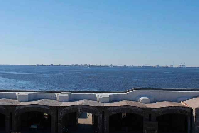
Near Charleston in Charleston County, South Carolina — The American South (South Atlantic)
Charleston Besieged
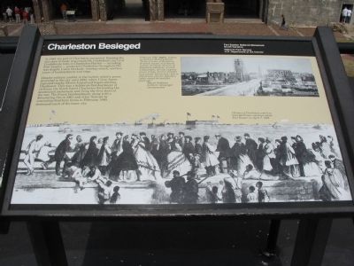
Despite military conflict in the harbor, relative peace prevailed in the city until 1863, when Union forces captured nearby Morris Island and began shelling Charleston. This was a deliberate bombardment of civilians; the North hated Charleston for leading the secessionist movement and firing the first shots of the war. The Union bombardment, along with a devastating fire in 1861 and other fires set by evacuating Southern forces in February 1865, destroyed much of the lower city.
Erected by Fort Sumter National Monument, South Carolina - National Park Service - U.S. Department of the Interior.
Topics. This historical marker is listed in this topic list: War, US Civil. A significant historical month for this entry is February 1865.
Location. 32° 45.14′ N, 79° 52.482′ W. Marker is near Charleston, South Carolina, in Charleston County. Marker is located at Fort Sumter National Monument and only reached by boat. See links below for more information about access to the site. Touch for map . Marker is in this post office area: Charleston SC 29412, United States of America. Touch for directions.
Other nearby markers. At least 8 other markers are within walking distance of this marker. Fort Johnson (here, next to this marker); Fort Moultrie (a few steps from this marker); Morris Island (a few steps from this marker); Flags of the Fort (a few steps from this marker); a different marker also named Morris Island (a few steps from this marker); Fort Sumter Today (a few steps from this marker); Fort Sumter 1861-65 (a few steps from this marker); Battery Huger (a few steps from this marker). Touch for a list and map of all markers in Charleston.
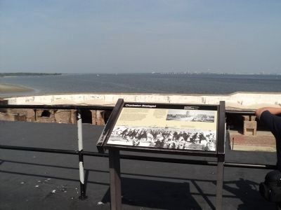
More about this marker. In the lower half of the marker is a contemporary sketch showing the Citizens of Charleston watch as ironclad Union warships attack Fort Sumter on April 7, 1863. In the upper right is a photo of Charleston shortly after the 1865 evacuation. February 1865, looking south down Meeting Street: "A city of ruins, of desolation, of vacant houses, of widowed women, of rotting wharves, of deserted warehouses, of wee-wild gardens, of miles of grass-grown streets, of acres of pitiful and voiceful barrenness - this is Charleston, wherein Rebellion loftily reared its head five years ago." -Sidney Andrews, northern newspaper correspondent.
Credits. This page was last revised on October 23, 2020. It was originally submitted on May 16, 2010, by Craig Swain of Leesburg, Virginia. This page has been viewed 1,190 times since then and 44 times this year. Photos: 1. submitted on May 16, 2010, by Craig Swain of Leesburg, Virginia. 2. submitted on August 18, 2013, by Bill Coughlin of Woodland Park, New Jersey. 3, 4. submitted on May 16, 2010, by Craig Swain of Leesburg, Virginia. 5. submitted on August 10, 2015, by Brandon Fletcher of Chattanooga, Tennessee.
