Centre Erlon in Reims in Marne, Alsace, Lorraine, Champagne-Ardenne, France — Western Europe
Place d’Erlon
Quartier Centre
| — | Du Moyen Âge à la Cité Art déco | — |
Photographed by James Hulse, August 5, 2026
1. Place d’Erlon Marker

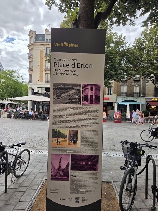
La place d'Erlon apparaît sous le nom de « rue de la Couture », lotie aux XIIᵉ-XIIIᵉ siècles dans une période faste où la ville commence à rebâtir ses églises, sort des remparts du IVᵉ siècle, s'accroît le long des voies romaines autour de trois faubourgs (Jaurès, Porte de Paris, Laon) et d'un bourg (Saint-Remi). Conçue pour des artisans, la place devient un centre économique près du champ de Foire. Elle accueille le marché aux laines au début du XIXᵉ siècle, puis les visiteurs découvrant la « ville du champagne », dans ses hôtels, restaurants, cafés, après l'ouverture de la gare. Proche de trois frontières, Reims est aussi une ville de garnisons, défendue par des forts extérieurs. Mais ils ne suffisent pas à arrêter les troupes allemandes qui s'en emparent et bombardent la ville de 1914 à 1918.
Reconstruite entre 1919 et 1925, la place d'Erlon tend à retrouver ses fonctions et son esthétique d'avant-guerre, respectant les rythmes médiévaux des bâtiments (galerie sous arcades dites « loges ») et des parcelles (laniérées). La modernité se glisse dans les intérieurs, matériaux et ornements,
this page online
Longtemps incomprise, cette reconstruction illustre la pensée urbaine et architecturale des années 1910 : chargé du plan de Reims, Georges B. Ford est un grand expert de l'urbanisme moderne américain, mais il fait le choix de respecter l'histoire de la ville.
Place d’Erlon vers 1930, carte postale colorisée © Archives municipales et communautaires de Reims
La place d’Erlon en 1866, cliché photographique Émile Matot BM Reims, XL V 12
Ancien studio d’art Peppy, passage Subé collection Michel Thibault
The square was designed by artisans and became an economic centre close to the medieval fairground. It was home to
Photographed by James Hulse, August 5, 2026
2. Place d’Erlon Marker
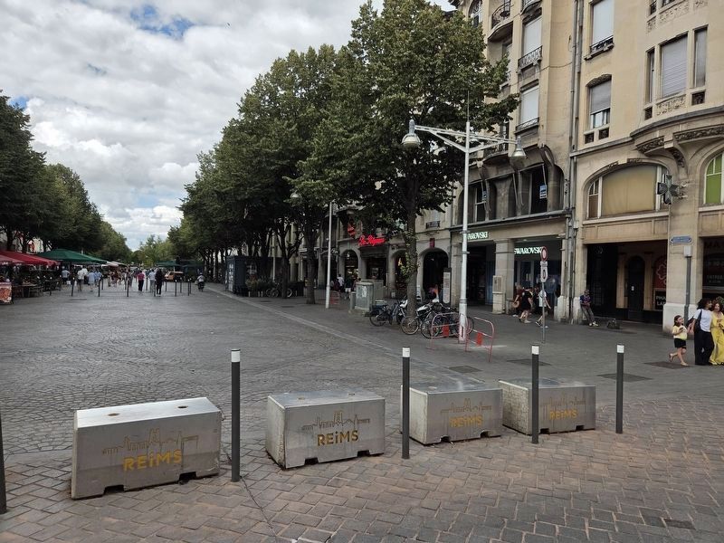
The marker is located behind the bikes and tree on the right side.
Place d’Erlon around 1930, colorized postcard © Reims Municipal and Metropolitan Archives
Place d’Erlon in 1866, photograph by Émile Matot, BM Reims, XL V 12
Former Peppy Art Studio, Passage Subé, Michel Thibault Collection
Photographed by James Hulse, August 5, 2026
3. Place d’Erlon Marker
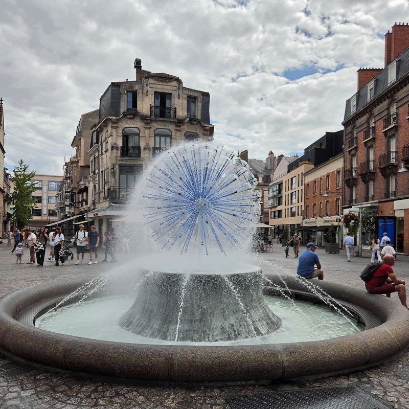
The Condorcet Fountain stands at the intersection of five streets near the marker.
Der für Handwerker entworfene Platz wurde zu einem Wirtschaftszentrum in der Nähe des Marktgeländes. Zu Beginn des 19. Jahrhunderts fand hier der Wollmarkt statt, und nach der Eröffnung des Bahnhofs entdeckten Besucher die „Stadt des Champagners“ mit ihren Hotels, Restaurants und Cafés.
Durch die Grenzlage war Reims auch eine Stadt der Garnisonen, die von äußeren Forts verteidigt wurde. Aber sie reichten nicht aus, um die deutschen Truppen aufzuhalten. Sie wurden eingenommen und die Stadt von 1914 bis 1918 bombardiert.
Der zwischen 1919 und 1925 wiederaufgebaute Place d’Erlon erhielt seine Funktionen und seine Ästhetik unter Berücksichtigung des mittelalterlichen Rhythmus der Gebäude (Galerie unter Arkaden) und der Riemenparzellen wieder. Die Moderne schlich sich in die Innenräume, Materialien
Photographed by James Hulse, August 5, 2026
4. Place d’Erlon Marker
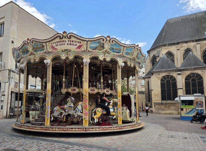
The Venetian Carousel on Rue Condorcet, with the Church of Saint-Jacques in the background.
Dieser lange missverstandene Wiederaufbau veranschaulicht das städtische und architektonische Denken der 1910er Jahre: George B. Ford, der für den Reims-Plan verantwortlich war, war ein großer Experte für moderne amerikanische Stadtplanung, doch er beschloss, die Geschichte der Stadt zu respektieren.
Place d’Erlon um 1930, kolorierte Postkarte © Stadt- und Gemeindearchiv Reims
Place d’Erlon im Jahr 1866, Fotografie von Émile Matot, BM Reims, XL V 12
Ehemaliges Kunststudio Peppy, Passage Subé, Sammlung Michel Thibault
Erected by City of Reims, Greater Reims Urban Community, Cities and Regions of Art and History, and Prefect of the Grand Est Region Cities and Regions of Art and History, Prefect of the Grand Est Region.
Topics. This historical marker is listed in these topic lists: Architecture • Industry & Commerce • War, World II. A significant historical year for this entry is 1914.
Location. 49° 15.258′ N, 4° 1.674′ E. Marker is in Reims, Grand Est (Alsace, Lorraine, Champagne-Ardenne), in Marne. It is in Centre Erlon. It is at the intersection of Place Drouet d'Erlon and Rue Condorcet, on the left when traveling south on Place Drouet d'Erlon. Touch for map. Marker is at or near this postal address: 8 Pl Drouet d'Erlon, Reims, Grand Est 51100, France. Touch for directions.

Regionally, it is in the North Atlantic Region, Europe, the European Union, Atlantic Europe, the Schengen Area, Western Europe, a coastal Mediterranean country, and the Western World. Historically, it finds itself in what was once a French colony, the Roman Empire, and specifically the Holy Roman Empire.
Other nearby markers. At least 8 other markers are within walking distance of this marker: Place Drouet-d’Erlon (within shouting distance of this marker); Église Saint-Jacques / Saint-Jacques Church (within shouting distance of this marker); Cinéma Opéra (within shouting distance of this marker); Fontaine Subé (about 90 meters away, measured in a direct line); Immeuble de rapport Kodak / Kodak Apartment Building (about 120 meters away); Rue de Vesle et Magasins Modernes (about 120 meters away); Hommage aux martyrs de la Résistance française / Tribute to the Martyrs of the French Resistance (about 150 meters away); Opéra, ancien Grand Théâtre / Opera, Former Grand Théâtre (about 210 meters away). Touch for a list and map of all markers in Reims.
Credits. This page was last revised on August 13, 2026. It was originally submitted on August 7, 2026, by James Hulse of Medina, Texas. This page has been viewed 20 times since then. Photos: 1, 2. submitted on August 7, 2026, by James Hulse of Medina, Texas. 3, 4. submitted on August 13, 2026, by James Hulse of Medina, Texas.
