Dublin Castle in County Dublin, Leinster, Ireland — Mid-East (and Dublin)
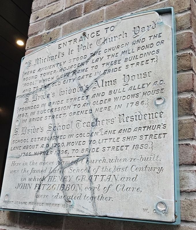
Entrance to S. Michael's le Pole Church Yard
Photographed by Ian Lefkowitz, May 18, 2026
1. Entrance to S. Michael's le Pole Church Yard Marker
S. Michael’s le Pole Church Yard
Here anciently stood the church and the round tower. Adjacent lay the mill pond or “pool” which gave name to these buildings and to the old city gate in Bride Street.
S. Bride’s Widows’ Alms House
Founded in Bride Street and Bull Alley A.D. 1683, in succession to an older widows’ house in Bride Street. Opened here in 1786.
S. Bride’s School Teachers’ Residence
School established in Golden Lane and Arthur’s Lane about A.D. 1700. Moved to Little Ship Street 1746, hither 1796, to Bride Street 1859.
Here in the above named church, when re-built, was the famed Latin School of the last century; in which Henry Grattan and John Fitzgibbon, earl of Clare, were educated together.
Mount Jerome Marble Works 1883.
Erected 1883.
Topics. This historical marker is listed in these topic lists: Education • Religion & Religious Structures. A significant historical year for this entry is 1683.
Location. 53° 20.516′ N, 6° 16.088′ W. Marker is in Dublin, Leinster, in County Dublin. It is in Dublin Castle. It is on Ship Street Great south of Ship Street Little, on the left when traveling north. Touch for map.
this page online

Regionally, this marker is in the Ancient East. Globally, it is on the Atlantic Ocean, in the North Atlantic Region, in Europe, on the Island of Ireland, on the Celtic Fringe, in the European Union, in Atlantic Europe, on one of the British Isles, in the Western World, and in the Anglosphere.
Other nearby markers. At least 8 other markers are within walking distance of this marker: The Battle of Clontarf (a few steps from this marker); Dubhlinn & The Poddle (a few steps from this marker); Le Pole Square (within shouting distance of this marker); Metropolitan Police (within shouting distance of this marker); St. Michael Le Pole (within shouting distance of this marker); Le Pole Sq. (within shouting distance of this marker); Hanna Sheehy Skeffington (within shouting distance of this marker); Silken Thomas (within shouting distance of this marker). Touch for a list and map of all markers in Dublin.
Also see . . . 2004:0547 - Dublin: Golden Lane, Dublin (Database of Irish Excavation Reports).
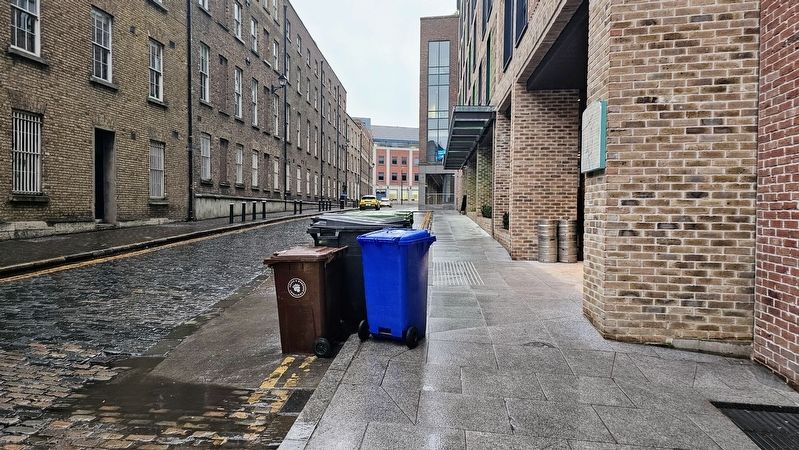
The site(Submitted on August 8, 2026, by Ian Lefkowitz of New York, New York.)of St Michael le Pole dates from as early as the 7th century AD and remained as a place of worship until the end of the 17th century, when it was converted into a school (Gowen 2001, 31). The foundations for a round tower and a church and the remains of a medieval graveyard were located during excavation at the site in 1981 (ibid., 38). The city of Dublin grew in parallel with the church site and Chancery Lane is recorded as a street from c. AD 1230 and Golden Lane is first referenced in AD 1382 (Clarke 2002, 13). The site of St Michael le Pole was completely surrounded by development in the city by the 18th century and no trace of the monument survives above ground level today.Photographed by Ian Lefkowitz, May 18, 20262. Entrance to S. Michael's le Pole Church Yard MarkerThis historic marker has been reinstalled on a new building on Great Ship Street (view facing south).
Credits. This page was last revised on August 8, 2026. It was originally submitted on August 8, 2026, by Ian Lefkowitz of New York, New York. This page has been viewed 13 times since then. Photos: 1, 2. submitted on August 8, 2026, by Ian Lefkowitz of New York, New York. • Andrew Ruppenstein was the editor who published this page.
