South Arroyo in Pasadena in Los Angeles County, California — The American West (Pacific Coastal)
The Old Firehouse
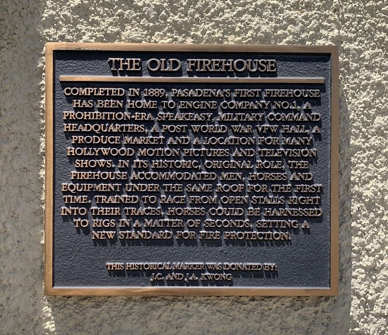
Photographed by Liam Williams, May 31, 2026
1. The Old Firehouse Marker
Topics. This historical marker is listed in this topic list: Notable Buildings. A significant historical year for this entry is 1889.
Location. 34° 8.623′ N, 118° 9.084′ W. Marker is in Pasadena, California, in Los Angeles County. It is in South Arroyo. It is on West Dayton Street west of Fair Oaks Avenue, on the right when traveling west. Touch for map. Marker is at or near this postal address: 35 W Dayton Street, Pasadena CA 91105, United States of America. Touch for directions.

Regionally, this marker is in Greater Los Angeles and in the Transverse Ranges. It is also on the American
this page online
Other nearby markers. At least 8 other markers are within walking distance of this marker: Baker Alley (within shouting distance of this marker); Friendship Baptist Church (within shouting distance of this marker); 107 S. Fair Oaks Ave (within shouting distance of this marker); 1909 Seagrave (about 300 feet away, measured in a direct line); Yuen Kee Laundry (about 300 feet away); Original Site of Throop University (about 400 feet away); Martin Alley (about 500 feet away); a different marker also named Yuen Kee Laundry (about 600 feet away). Touch for a list and map of all markers in Pasadena.
Another marker is no longer nearby. Mills Place (was about 300 feet away but has been replaced with another marker now near it).

Photographed by Liam Williams, May 31, 2026
2. The Old Firehouse Marker

Photographed by Liam Williams, May 31, 2026
3. The Old Firehouse
Marker is at far left.
Credits. This page was last revised on August 14, 2026. It was originally submitted on August 10, 2026, by Liam Williams of Irvine, California. This page has been viewed 19 times since then. Photos: 1, 2, 3. submitted on August 10, 2026, by Liam Williams of Irvine, California. • Andrew Ruppenstein was the editor who published this page.
