North Branch in Somerset County, New Jersey — The American Northeast (Mid-Atlantic)
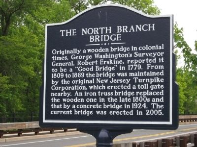
The North Branch Bridge
Photographed by Alan Edelson, May 17, 2010
1. The North Branch Bridge Marker
Topics. This historical marker is listed in this topic list: Bridges & Viaducts. A significant historical year for this entry is 1779.
Location. 40° 36.002′ N, 74° 40.446′ W. Marker is in North Branch, New Jersey, in Somerset County. It is on Easton Turnpike (County Road 614) west of Church Road, on the right when traveling east. Touch for map. Marker is at or near this postal address: 1200 Easton Turnpike, Somerville NJ 08876, United States of America. Touch for directions.

Regionally, this marker is in New Jersey’s Central Jersey, in Greater Princeton, and in the New York City Metropolitan Area. It is also in the American Northeast, in the Mid-Atlantic, and on the Eastern Seaboard. Globally, it is in the
this page online
Other nearby markers. At least 8 other markers are within 3 miles of this marker, measured as the crow flies: Bridgewater Township Historic Monument (approx. 2.6 miles away); The Official End Of World War I (approx. 2.7 miles away); Washington’s Route from Princeton to Morristown (approx. 2.9 miles away); Branchburg Veterans Memorial (approx. 3 miles away); Jacob Vosseller House (approx. 3 miles away); Whitehouse Veterans Monument (approx. 3 miles away); Raritan Veterans Memorial (approx. 3 miles away); Raritan Veterans Monument (approx. 3 miles away).
Photographed by Alan Edelson, May 17, 2010
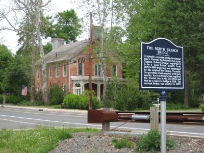
2. The North Branch Bridge Marker
Photographed by Alan Edelson, May 17, 2010
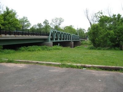
3. The North Branch Bridge
Credits. This page was last revised on June 16, 2016. It was originally submitted on May 17, 2010, by Alan Edelson of Union Twsp., New Jersey. This page has been viewed 1,491 times since then and 36 times this year. Photos: 1, 2, 3. submitted on May 17, 2010, by Alan Edelson of Union Twsp., New Jersey. • Syd Whittle was the editor who published this page.
