Dupo in St. Clair County, Illinois — The American Midwest (Great Lakes)
Prairie du Pont
Photographed by Thomas Smith, August 3, 2026
1. Prairie du Pont Marker
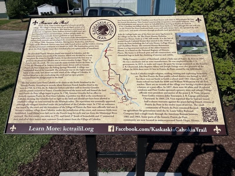
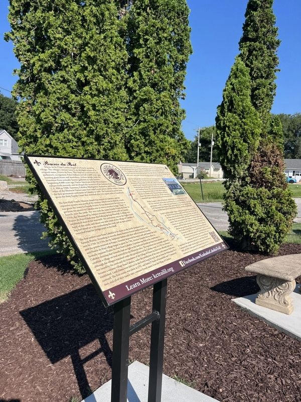
Dupo, in St. Clair County began as a French-speaking village. The village's current name is an abridged version of original name, Prairie du Pont. This land has a rich history of prehistoric occupation. Paleo Indians arrived 12,000 years ago, hunting giant bison and mastodons, Archaic people made the transition from nomadic hunter-gatherers to early farmers, beginning 8,000 years ago. Native Americans of the Mississippians culture built mounds and developed the resources of the bottoms from CE 850 to 1500. Tamoroa, Cahokia, Michigamea, Kaskaskia, and Peoria tribes of the Iliniwek Nation came here with French priests and fur traders, creating the first permanent settlement at Cahokia in 1699. The Seminarian priests were given the Holy Family Grant that stretched over 144 square miles of marshland.
The first Holy Family Mission chapel was erected in Cahokia, and the expansive prairie area south of the mission, which was divided by a creek, was given the name Le Grande Prairie. It was determined the best way to get from the prairie to Cahokia was to erect a wooden bridge, "Pont" in French, over the creek
this page online
The first settlers came from Cahokia to be closer to the fertile farmland in the Grande Prairie. According to records, about fourteen French families lived in the area in 1760. In 1764, the St. Sulpician fathers sold their mill to Antoine Girardin and the priests returned to France. Girardin improved the water-mill and farmed the land and Prairie du Pont village began to grow. In 1780, Antoine Girardin led an effort to formally separate Prairie du Pont from Cahokia. A petition was filed at the courthouse in Cahokia claiming that Girardin had no right to the land and should not have been allowed to establish a village on land reserved for the Illiniwek tribes. The separation was
Photographed by Thomas Smith, August 3, 2026
2. Prairie du Pont Marker
Jean Francois Perry and M. Claudius were from France and came to Philadelphia during the French Revolution. They formed a partnership to operate mercantile business. They left Philadelphia and opened a store in Cahokia before moving to Prairie du Pont in 1792. Claudius was killed when he was thrown from his horse. Perry bought the old mill site on the Prairie Du Pons Creek and built a new mill and a home there. He operated the mill and a store, and made a fortune through profitable land speculations.
John B. LaPage built one of the first one-story log homes in the village on lot No. 58. The Pierre Martin Nicholas Boismenue House, built in 1790, still stands. It is the last of several French Colonial homes that existed in the 1930s in Prairie du Pont including the LaCroix House, LePage House, and Chatillion n House. The restored Martin-Boismense House is a log structure and one of the oldest homes in Illinois. It is listed on the National Register of Historic Places. The home is of French post and sill construction, with channeled logs to hold the chinking of mortar and rubble.
Philip Creamer, a native of Maryland, settled a little east of Prairie du Pont in 1805. He was a mechanic and an arms manufacturer. He was employed by the U.S. government, in 1812, to make and repair the guns for troops stationed on the frontier. J. B. Chartrand, John Baptiste Allary and Joseph Deloge were also pioneers of the village. In 1834 there were 21 lots in Prairie du Pont, owned by ten individuals.
French Catholics taught religion, reading, writing and cyphering from early on. The first Prairie du Pont public school district was formed in 1847. but there were no funds to build a school until 1861 when an 18 x 30 frame school was built for $500 and William Williamson was the first teacher. There are no records of the village ever having a resident doctor, a lawyer, or a post office. In 1857, there were 40 white and 10 colored residents and Peter Godin operated a grocery store and saloon Village officials were president and justice of the peace J. B. Viens : treasurer Peter Goding trustees John Touranjon, J. B. Lapage and Joseph Chartrand. In 1869, J.B. Vien reported that he had not issued half-a-dozen warrants against the peace-loving French citizens of Prairie du Pont in his twelve years of service. The small community of Prairie du Pont remained focused on agriculture for generations until the St. Louis Valley Railroad Company laid a single track through the American Bottom between 1901 and 1903. Some parts of the historic Prairie du Pont community are now located in unincorporated North Dupo.
Erected 2026 by Kaskaskia/ Cahokia Trail Coalition.
Topics. This historical marker is listed in these topic lists: Education • Industry & Commerce • Religion & Religious Structures • Settlements & Settlers. A significant historical year for this entry is 1500.
Location. 38° 30.673′ N, 90° 12.444′ W. Marker is in Dupo, Illinois, in St. Clair County. It is at the intersection of S Main Street and Bluffview St., on the right when traveling south on S Main Street. Across from Dupo High School. Touch for map. Marker is in this post office area: Dupo IL 62239, United States of America. Touch for directions.

Regionally, this marker is in Greater St. Louis. It is also in the American Midwest, in the Lewis & Clark Corridor, in the Corn Belt, and in the Great River Road Region. Globally, it is in North America, the Western Hemisphere, the Western World, and the Anglosphere. Historically, it finds itself in what was once the Viceroyalty of New France, the territory of the Mississippian Culture, and the Northwest Territory.
Other nearby markers. At least 8 other markers are within 4 miles of this marker, measured as the crow flies: Dedicated to the Memory of Our Honored Heroes (approx. 0.4 miles away); In Memory of Those That Have Served (approx. 0.6 miles away); The Village of Dupo (approx. 0.6 miles away); Bell Tower (approx. 3 miles away); Palmier Cemetery (approx. 3.3 miles away); a different marker also named Palmier Cemetery (approx. 3.3 miles away); Jefferson Barracks - A River Flowing Through Time (approx. 3.4 miles away in Missouri); Millstadt Junction (0) (approx. 3.4 miles away). Touch for a list and map of all markers in Dupo.
Another marker is no longer nearby. Martin-Boismenue House (was approx. 2½ miles away but has been confirmed missing).
Credits. This page was last revised on August 28, 2026. It was originally submitted on August 10, 2026, by Thomas Smith of Waterloo, Ill. This page has been viewed 11 times since then. Photos: 1, 2. submitted on August 10, 2026, by Thomas Smith of Waterloo, Ill. • Andrew Ruppenstein was the editor who published this page.
