
Dayton in Columbia County, Washington — The American West (Northwest)
Vanishing Grist Wheel
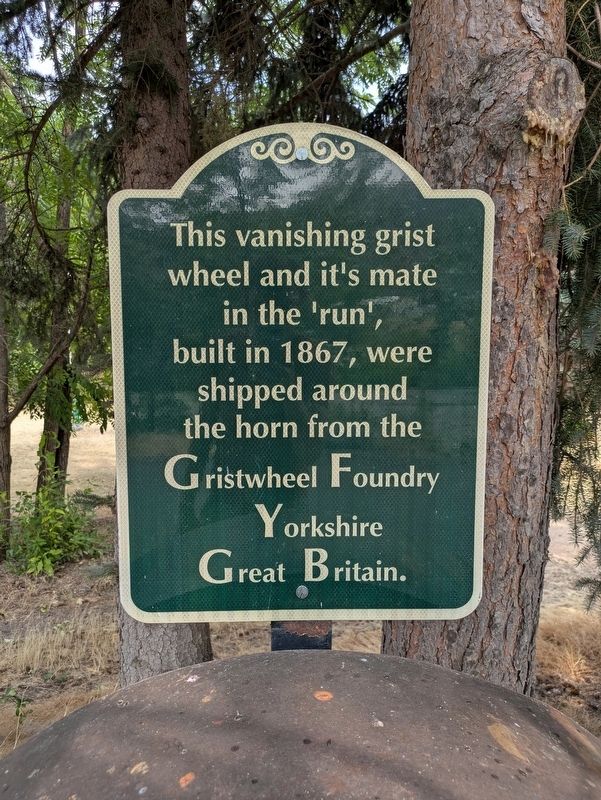
Photographed by Clayton Pickett, August 8, 2026
1. Vanishing Grist Wheel Marker
Topics. This historical marker is listed in this topic list: Industry & Commerce. A significant historical year for this entry is 1867.
Location. 46° 18.957′ N, 117° 58.736′ W. Marker is in Dayton, Washington, in Columbia County. It is on Dayton Riverfront Path ¼ mile south of West Main Street (U.S. 12), on the left when traveling south. Touch for map. Marker is in this post office area: Dayton WA 99328, United States of America. Touch for directions.

Regionally, this marker is in Washington’s Palouse. It is also in the American Mountain West and in the Lewis & Clark Corridor. Globally, it is in North America, the Pacific Rim, the Western Hemisphere, the Western World, and the Anglosphere.
Other nearby markers. At least 8 other markers are within walking distance of this marker: Cayuse, Umatilla, and Walla Walla Homeland (approx. ¼ mile away); "a good road" (approx. ¼ mile away); Dodge Quarantine Cabin (approx. 0.3 miles away); Smith Hollow Schoolhouse (approx.
this page online

Photographed by Clayton Pickett, August 8, 2026
2. Vanishing Grist Wheel Marker
Credits. This page was last revised on August 11, 2026. It was originally submitted on August 10, 2026, by Clayton Pickett of Richland, Washington. This page has been viewed 7 times since then. Photos: 1, 2. submitted on August 10, 2026, by Clayton Pickett of Richland, Washington. • Andrew Ruppenstein was the editor who published this page.
