Latrobe in Westmoreland County, Pennsylvania — The American Northeast (Mid-Atlantic)
Historic Latrobe Pennsylvania

Photographed by Bradley Owen, July 12, 2025
1. Historic Latrobe Pennsylvania Marker
OLIVER BARNES
Oliver W. Barnes was a civil engineer with the Pennsylvania Railroad. On February 18, 1851 Barnes purchased the 140 acre Thomas Kirk farm and would lay out streets and lots for a new town, which he named after a long-time friend and associate, Benjamin Latrobe.
RAILROAD
The Pennsylvania Railroad, which in the 1840s began planning to extend their tracks through Westmoreland County to connect the eastern part of the state with Pittsburgh. The first train chugged through Latrobe on November 29, 1852.
INDUSTRY
In the early nineteenth century, agriculture and its accompanying grist mills were the main industries in the area. The railroad and the natural resources would soon draw more industries to Latrobe. The Pennsylvania Car Works was Latrobe's first industry followed by distilleries and breweries soon to follow. However it was the steel industry that would drive Latrobe's growth and development.
CHURCHES
As Irish, German, Italian, Polish, and Slovak immigrants arrived, congregations were formed by those who shared not only a religion but also a language. The United Presbyterian congregation was formed in 1853 followed by Holy Family Catholic Church and a Methodist church in 1856. The first Presbyterian Church was built in 1857, Trinity Lutheran organized in 1863 and Congregation Beth Israel formed in 1900.
RECREATION
The first modern two-wheel bicycle was introduced to Latrobe in 1891 and it wasn't long until cycling clubs were formed. In the 1930s Legion-Keener Park was built on 27 acres of floodplain. In the 1950s Memorial Stadium was built, the Jaycees would build the Little League Field, and the Rogers-McFeely family provided the funds for a community swimming pool.
Topics. This historical marker is listed in these topic lists: Industry & Commerce • Railroads & Streetcars
this page online
Location. 40° 18.975′ N, 79° 23.075′ W. Marker is in Latrobe, Pennsylvania, in Westmoreland County. It is at the intersection of Ligonier Street and Main Street (Pennsylvania Route 981), on the left when traveling west on Ligonier Street. Touch for map. Marker is at or near this postal address: 903 Ligonier Street, Latrobe PA 15650, United States of America. Touch for directions.

Regionally, this marker is in the Laurel Highlands and in Greater Pittsburgh. It is also in the American Northeast, in the Mid-Atlantic, in Appalachia, and specifically in Northern Appalachia. Globally, it is in North America, the Western Hemisphere, the Western World, and the Anglosphere. Historically, it finds itself in what was once the Viceroyalty of New France, the Haudenosaunee (Iroquois) Confederacy, and one of the original Thirteen Colonies.
Other nearby markers. At least 8 other markers are within walking distance of this marker: Famous Latrobe Pennsylvania (here, next to this marker); Citizens National Bank of Latrobe (within shouting
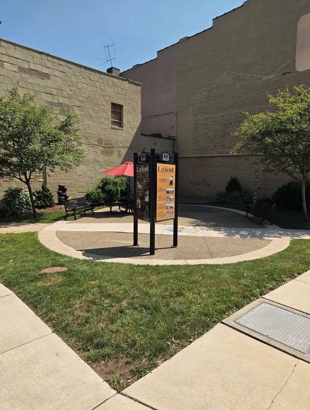
Photographed by Bradley Owen, July 12, 2025
2. Historic Latrobe Pennsylvania and Famous Latrobe Pennsylvania Markers
Credits. This page was last revised on August 11, 2026. It was originally submitted on July 18, 2025, by Bradley Owen of Morgantown, West Virginia. This page has been viewed 529 times since then and 227 times this year. Last updated on August 10, 2026, by Carl Gordon Moore Jr. of North East, Maryland. Photos: 1, 2. submitted on July 18, 2025, by Bradley Owen of Morgantown, West Virginia. • Devry Becker Jones was the editor who published this page.
