Drexel Hill in Delaware County, Pennsylvania — The American Northeast (Mid-Atlantic)
Archbishop Prendergast High School/ Monsignor Bonner High School
Photographed by Kate Clifford, August 6, 2026
1. Archbishop Prendergast High School/ Monsignor Bonner High School Marker
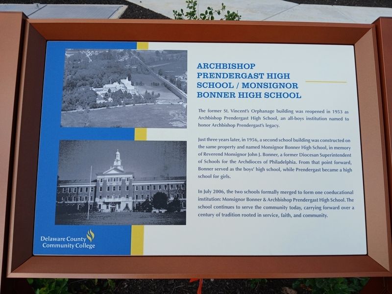
Just three years later, in 1956, a second school building was constructed on the same property and named Monsignor Bonner High School, in memory of Reverend Monsignor John J. Bonner, a former Diocesan Superintendent of Schools for the Archdiocese of Philadelphia. From that point forward, Bonner served as the boys' high school, while Prendergast became a high school for girls.
In July 2006, the two schools formally merged to form one coeducational institution: Monsignor Bonner & Archbishop Prendergast High School. The school continues to serve the community today, carrying forward over a century of tradition rooted in service, faith, and community.
Erected 2026 by Delaware County Community College.
Topics. This historical marker is listed in these topic lists: Education • Religion & Religious Structures. A significant historical year for this entry is 1953.
Location. 39° 57.168′ N, 75° 16.974′ W. Marker is in Drexel Hill, Pennsylvania,
this page online

Regionally, this marker is in Southeast Pennsylvania and in Greater Philadelphia. It is also in the American Northeast and in the Mid-Atlantic. Globally, it is in North America, the Western Hemisphere, the Western World, and the Anglosphere. Historically, it finds itself in what was once the Haudenosaunee (Iroquois) Confederacy, New Netherland, and one of the original Thirteen Colonies.
Other nearby markers. At least 8 other markers are within 2 miles of this marker, measured as the crow flies: St. Vincent's Orphanage (here, next to this marker); Residence of Anthony Joseph Drexel Jr. (a few steps from this marker); Thomas Garrett (approx. ¾ mile away); Henry Albertson Subdivision Historic District (approx. 0.8 miles away); Lansdowne World War Monument (approx. 0.8 miles away); Abraham L. Pennock (approx. 0.8 miles away); Lansdowne Park Historic District (approx. 1.1 miles away); Clifton Heights
Photographed by Kate Clifford, August 6, 2026
2. Archbishop Prendergast High School/ Monsignor Bonner High School Marker
Photographed by Kate Clifford, August 6, 2026
3. Interpretive signs to north
Credits. This page was last revised on August 19, 2026. It was originally submitted on August 11, 2026, by Kate Clifford of Lansdowne, Pennsylvania. This page has been viewed 18 times since then. Photos: 1, 2, 3. submitted on August 11, 2026, by Kate Clifford of Lansdowne, Pennsylvania. • Andrew Ruppenstein was the editor who published this page.
