Napanee in Greater Napanee in Lennox and Addington County, Ontario — Central Canada (North America)
Old Hay Bay Church
⎯⎯⎯
La vielle église de la Baie Hay
Photographed by Tim Boyd, August 8, 2026
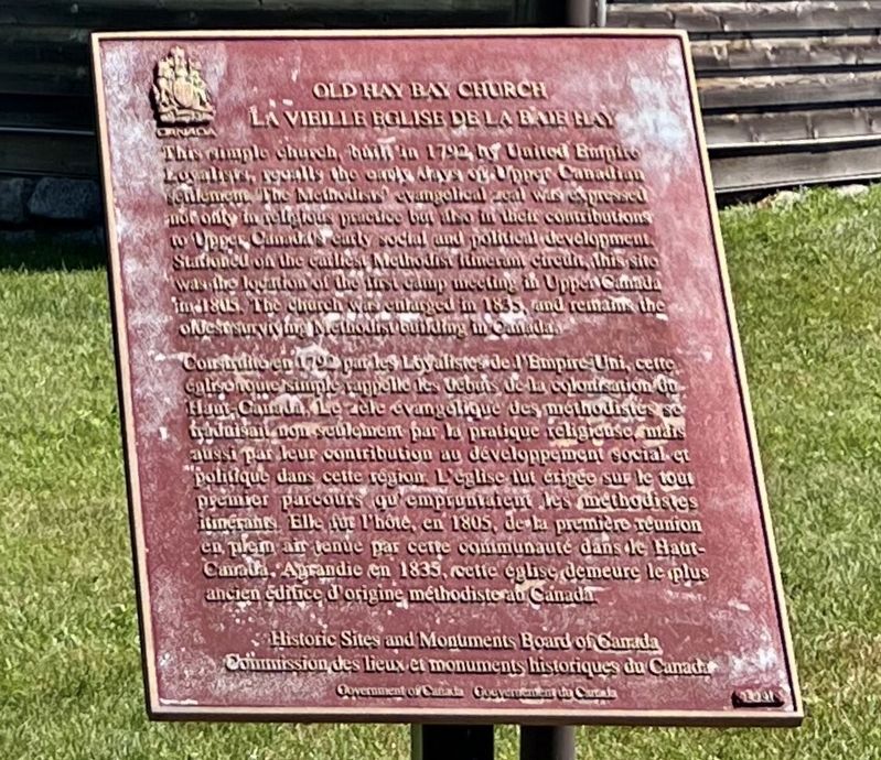
1. Old Hay Bay Church/La Vielle église de la Baie Hay Marker

This simple church, built in 1792 by United Empire Loyalists, recalls the early days of Upper Canadian settlement. The Methodists’ evangelical zeal was expressed not only in religious practice but also in their contribution to Upper Canada's early social and political development. Stationed on the earliest Methodist itinerant circuit, this site was the location of the first camp meeting in Upper Canada in 1805. The church was enlarged in 1835, and remains the oldest surviving Methodist building in Canada.
Construite en 1792 par les Loyalistes de l'Empire-Uni, cette église toute simple rappelle les débuts de la colonisation du Haut-Canada. Le zèle évangélique des méthodistes se traduisait non seulement par la pratique religieuse, mais aussi par leur contribution au développement social et politique dans cette région. L'église fut érigée sur le tout premier parcours qu’empruntaient les méthodistes itinérants. Elle fur l'hôte, en 180S, de la première réunion en plein air tenue par cette communauté dans le Haut-Canada. Agrandie en 1835, cette église demeure
this page online
Erected 2001 by Historic Sites and Monuments Board of Canada.
Topics and series. This historical marker is listed in these topic lists: Religion & Religious Structures • Settlements & Settlers. In addition, it is included in the Canada, Historic Sites and Monuments Board series list. A significant historical year for this entry is 1792.
Location. 44° 6.136′ N, 77° 1.204′ W. Marker is in Greater Napanee, Ontario, in Lennox and Addington County. It is in Napanee. It is on South Shore Road 2.5 kilometers Hastings County Road 18, on the right when traveling east. Touch for map. Marker is in this post office area: Greater Napanee ON K7R 3K7, Canada. Touch for directions.

Regionally, this marker is in Eastern Ontario and specifically in Southeastern Ontario. It is also in Central Canada. Globally, it is in North America, on the Great Lakes, in the Western Hemisphere, in the Western World, and in the Anglosphere. Historically, it finds itself in what was once a British colony, the Viceroyalty of New France, the Haudenosaunee (Iroquois) Confederacy, and Rupert’s
Photographed by Tim Boyd, July 31, 2026
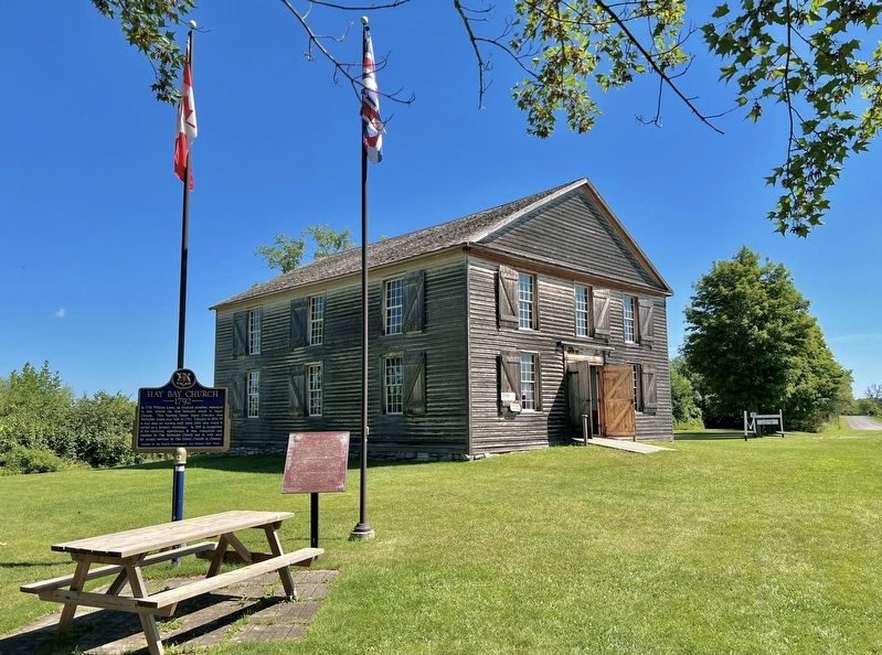
2. Old Hay Bay Churcg/La Vielle église de la Baie Hay Marker
Other nearby markers. At least 8 other markers are within 10 kilometers of this marker, measured as the crow flies: Hay Bay Church (here, next to this marker); The Quakers of Adolphustown (approx. 0.8 kilometers away); Bay of Quinte Loyalist Settlement (approx. 6.5 kilometers away); The Royal Union Flag (approx. 6.5 kilometers away); a different marker also named The Royal Union Flag (approx. 7.5 kilometers away); Sir Rodmond P. Roblin 1853-1937 (approx. 8.3 kilometers away); United Church (approx. 9.8 kilometers away); Gitchi Nagamo - 'A beautiful Song' (approx. 9.8 kilometers away). Touch for a list and map of all markers in Greater Napanee.
Photographed by Tim Boyd, July 31, 2026
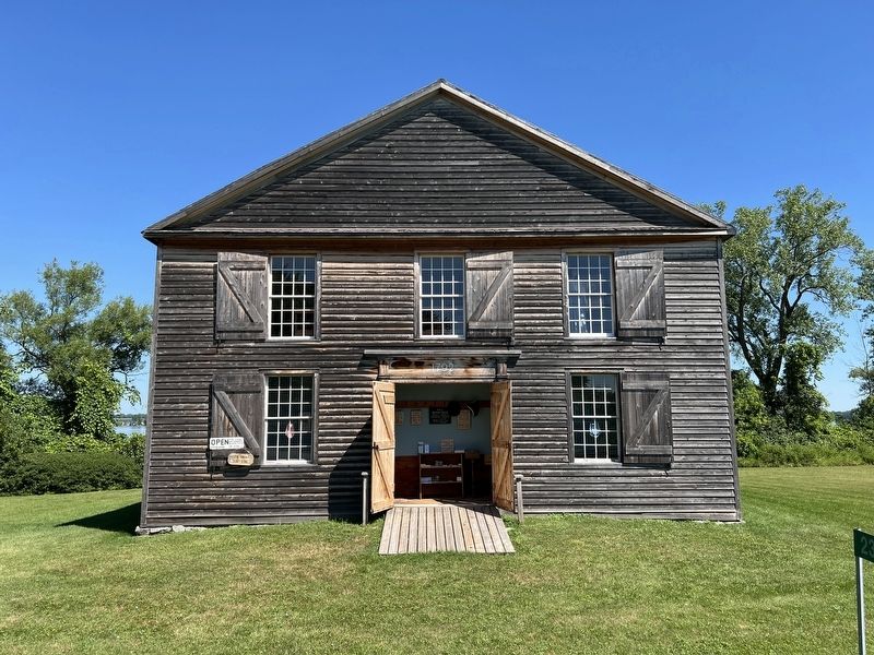
3. The Hay Bay Church in 2026
Photographed by Tim Boyd, July 31, 2026
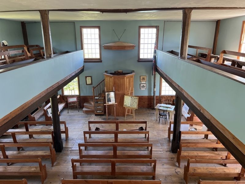
4. The Hay Bay Church, interior
Credits. This page was last revised on August 11, 2026. It was originally submitted on August 11, 2026, by Tim Boyd of Hamilton, Ontario. This page has been viewed 15 times since then. Photos: 1, 2, 3, 4. submitted on August 11, 2026, by Tim Boyd of Hamilton, Ontario. • Andrew Ruppenstein was the editor who published this page.
