Port Tampa City in Hillsborough County, Florida — The American South (South Atlantic)
Frederick Douglass School
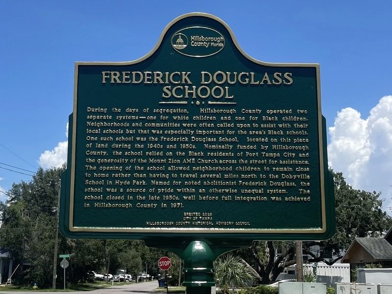
Photographed by Tim Fillmon, August 11, 2026
1. Frederick Douglass School Marker
During the days of segregation, Hillsborough County operated two separate systems-one for white children and one for Black children. Neighborhoods and communities were often called upon to assist with their local schools but that was especially important for the area's Black schools. One such school was the Frederick Douglass School, located on this piece of land during the 1940s and 1950s. Nominally funded by Hillsborough County, the school relied on the Black residents of Port Tampa City and the generosity of the Mount Zion AME Church across the street for assistance. The opening of the school allowed neighborhood children to remain close to home rather than having to travel several miles north to the Dobyville School in Hyde Park. Named for noted abolitionist Frederick Douglass, the school was a source of pride within an otherwise unequal system. The school closed in the late 1950s, well before full integration was achieved in Hillsborough County in 1971.
Erected 2026 by City of Tampa, Hillsborough County Historical Advisory Council.
Topics. This historical marker is listed in these topic lists:
this page online
Location. 27° 51.551′ N, 82° 31.713′ W. Marker is in Tampa, Florida, in Hillsborough County. It is in Port Tampa City. It is at the intersection of South Kissimmee Street and West Idaho Street, on the left when traveling south on South Kissimmee Street. Touch for map. Marker is at or near this postal address: 7406 S Kissimmee St, Tampa FL 33616, United States of America. Touch for directions.

Regionally, this marker is on Tampa Bay. It is also in the American South and on the Gulf Coast. Globally, it is in the North Atlantic Region, North America, a Gulf of Mexico state, the Western Hemisphere, the Western World, and the Anglosphere. Historically, it finds itself in what was once New Spain, the territory of the Mississippian Culture, one of the Confederate States of America, and the Antebellum South.
Other nearby markers. At least 8 other markers are within 2 miles of this marker, measured as the crow flies: Mount Zion AME Church (within shouting distance of this marker); St. Mark Missionary Baptist Church (approx. 0.2 miles away); Liberty Tree Memorial

Photographed by Tim Fillmon, August 11, 2026
2. Frederick Douglass School Marker
Other markers no longer nearby. The Rough Riders Embark the S.S. Yucatan (was approx. 1.1 miles away but has been replaced with another marker now near it); Picnic Island (was approx. 1.3 miles away but has been confirmed missing).
Credits. This page was last revised on August 11, 2026. It was originally submitted on August 11, 2026, by Tim Fillmon of Webster, Florida. This page has been viewed 20 times since then. Photos: 1, 2. submitted on August 11, 2026, by Tim Fillmon of Webster, Florida.
