Buford in Albany County, Wyoming — The American West (Mountains)
The Ames Monument
Photographed by Jimmy Emerson, September 25, 2010
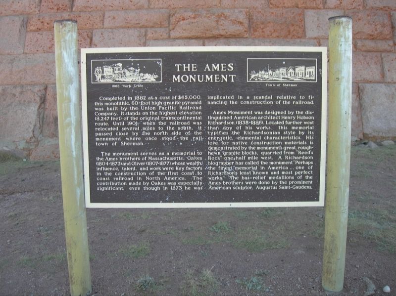
1. The Ames Monument Marker
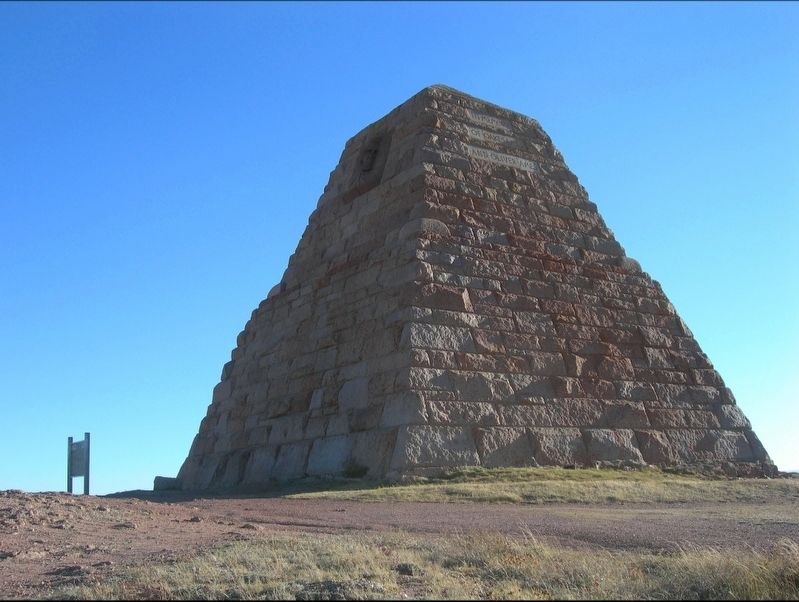
Completed in 1882 at a cost of $65,000. this monolithic, 60-foot high granite pyramid was built by the Union Pacific Railroad Company. It stands on the highest elevation (8,247 feet) of the original transcontinental route. Until 1901, when the railroad was relocated several miles to the south, it passed close by the north side of the monument where once stood the rail town of Sherman.
The monument serves as a memorial to the Ames brothers of Massachusetts. Oakes (1804-1873) and Oliver (1807-1877), whose wealth influence, talent, and work were key factors in the construction of the first coast to coast railroad in North America. The contribution made by Oakes was especially significant, even though in 1873, he was implicated in a scandal relative to financing the construction of the railroad.
Ames Monument was designed by the distinguished American architect Henry Hobson Richardson (1838-1886). Located further west than any of his works. this memorial typifies the Richardsonian style by its energetic, elemental characteristics. His love for native construction materials is demonstrated by the monument's great, rough-hewn
this page online
Topics. This historical marker and monument is listed in these topic lists: Architecture • Railroads & Streetcars. A significant historical year for this entry is 1882.
Location. This marker has been replaced by another marker nearby. It was located near 41° 7.858′ N, 105° 23.885′ W. Marker was in Buford, Wyoming, in Albany County. It was on Monument Road. Touch for map. Marker was at or near this postal address: 200 Monument Road, Buford WY 82052, United States of America. Touch for directions.

Regionally, this marker and monument was in the Laramie Basin. It was also in the American Mountain West. Globally, it was in North America, the Rocky Mountains, the Western Hemisphere, the Western World, and the Anglosphere. Historically, it found itself in what was once the Republic of Texas.
Other nearby markers. At
Photographed by Jimmy Emerson, September 25, 2010
2. The Ames Monument
Another marker is no longer nearby. Sherman Mountains (was approx. 2.7 miles away but has been confirmed missing).
More about this marker. This marker was at the base of the Ames Monument as of September 25, 2010. It had been removed as of September 5, 2015. As of November 4, 2017 it was leaned up against the historic train depot in Laramie Wyoming. This marker was replaced by a new marker here.

Photographed by Jimmy Emerson, November 4, 2017
3. The Ames Monument
Removed from the grounds of the Ames Monument by 2015 and leaned up against the train depot in Laramie Wyoming.
Credits. This page was last revised on August 21, 2026. It was originally submitted on October 1, 2025, by Jimmy Emerson of Dalton, Georgia. This page has been viewed 170 times since then and 93 times this year. Last updated on August 11, 2026, by Jimmy Emerson of Dalton, Georgia. Photos: 1, 2, 3. submitted on October 1, 2025, by Jimmy Emerson of Dalton, Georgia. • Devry Becker Jones was the editor who published this page.
