Port Tampa City in Hillsborough County, Florida — The American South (South Atlantic)
St. Mark Missionary Baptist Church
Photographed by Tim Fillmon, August 11, 2026
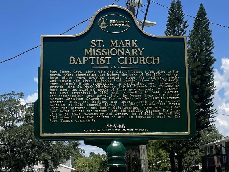
1. St. Mark Missionary Baptist Church Marker
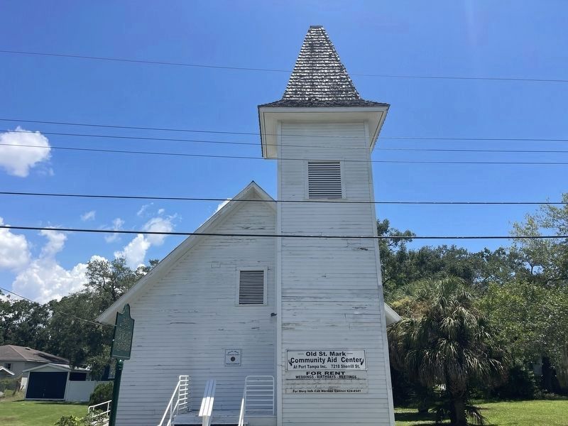
Port Tampa City, along with the City of Tampa a few miles to the north, were flourishing just before the turn of the 20th century. Both cities were growing rapidly along the railroad tracks and among the cigar factories that created times of prosperity. Port Tampa's Black population, in particular, saw tremendous growth, and St. Mark Missionary Baptist Church was founded to help meet the spiritual needs of those new arrivals. The church was first organized in 1892 and, according to oral histories, the congregation soon moved into the former home of the First Advent Christian Church on the southern end of O'Brien Street. Around 1900, the building was moved north to its current location at 7218 Sherrill Street. In 1961, parishioners moved from the historic, but badly deteriorating, structure to their new home across the street. The old building became the home of the St. Mark Community Aid Center. As of 2025, the building still stands, and the church is still an important part of the Port Tampa community.
Erected 2026 by City of Tampa, Hillsborough County Historical Advisory Council.
Topics. This
this page online
Location. 27° 51.665′ N, 82° 31.858′ W. Marker is in Tampa, Florida, in Hillsborough County. It is in Port Tampa City. It is on South Sherrill Street 0.2 miles north of West Idaho Street, on the right when traveling north. Touch for map. Marker is at or near this postal address: 7218 S Sherrill St, Tampa FL 33616, United States of America. Touch for directions.

Regionally, this marker is on Tampa Bay. It is also in the American South and on the Gulf Coast. Globally, it is in the North Atlantic Region, North America, a Gulf of Mexico state, the Western Hemisphere, the Western World, and the Anglosphere. Historically, it finds itself in what was once New Spain, the territory of the Mississippian Culture, one of the Confederate States of America, and the Antebellum South.
Other nearby markers. At least 8 other markers are within 2 miles of this marker, measured as the crow flies: Mount Zion AME Church (approx. 0.2 miles away); Frederick Douglass School
Photographed by Tim Fillmon, August 11, 2026
2. St. Mark Missionary Baptist Church Marker
Other markers no longer nearby. The Rough Riders Embark the S.S. Yucatan (was approx. one mile away but has been replaced with another marker now near it); Picnic Island (was approx. 1.2 miles away but has been confirmed missing).
Credits. This page was last revised on August 11, 2026. It was originally submitted on August 11, 2026, by Tim Fillmon of Webster, Florida. This page has been viewed 35 times since then. Photos: 1, 2. submitted on August 11, 2026, by Tim Fillmon of Webster, Florida.
