Keyser in Mineral County, West Virginia — The American South (Appalachia)
The Battle for Kesternich
January 30 - 31, 1945
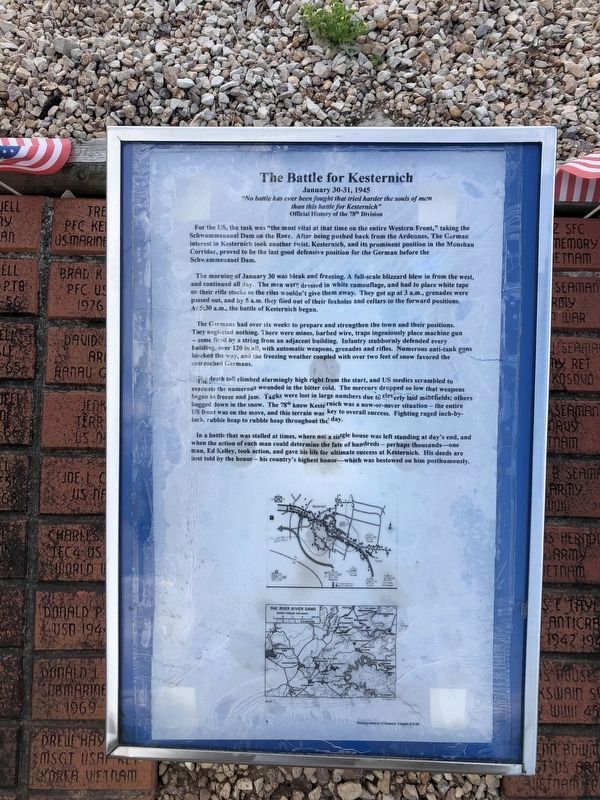
"No battle has ever been fought that tried harder the souls of men than this battle for Kesternich"
Official History of the 78th Division
For the US, the task was "the most vital at that time on the entire Western Front," taking the Schwammenauel Dam on the Roer. After being pushed back from the Ardennes. The German interest in Kisternich took another twist. Kesternich, and its prominent position in the Monshau Corridor, proved to be the last good defensive position for the German before the Schwammenauel Dam.
The morning of January 30 was bleak and freezing. A full-scale blizzard blew in from the west, and continued all day. The men were dressed in white camouflage, and had to place white tape on their rifle stocks so the rifles wouldn't give them away. They got up at 3 a.m., grenades were passed out, and by 5 a.m. they filed out their foxholes and cellars to the forward positions. At 5:30 a.m., the battle Kesternich began.
The Germans had over six weeks to prepare and strengthen the town and their positions. They neglected nothing. There were mines, barbed wire, traps ingeniously place machine gun — some fired
this page online
The death toll climbed alarmingly high right from the start, and US medics scrambled to evacuate the numerous wounded in the bitter cold. The mercury dropped so low that weapons began to freeze and jam. Tanks were lost in large numbers due to cleverly laid minefields; others bogged down in the snow. The 78th knew Kesternich was a now-or-never situation — the entire US front was on the move, and this terrain was key to overall success. Fighting raged inch-by-inch, rubble heap to rubble heap throughout the day.
In a battle that was stalled at times, where not a single house was left standing at day's end, and when the action of each man could determine the fate of hundreds — perhaps thousands — one man, Ed Kelley, took action, and gave his life for ultimate success at Kesternich. His deeds are best told by the honor — his country's highest honor—which was bestowed
July 12, 2020
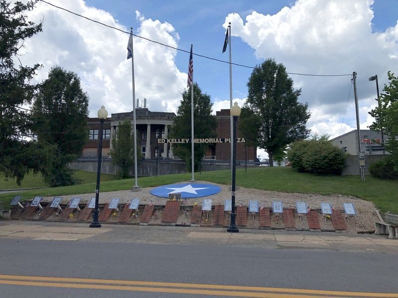
2. Ed Kelley Memorial Plaza
Topics and series. This historical marker is listed in this topic list: War, World II. In addition, it is included in the Medal of Honor Recipients series list. A significant day of the year for for this entry is January 30.
Location. This marker has been replaced by another marker nearby. It was located near 39° 26.384′ N, 78° 58.617′ W. Marker was in Keyser, West Virginia, in Mineral County. It was on East Piedmont Street (West Virginia Route 46) just west of North Davis Street, on the left when traveling west. Touch for map. Marker was at or near this postal address: 31 E Piedmont St, Keyser WV 26726, United States of America. Touch for directions.

Regionally, this marker was in the Eastern Panhandle. It was also in the American South, specifically in the Upper South, in Appalachia, and specifically in Northern Appalachia. Globally, it was in North America, the Western Hemisphere, the Western World, and the Anglosphere. Historically, it found itself in what was once the territory of the Mississippian Culture.
Other nearby markers. At least 3 other markers are within walking distance of this location: Jonah Edward Kelley

Photographed by Craig Doda, August 1, 2026
3. Ed Kelley Memorial Plaza
Other markers no longer nearby. The Aftermath of Kesternich / Germans Retreat (was here, next to this marker but has been replaced with another marker now near it); The Medal of Honor (was here, next to this marker but has been replaced with another marker now near it); The Bridge at Remagen (was here, next to this marker but has been replaced with another marker now near it); Regaining the Initiative (was here, next to this marker but has been replaced with another marker now near it); a different marker also named The Bridge at Remagen (was here, next to this marker but has been replaced with another marker now near it); The Battle of the Bulge (was here, next to this marker but has been replaced with another marker now near it); The First Battle of Kesternich (was here, next to this marker but has been replaced with another marker now near it); a different marker also named The Bridge at Remagen (was here, next to this marker but has been replaced with another marker now near it); Encircling the Nazi War Machine & German Capitulation (was here, next to this marker but has been replaced with another marker now near it); Key Terrain (was here, next to this marker but has been replaced with another marker now near it); D-Day (was here, next to this marker but has been replaced with another marker now near it); World War II (was here, next to this marker but has been replaced with another marker now near it); Kelley Memorial Plaza (was a few steps from this marker but has been replaced with another marker now near it).
Credits. This page was last revised on August 12, 2026. It was originally submitted on July 14, 2020, by Devry Becker Jones of Washington, District of Columbia. This page has been viewed 364 times since then and 67 times this year. Last updated on August 12, 2026, by Craig Doda of Napoleon, Ohio. Photos: 1. submitted on July 14, 2020, by Devry Becker Jones of Washington, District of Columbia. 2. submitted on July 14, 2020. 3. submitted on August 12, 2026, by Craig Doda of Napoleon, Ohio.
