Keyser in Mineral County, West Virginia — The American South (Appalachia)
The Battle of the Bulge
The largest battle in US history
| — | December 16, 1944 - January 25, 1945 | — |
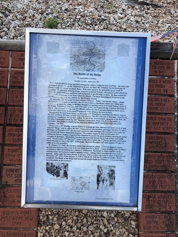
Hitler had decided to make one final attempt for victory, using his best SS troops — the ones with the highest moral — to cut the Allied forces in two. He chose the Ardennes Forest, knowing US Forces would not expect an attack there. With strict secrecy, he massed his forces south of Monshau. He planned airborne drops, a massive armored assault, and Special Forces attacks by SS troops using American uniforms and equipment to get through US lines. He then waited for bad weather to provide cover from Allied air attacks. The snow that plagued US Forces in the Monshau Corridor was the catalyst for the German assault.
On December 16th the great German counter offensive — Hitler's last bid for victory — began. Designed to cut through to Antwerp, the Germans made a significant salient into Allied lines. Confusion gripped the Allies, as Bradley thought it a spoiling attack to forestall Patton's drive to the South. Eisenhower however, saw it for what it was, and began moving Armored Divisions to stop it. The German airdrop was not effective militarily, but it sent psychological shock waves across the Allied front. Extra security
this page online
Recognizing the enormous threat, on December 17th, Eisenhower committed his theater reserve, the 101st Airborne Division, to hold vital road centers. The 101st was sent to Bastogne, where it was quickly surrounded by the German salient. In one of the most dramatic moments of the War, the German Commander asked the 101st Division Commander, Brig. Gen. A. C. McAuliffe, to surrender. McAuliffe, exemplifying the American fighting spirit, answered with a one word response: "NUTS!"
On December 18th Bradley ordered Patton to suspend the Saar offensive and move north to help stop the "Bulge" and to relieve the 101st. Patton moved into position, and began his drive to relieve Bastogne on December 22nd. Having intercepted US radio messages, the Germans were ready for the assault and Patton made little progress. The weather began to clear on December 23rd (following Patton's famous request of his Chaplain for prayer for good weather) allowing for aerial resupply of Bastogne. Meanwhile, German advances had slowed due to lack of fuel, and traffic jams. On December 26th the US 2nd Armored Division crushed
July 12, 2020
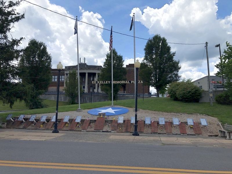
2. Ed Kelley Memorial Plaza
By January 3rd, 1945, the German salient had reached its zenith. US Forces began to retake ground they had lost, but it was to be real estate paid for in blood. A long-standing order by Hitler remained in effect forbidding any voluntary withdrawal. Hardened to winter warfare on the Russian front, the Germans waged a fighting retreat — taking Allied casualties for every foot of ground. Allies ought the entire month of January 1945 to restore the front to where it had been on December 16th, 1944. From January 3, 1945 to March 28, 1945 the US suffered another 39,672 casualties. The Battle of the Bulge had become the largest battle in US history — and it was now time to turn the tables on the Germans.
Topics and series. This historical marker is listed in this topic list: War, World II. In addition, it is included in the Former U.S. Presidents: #34 Dwight D. Eisenhower series list. A significant historical date for this entry is January 3, 1945.
Location. This marker has been replaced by another marker nearby. It was located near
Photographed by Craig Doda, August 1, 2026
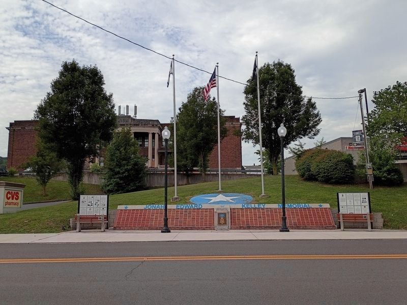
3. Ed Kelley Memorial Plaza

Regionally, this marker was in the Eastern Panhandle. It was also in the American South, specifically in the Upper South, in Appalachia, and specifically in Northern Appalachia. Globally, it was in North America, the Western Hemisphere, the Western World, and the Anglosphere. Historically, it found itself in what was once the territory of the Mississippian Culture.
Other nearby markers. At least 3 other markers are within walking distance of this location: Jonah Edward Kelley (here, next to this marker); The Ed Kelley Memorial Plaza (a few steps from this marker); a different marker also named The Medal of Honor (a few steps from this marker). Touch for a list and map of all markers in Keyser.
Other markers no longer nearby. The First Battle of Kesternich (was here, next to this marker but has been replaced with another marker now near it); Regaining the Initiative (was here, next to this marker but has been replaced with another marker now near it); Key Terrain (was here, next to this marker but has been replaced with another marker now near it); D-Day (was here, next to this marker but has been replaced with another marker now near it); World War II (was here, next to this marker but has been replaced with another marker now near it); The Medal of Honor (was here, next to this marker but has been replaced with another marker now near it); Kelley Memorial Plaza (was here, next to this marker but has been replaced with another marker now near it); The Battle for Kesternich (was here, next to this marker but has been replaced with another marker now near it); The Aftermath of Kesternich / Germans Retreat (was here, next to this marker but has been replaced with another marker now near it); The Bridge at Remagen (was here, next to this marker but has been replaced with another marker now near it); a different marker also named The Bridge at Remagen (was a few steps from this marker but has been replaced with another marker now near it); a different marker also named The Bridge at Remagen (was a few steps from this marker but has been replaced with another marker now near it); Encircling the Nazi War Machine & German Capitulation (was a few steps from this marker but has been replaced with another marker now near it).
Additional commentary.
1. Marker typo
Note that in the last paragraph of the inscription the text shows "ought", which should be "fought".
— Submitted October 7, 2025.
Credits. This page was last revised on August 12, 2026. It was originally submitted on July 14, 2020, by Devry Becker Jones of Washington, District of Columbia. This page has been viewed 384 times since then and 57 times this year. Last updated on August 12, 2026, by Craig Doda of Napoleon, Ohio. Photos: 1. submitted on July 14, 2020, by Devry Becker Jones of Washington, District of Columbia. 2. submitted on July 14, 2020. 3. submitted on August 12, 2026, by Craig Doda of Napoleon, Ohio.
